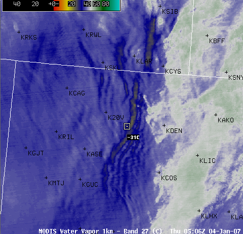
“Foehn gap” and mountain waves in Colorado
AWIPS MODIS water vapor channel imagery (above) shows a well-defined (but cloud-free) variant of a “Foehn gap” over central Colorado on 04 January 2007. This Foehn gap was oriented roughly north-south, just to the lee of the highest terrain of the Front Range of the Rocky Mountains (below), and formed as 60-70 knot winds at 500 hPa were flowing from west to east over that region (winds at Boulder CO KBJC were westerly at 21 gusting to 37 mph around the time of the MODIS image). A comparison of MODIS and GOES water vapor imagery reveals that, due to parallax error with the GOES-12 image, this Foehn gap incorrectly appears to the west of the highest terrain. Also evident on the 1-km resolution MODIS water vapor image is a series of mountain waves further downwind of the Foehn gap (these mountain waves were not apparent on the 4-km resolution GOES-12 water vapor imagery). There was only one isolated pilot report of turbulence in the area around the time of the MODIS water vapor image, but air traffic is generally at a minimum during that time of day.


