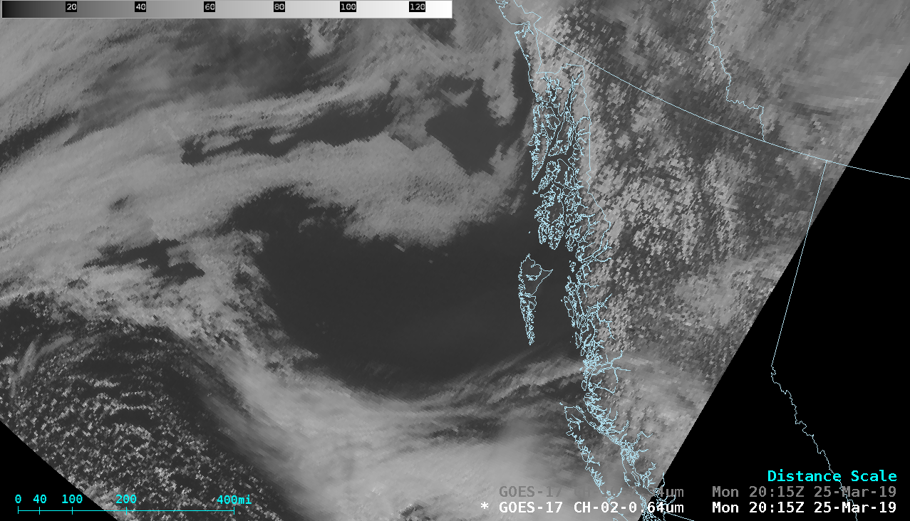
Plume of wildfire smoke from British Columbia

GOES-17 “Red” Visible (0.64 µm) and Low-level Water Vapor (7.3 µm) images [click to play animation | MP4]
This aerosol plume was more easily seen in GOES-17 True Color Red-Green-Blue (RGB) images from the AOS site (below).
![GOES-17 True Color RGB images [click to play animation | MP4]](https://cimss.ssec.wisc.edu/satellite-blog/wp-content/uploads/sites/5/2019/03/201903251800_ak.jpg)
GOES-17 True Color RGB images [click to play animation | MP4]
![VIIRS Visible (0.64 µm) and Day/Night Band (0.7 µm) from Suomi NPP at 2104 UTC and NOAA-20 at 2154 UTC [click to enlarge]](https://cimss.ssec.wisc.edu/satellite-blog/wp-content/uploads/sites/5/2019/03/190325_viirs_visible_dayNightBand_BC_smoke_anim.gif)
VIIRS Visible (0.64 µm) and Day/Night Band (0.7 µm) from Suomi NPP at 2104 UTC and NOAA-20 at 2154 UTC [click to enlarge]

Terra MODIS Visible (0.65 µm), Near-Infrared “Cirrus” (1.61 µm) and Water Vapor (6.7 µm) images at 1936 UTC [click to enlarge]
![Suomi NPP VIIRS True Color RGB image and Aerosol Optical Depth product at 2015 UTC [click to enlarge]](https://cimss.ssec.wisc.edu/satellite-blog/wp-content/uploads/sites/5/2019/03/190325_2015utc_suomiNPP_truecolor_aerosolOpticalDepth_fires_BC_anim.gif)
Suomi NPP VIIRS True Color RGB image and Aerosol Optical Depth product at 2015 UTC [click to enlarge]


![Suomi NPP VIIRS Visible (0.64 µm) image, with available NUCAPS locations [click to enlarge]](https://cimss.ssec.wisc.edu/satellite-blog/wp-content/uploads/sites/5/2019/03/190325_2202utc_suomiNPP_visible_nucaps_BC_anim.gif)
![NUCAPS profiles at Points 1, 2 and 3 [click to enlarge]](https://cimss.ssec.wisc.edu/satellite-blog/wp-content/uploads/sites/5/2019/03/190325_nucaps_profiles_BC_anim.gif)