Tropical Storm Ana
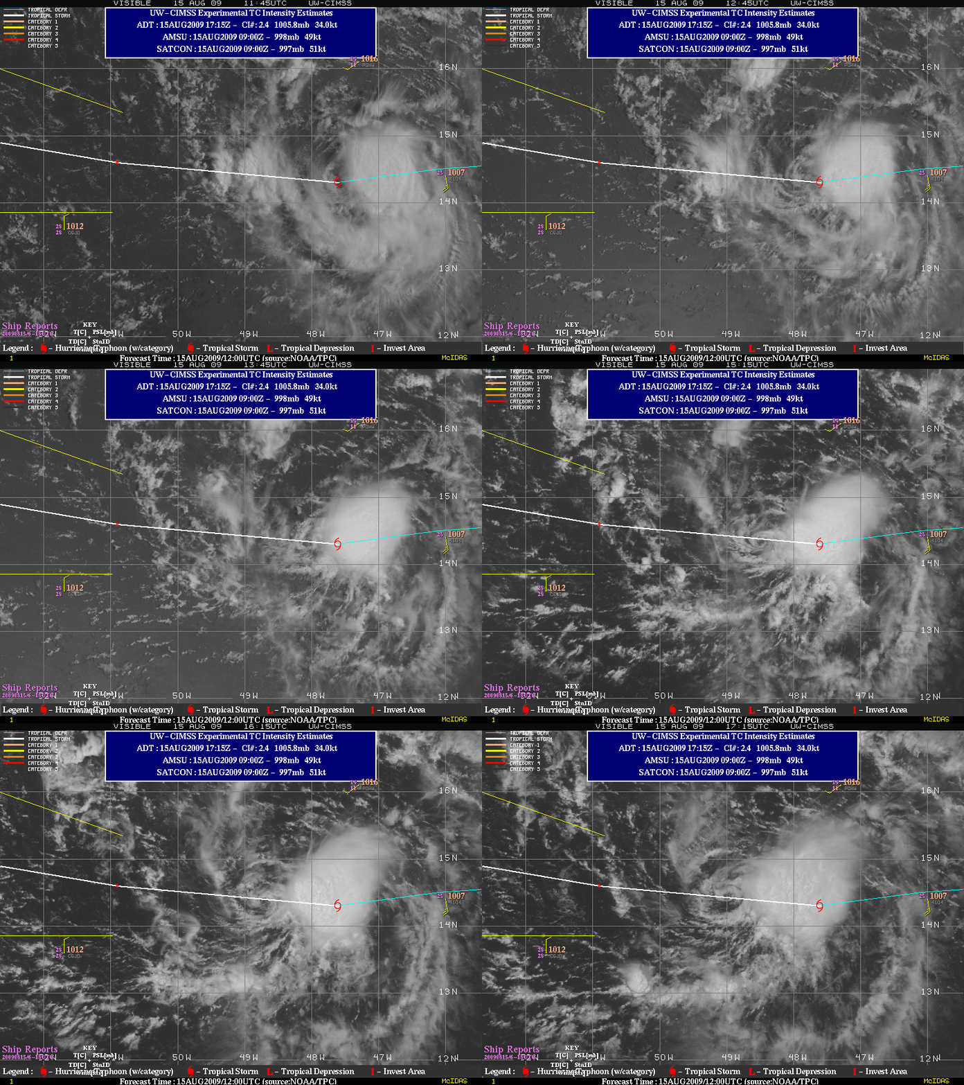
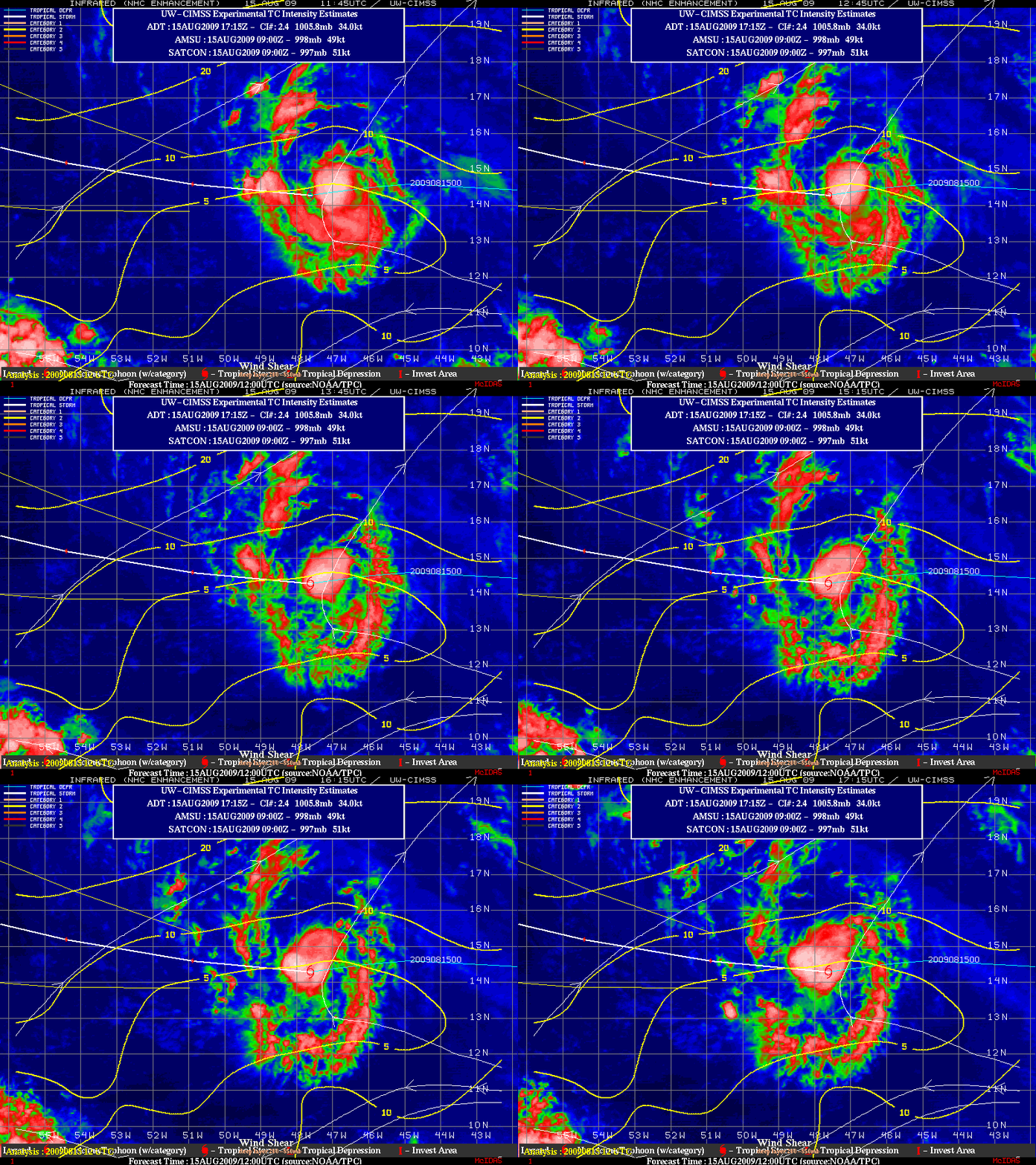
GOES-12 visible images from the CIMSS Tropical Cyclones site on 15 August 2009 (above) showed that the low-level circulation of Tropical Storm Ana (the first named Atlantic Basin tropical storm of the 2009 season) had become exposed from the main area of deep convection located farther to the east. This suggested that Ana was moving into a region of increasing westerly wind shear, though the CIMSS deep layer wind shear product (below) only showed about 5-10 knots of shear over the tropical cyclone at that time.


