Unusual August ice concentration in Hudson Bay and James Bay, Canada
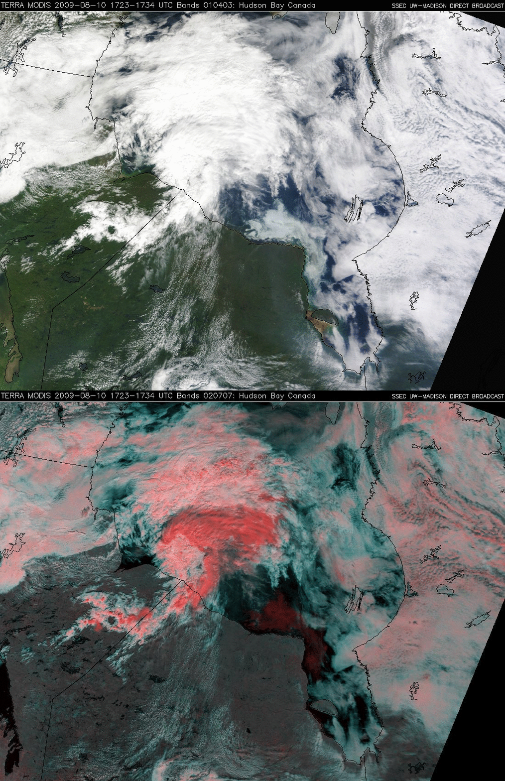
A comparison of MODIS “true color” and “false color” Red/Green/Blue (RGB) images (above) showed that significant amounts of ice remained in parts of southern Hudson Bay and northern James Bay in Canada on 10 August 2009. On the true color RGB image (using MODIS bands 01/04/03), the ice did not appear as as bright as the surrounding clouds, and had a slightly “light blue” appearance. On the false color RGB image (using MODIS bands 02/07/07), the ice (along with clouds that were composed of ice crystals) exhibited a darker red appearance, in contrast to the cyan to white colored supercooled water droplet clouds.
Also note the hazy appearance over parts of Ontario, just to the west of James Bay: this was due to smoke aloft from recent fire activity in Alaska and the Yukon Territory.
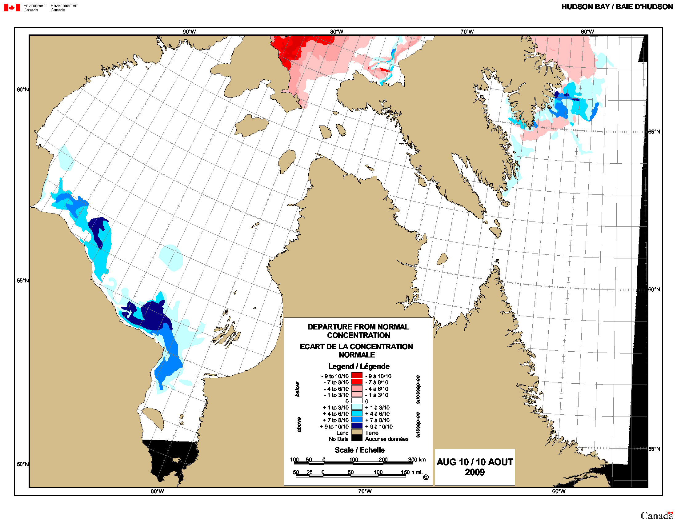
A map of the departure from normal ice concentration (below, courtesy of the Canadian Ice Service) indicated that there were large areas where the ice was in the 7/10ths to 10/10ths range above the normal concentration for the date (darker blue colors). The persistence of a deep area of low pressure just south of Hudson Bay (July 2009 mean 850 hPa geopotential height) kept that region (along with much of the eastern US) unusually cold during the summer, which undoubtedly slowed the rate of ice melt in Hudson Bay and James Bay.


