Cloud-top waves producing turbulence north of Hawai’i
![GOES-17 Low-level (7.3 µm), Mid-level (6.9 µm) and Upper-level (6.2 µm) Water Vapor images [click to play MP4 animation]](https://cimss.ssec.wisc.edu/satellite-blog/wp-content/uploads/sites/5/2019/02/hi_wv8-20190206_222218.png)
GOES-17 Low-level (7.3 µm), Mid-level (6.9 µm) and Upper-level (6.2 µm) Water Vapor images [click to play MP4 animation]
* GOES-17 images shown here are preliminary and non-operational *
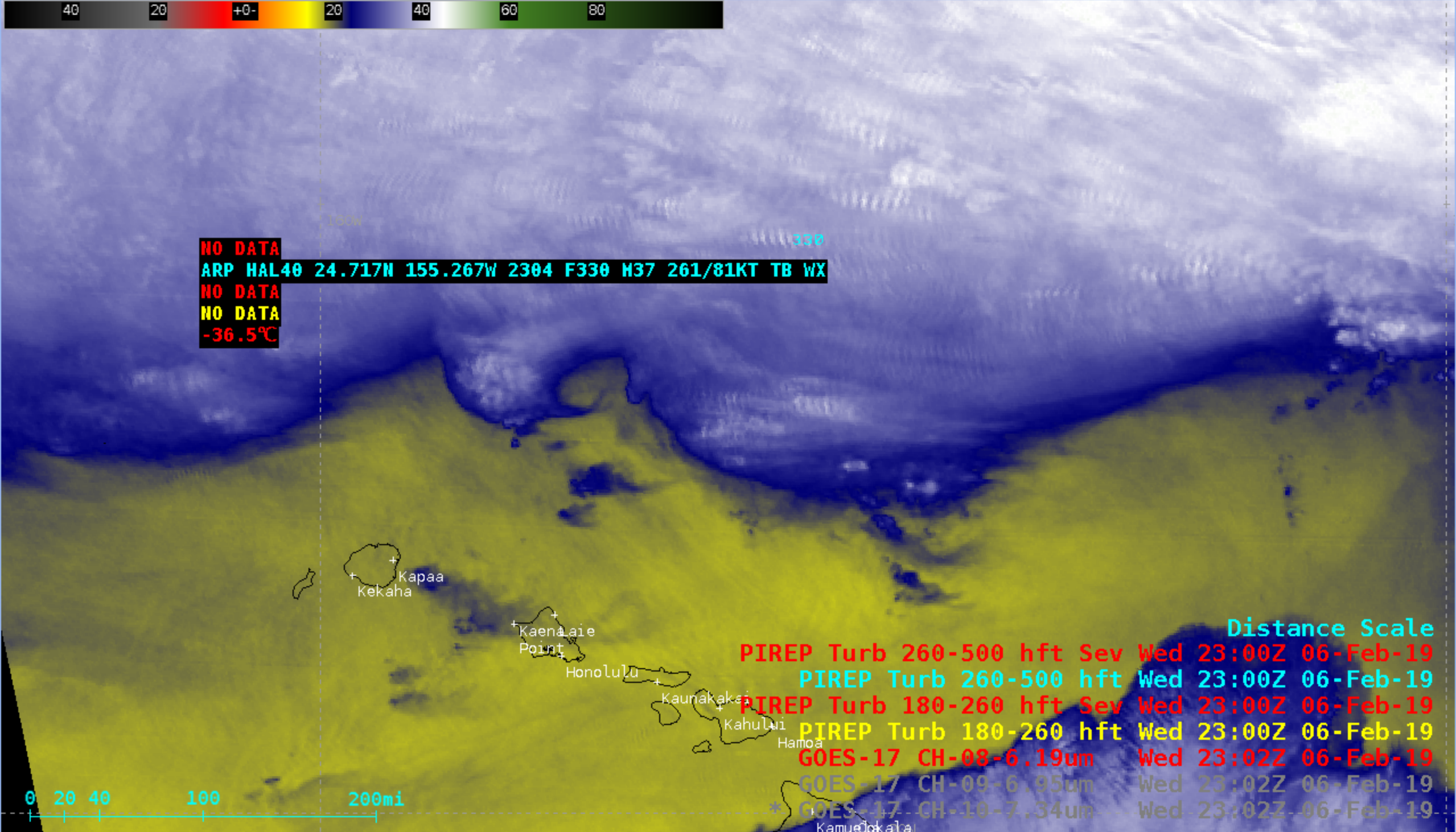
Transient pockets of cloud-top waves were evident on GOES-17 Low-level (7.3 µm), Mid-level (6.9 µm) and Upper-level (6.2 µm) Water Vapor images (above) north of Hawai’i on 06 February 2019. Some of the waves were located along the tops of convective cloud features, while others appeared to be randomly distributed.
Plots of rawinsonde data from Lihue, Hawai’i (below) showed that winds within the middle to upper troposphere had a general westerly component — so these mesoscale cloud-top wave features were oriented perpendicular to the flow.
![Plots of rawinsonde data from Lihue, Hawai'i [click to enlarge]](https://cimss.ssec.wisc.edu/satellite-blog/wp-content/uploads/sites/5/2019/02/190206_PHLI_RAOBS.GIF)
Plots of rawinsonde data from Lihue, Hawai’i [click to enlarge]
![GOES-17 Upper-level Water Vapor (6.2 µm) images within 30 minutes of the 2304 UTC pilot report of turbulence [click to enlarge]](https://cimss.ssec.wisc.edu/satellite-blog/wp-content/uploads/sites/5/2019/02/190206_goes17_waterVapor_pirep_Hawaii_anim.gif)
GOES-17 Upper-level Water Vapor (6.2 µm) images within 30 minutes of the 2304 UTC pilot report of turbulence [click to enlarge]
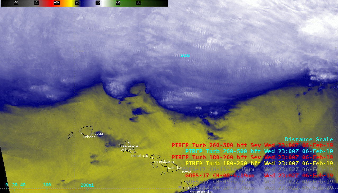
GOES-17 Upper-level Water Vapor (6.2 µm) and “Clean” Infrared Window (10.3 µm) images at 2302 UTC [click to enlarge]
![GOES-17 Upper-level Water Vapor (6.2 µm) image, with plots of aviation Significant Weather advisories [click to enlarge]](https://cimss.ssec.wisc.edu/satellite-blog/wp-content/uploads/sites/5/2019/02/190206_2302utc_goes17_waterVapor_pirep_sigWX_HI.png)
GOES-17 Upper-level Water Vapor (6.2 µm) image, with plots of aviation Significant Weather advisories that were in effect at that time [click to enlarge]
![VIIRS Infrared Window (11.45 µm) images from NOAA-20 (at 2230 and 0030 UTC) and Suomi NPP (at 2320 UTC) [click to enlarge]](https://cimss.ssec.wisc.edu/satellite-blog/wp-content/uploads/sites/5/2019/02/190206_suomiNPP_noaa20_viirs_infrared_HI_anim.gif)
VIIRS Infrared Window (11.45 µm) images from NOAA-20 (at 2230 and 0030 UTC) and Suomi NPP (at 2320 UTC) [click to enlarge]