Standing wave cloud over Minnesota and Lake Superior
![GOES-16 Mid-level Water Vapor (6.9 µm) images [click to play animation |MP4]](https://cimss.ssec.wisc.edu/satellite-blog/wp-content/uploads/sites/5/2019/01/190108_goes16_waterVapor_MN_standing_wave_anim.gif)
GOES-16 Mid-level Water Vapor (6.9 µm) images [click to play animation | MP4]
A northwest-to-southeast oriented cross section of RAP40 model fields along line segment B-B’ (below) showed a deep pocket of positive Omega (upward vertical motion, yellow to red colors) that corresponded to the cloud band along the Minnesota Lake Superior shoreline. Note that this Omega feature was vertically tilted in an “upshear” direction (toward the northwest), and extended upward to the 350-400 hPa pressure level. There was also an increasing upward component of the ageostrophic vertical circulation, which was likely the initial forcing mechanism leading to formation of the standing wave cloud seen on satellite imagery.
![RAP40 model cross section along line B-B' [click to play animation | MP4]](https://cimss.ssec.wisc.edu/satellite-blog/wp-content/uploads/sites/5/2019/01/190108_ruc40_cross_section_MN_anim.gif)
RAP40 model cross section along line B-B’ [click to play animation | MP4]
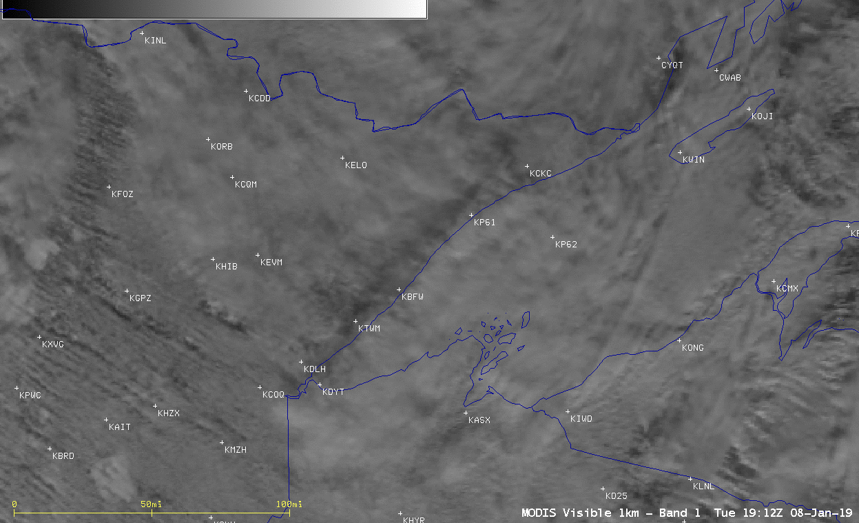
Aqua MODIS Visible (0.65 µm), Near-Infrared “Cirrus” (1.37 µm), Shortwave Infrared (3.7 µm) and Infrared Window (11.0 µm) images [click to enlarge]
![Suomi NPP and NOAA-20 VIIRS Visible (0.64 µm), Shortwave Infrared (3.74 µm) and Infrared Window (11.45 µm) images [click to enlarge]](https://cimss.ssec.wisc.edu/satellite-blog/wp-content/uploads/sites/5/2019/01/190108_suomiNPP_noaa20_viirs_visible_shortwaveInfrared_infraredWindow_MN_anim.gif)
Suomi NPP and NOAA-20 VIIRS Visible (0.64 µm), Shortwave Infrared (3.74 µm) and Infrared Window (11.45 µm) images [click to enlarge]
![Plots of rawinsonde data from International Falls, Minnesota [click to enlarge]](https://cimss.ssec.wisc.edu/satellite-blog/wp-content/uploads/sites/5/2019/01/190108_KINL_RAOBS.GIF)
Plots of rawinsonde data from International Falls, Minnesota [click to enlarge]