Severe thunderstorms in Wisconsin
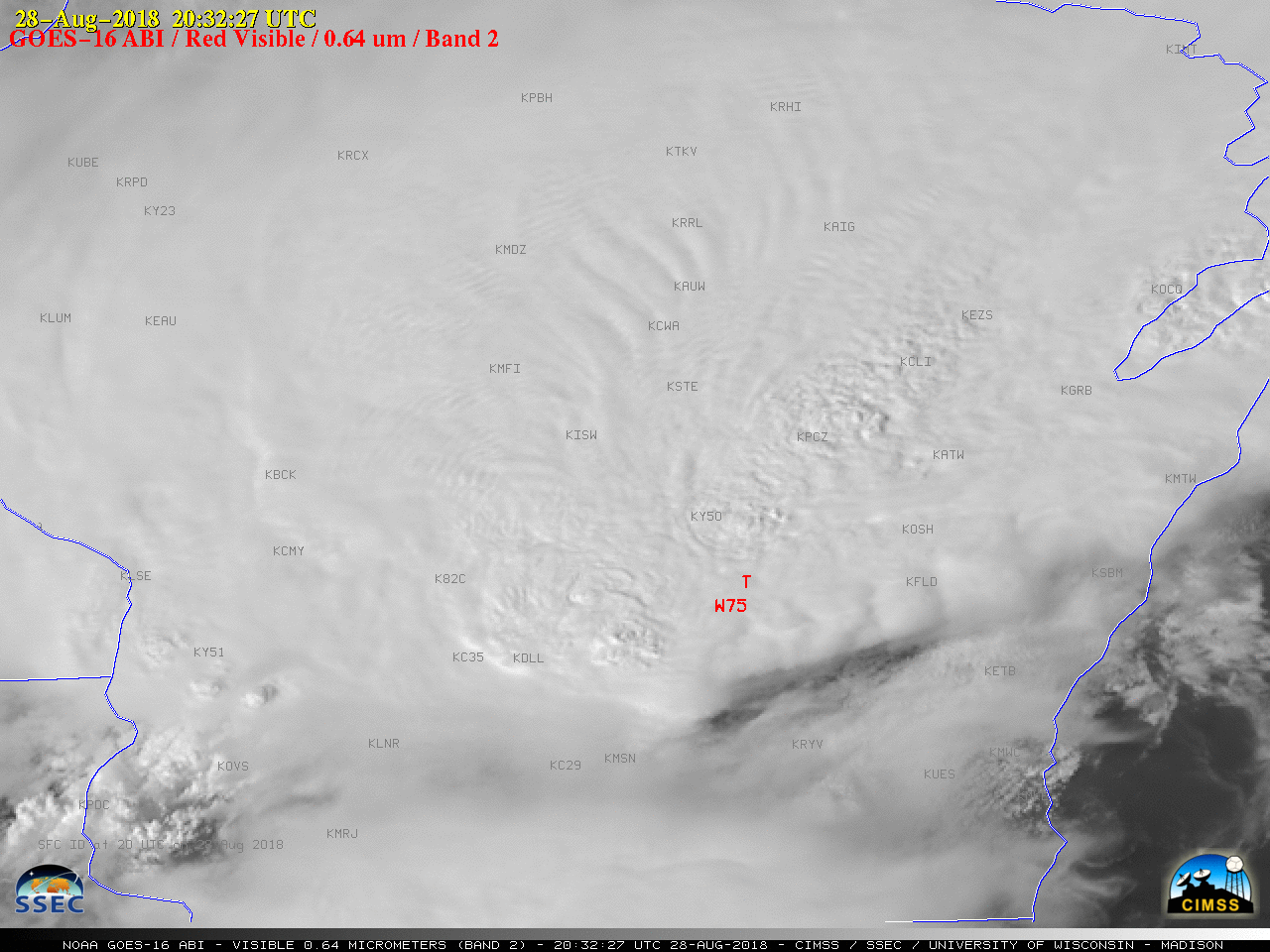
GOES-16 “Red” Visible (0.64 µm) images, with SPC storm reports plotted in red [click to play MP4 animation]
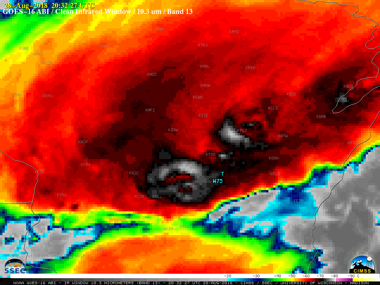
GOES-16 “Clean” Infrared Window (10.3 µm) images, with SPC storm reports plotted in cyan [click to play MP4 animation]
![Terra MODIS Visible (0.65 µm) and Infrared Window (11.0 µm) images, with plots of SPC storm reports [click to enlarge]](https://cimss.ssec.wisc.edu/satellite-blog/wp-content/uploads/sites/5/2018/08/180828_1715utc_terra_modis_visible_infrared_WI_anim.gif)
Terra MODIS Visible (0.65 µm) and Infrared Window (11.0 µm) images, with plots of SPC storm reports [click to enlarge]
![Aqua MODIS Visible (0.65 µm) and Infrared Window (11.0 µm) images, with plots of SPC storm reports [click to enlarge]](https://cimss.ssec.wisc.edu/satellite-blog/wp-content/uploads/sites/5/2018/08/180828_1855utc_aqua_modis_visible_infrared_WI_anim.gif)
Aqua MODIS Visible (0.65 µm) and Infrared Window (11.0 µm) images, with plots of SPC storm reports [click to enlarge]
![Suomi NPP VIIRS Visible (0.64 µm) and Infrared Window (11.45 µm) images, with plots of SPC storm reports [click to enlarge]](https://cimss.ssec.wisc.edu/satellite-blog/wp-content/uploads/sites/5/2018/08/180828_1945utc_suomi_npp_viirs_visible_infrared_WI_anim.gif)
Suomi NPP VIIRS Visible (0.64 µm) and Infrared Window (11.45 µm) images, with plots of SPC storm reports [click to enlarge]
![24-hour precipitation ending at 12 UTC on 28 August and 29 August [click to enlarge]](https://cimss.ssec.wisc.edu/satellite-blog/wp-content/uploads/sites/5/2018/08/180828_180829_24hour_precip_WI_anim.gif)
24-hour precipitation ending at 12 UTC on 28 August and 29 August [click to enlarge]