Beta stage GOES-17 imagery now available in AWIPS
![AWIPS Satellite menu [click to enlarge]](https://cimss.ssec.wisc.edu/satellite-blog/wp-content/uploads/sites/5/2018/08/GOES17_awips_menu.png)
AWIPS Satellite menu [click to enlarge]
* GOES-17 images shown here are preliminary and non-operational *
Beginning at 1530 UTC on 28 August 2018, GOES-17 data and imagery became available via the GOES Rebroadcast (GRB) distribution mechanism — and beginning at 1700 UTC via the Satellite Broadcast Network (SBN) that provides data to AWIPS (above). While images are available from all 16 of the ABI spectral bands, it is important to note that ABI cooling system issues will affect the image quality from certain bands during certain times.
GOES-17 Mid-level Water Vapor (6.9 µm) imagery is shown below.
![GOES-17 Mid-level Water Vapor (6.9 µm) image [click to enlarge]](https://cimss.ssec.wisc.edu/satellite-blog/wp-content/uploads/sites/5/2018/08/180828_goes17_water_vapor_full_disk_anim.gif)
GOES-17 Mid-level Water Vapor (6.9 µm) image [click to enlarge]
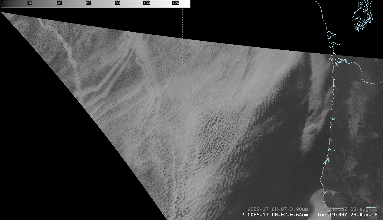
GOES-17 “Red” Visible (0.64 µm) and Shortwave Infrared (3.9 µm) images [click to play animation | MP4]
![GOES-17 Mid-level Water Vapor image, viewed in the operational GOES-West perspective [click to enlarge]](https://cimss.ssec.wisc.edu/satellite-blog/wp-content/uploads/sites/5/2018/08/g17_fd_wv_west-20180828_170039.png)
GOES-17 Mid-level Water Vapor image, viewed in the operational GOES-West perspective [click to enlarge]

GOES-17 “Red” Visible (0.64 µm) images, showing the peaks of Denali and the Alaska Range [click to play animation]
![GOES-16 (GOES-East) Mid-level Water Vapor (6.9 µm) image [click to enlarge]](https://cimss.ssec.wisc.edu/satellite-blog/wp-content/uploads/sites/5/2018/08/g16_fd_wv_west-20180828_170036.png)
GOES-16 Mid-level Water Vapor image, viewed in the operational GOES-West perspective [click to enlarge]