Tornadoes in Wyoming
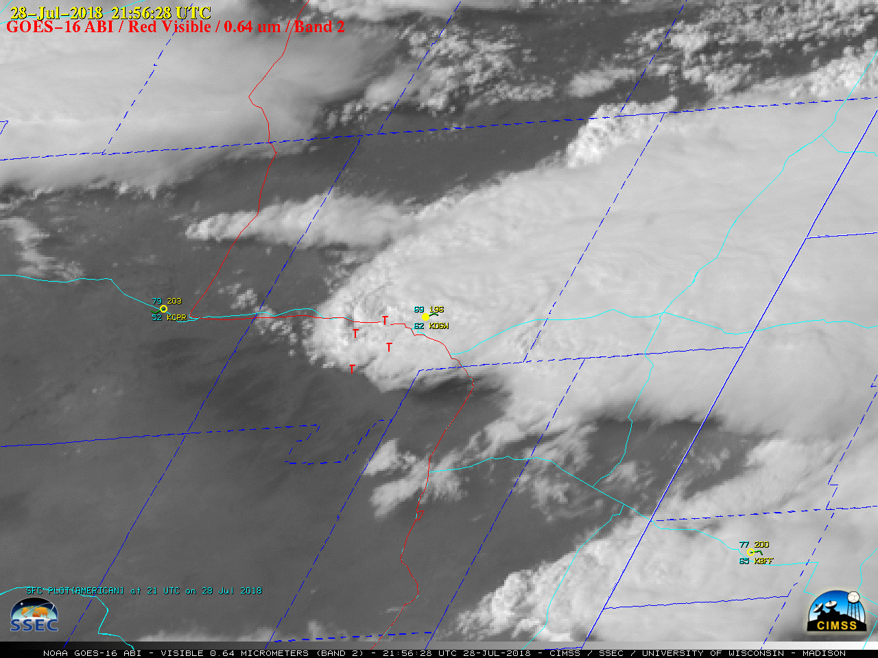
GOES-16 “Red” Visible (0.64 µm) images, with hourly plots of surface observations (cyan/yellow) along with SPC storm reports and Interstate Highways (red) and State Highways (cyan) [click to play MP4 animation]
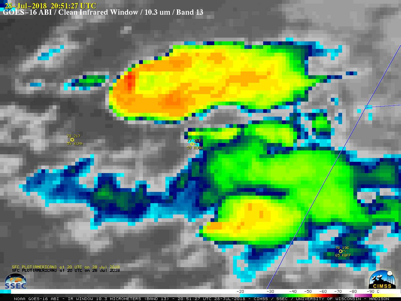
The corresponding GOES-16 “Clean” Infrared Window (10.3 µm) images (below) revealed that the dominant northern storm began to exhibit a well-defined enhanced-V signature (2051 UTC image) about an hour before it began to produce tornadoes. Minimum cloud-top infrared brightness temperatures were in the -60 to -65ºC range (darker shades of red) with the stronger pulses of overshooting tops.
![GOES-16 "Clean" Infrared Window (10.3 µm) images, with hourly plots of surface observations (yellow) along with SPC storm reports (cyan) Interstate Highways (violet) and State Highways (cyan) [click to play MP4 animation]](https://cimss.ssec.wisc.edu/satellite-blog/wp-content/uploads/sites/5/2018/07/G16_IR_WY_SVR_28JUL2018_960x1280_B13_2018209_215628_0001PANEL_00147.GIF)
GOES-16 “Clean” Infrared Window (10.3 µm) images, with hourly plots of surface observations (yellow) along with SPC storm reports (cyan) Interstate Highways (violet) and State Highways (cyan) [click to play MP4 animation]
![Suomi NPP VIIRS and Aqua MODIS Infrared Window images [click to enlarge]](https://cimss.ssec.wisc.edu/satellite-blog/wp-content/uploads/sites/5/2018/07/180728_viirs_modis_infrared_WY_anim.gif)
Infrared Window images from Suomi NPP VIIRS (11.45 µm) and Aqua MODIS (11.0 µm) [click to enlarge]
![Terra and Aqua MODIS Total Precipitable Water product [click to enlarge]](https://cimss.ssec.wisc.edu/satellite-blog/wp-content/uploads/sites/5/2018/07/180728_modis_tpw_anim.gif)
Terra and Aqua MODIS Total Precipitable Water product [click to enlarge]