Large hail and high winds in South Dakota and Nebraska
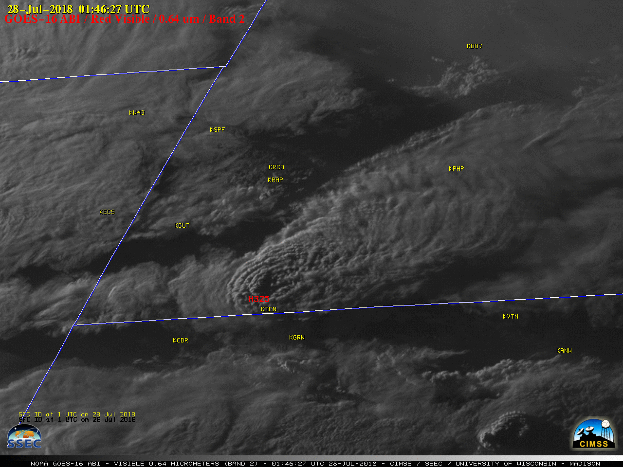
GOES-16 “Red” Visible (0.64 µm) images, with SPC storm reports plotted in red [click to play MP4 animation]
The corresponding GOES-16 “Clean” Infrared Window (10.3 µm) images (below) revealed minimum cloud-top infrared brightness temperatures in the -60 to -70ºC range (darker red to black enhancement) with the strongest pulses of overshooting tops. The storm began to exhibit a well-defined enhanced-V signature once it crossed the South Dakota / Nebraska border after about 0200 UTC.
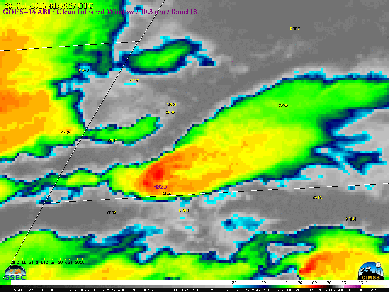
GOES-16 “Clean” Infrared Window (10.3 µm) images, with SPC storm reports plotted in purple [click to play MP4 animation]
OST EM & Martin Fire on scene all night at Oglala. Major hail damage. Aid center at Oglala Recreation Center. pic.twitter.com/BNJu357ytq
— Martin Vol Fire Dept (@martin_vol) July 28, 2018
Major window and siding damage. Crops and grass beat to the ground. Crews assembling to assist area residents. No serious injuries reported at this time. pic.twitter.com/fUA3CqYeO1
— Martin Vol Fire Dept (@martin_vol) July 28, 2018
===== 30 July Update =====
![Terra MODIS True Color and False Color RGB images [click to enlarge]](https://cimss.ssec.wisc.edu/satellite-blog/wp-content/uploads/sites/5/2018/07/180730_1755utc_terra_modis_truecolor_falsecolor_South_Dakota_hail_damage_swath_anim.gif)
Terra MODIS True Color and False Color RGB images, with hail damage swath highlighted by red arrows [click to enlarge]
Before/after (16/30 July) comparisons of MODIS True Color RGB images viewed using RealEarth and MODIS Today (below) further illustrate the appearance of the hail damage swath.
![MODIS True Color RGB images from 16 July and 30 July [click to enlarge]](https://cimss.ssec.wisc.edu/satellite-blog/wp-content/uploads/sites/5/2018/07/180716_180730_modis_truecolor_SD_anim.gif)
Terra MODIS True Color RGB images from 16 July and 30 July [click to enlarge]
![Terra MODIS True Color RGB images from 16 and 30 July [click to enlarge]](https://cimss.ssec.wisc.edu/satellite-blog/wp-content/uploads/sites/5/2018/07/180716_180730_terra_modis_truecolor_SD_anim.gif)
Terra MODIS True Color RGB images from 16 July and 30 July [click to enlarge]
![Terra MODIS Visible (0.65 µm) image and Land Surface Temperature and Normalized Difference Vegetation Index products [click to enlarge]](https://cimss.ssec.wisc.edu/satellite-blog/wp-content/uploads/sites/5/2018/07/180730_1746utc_terra_modis_Visible_LandSurfaceTemperature_NormalizedDifferenceVegetationIndex_SD_anim.gif)
Terra MODIS Visible (0.65 µm) image and Land Surface Temperature and Normalized Difference Vegetation Index products [click to enlarge]
===== 31 July Update =====
![MODIS True Color RGB images from Terra (14 July) and Aqua (31 July) [click to enlarge]](https://cimss.ssec.wisc.edu/satellite-blog/wp-content/uploads/sites/5/2018/07/180714_180731_terra_modis_truecolor_SD_anim.gif)
MODIS True Color RGB images from Terra (14 July) and Aqua (31 July) [click to enlarge]