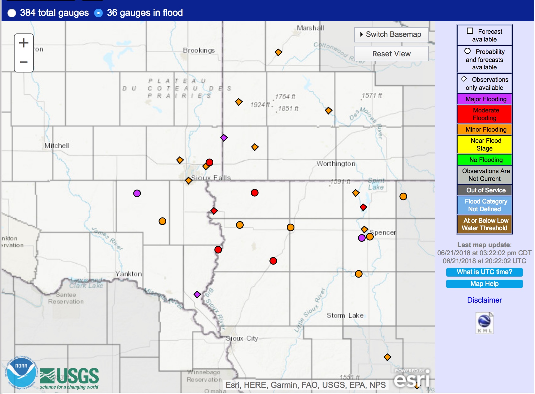
Summer solstice TROWAL over the Upper Midwest
![Aqua MODIS Water Vapor (6.7 µm) image, with overlays of surface pressure/fronts (cyan), RUC model 310K equivalent potential temperature (red) and 24-hour precipitation (green) [click to enlarge]](https://cimss.ssec.wisc.edu/satellite-blog/wp-content/uploads/sites/5/2018/06/180621_0814utc_aqua_modis_water_vapor_Upper_Midwest_TROWAL_anim.gif)
Aqua MODIS Water Vapor (6.7 µm) image, with overlays of surface pressure/fronts (cyan), RUC model 310K equivalent potential temperature (red) and 24-hour precipitation (green) [click to enlarge]
Suomi NPP VIIRS Infrared Window (11.45 µm) images (below) displayed minimum cloud-top brightness temperature values of -50 to -55ºC (yellow to orange enhancement) near the TROWAL axis.
![Suomi NPP VIIRS Infrared Window (11.45 µm) images, with plots of surface reports [click to enlarge]](https://cimss.ssec.wisc.edu/satellite-blog/wp-content/uploads/sites/5/2018/06/180621_suomi_npp_viirs_infrared_TROWAL_anim.gif)
Suomi NPP VIIRS Infrared Window (11.45 µm) images, with plots of surface reports [click to enlarge]
![GOES-16 Mid-level Water Vapor (6.9 µm) images, with hourly plots of surface weather type [click to play MP4 animation]](https://cimss.ssec.wisc.edu/satellite-blog/wp-content/uploads/sites/5/2018/06/G16_WV_UPPER_MIDWEST_TROWAL_21JUN2018_960x1280_B9_2018172_080225_0001PANEL_00097.GIF)
GOES-16 Mid-level Water Vapor (6.9 µm) images, with hourly plots of surface weather type [click to play MP4 animation]