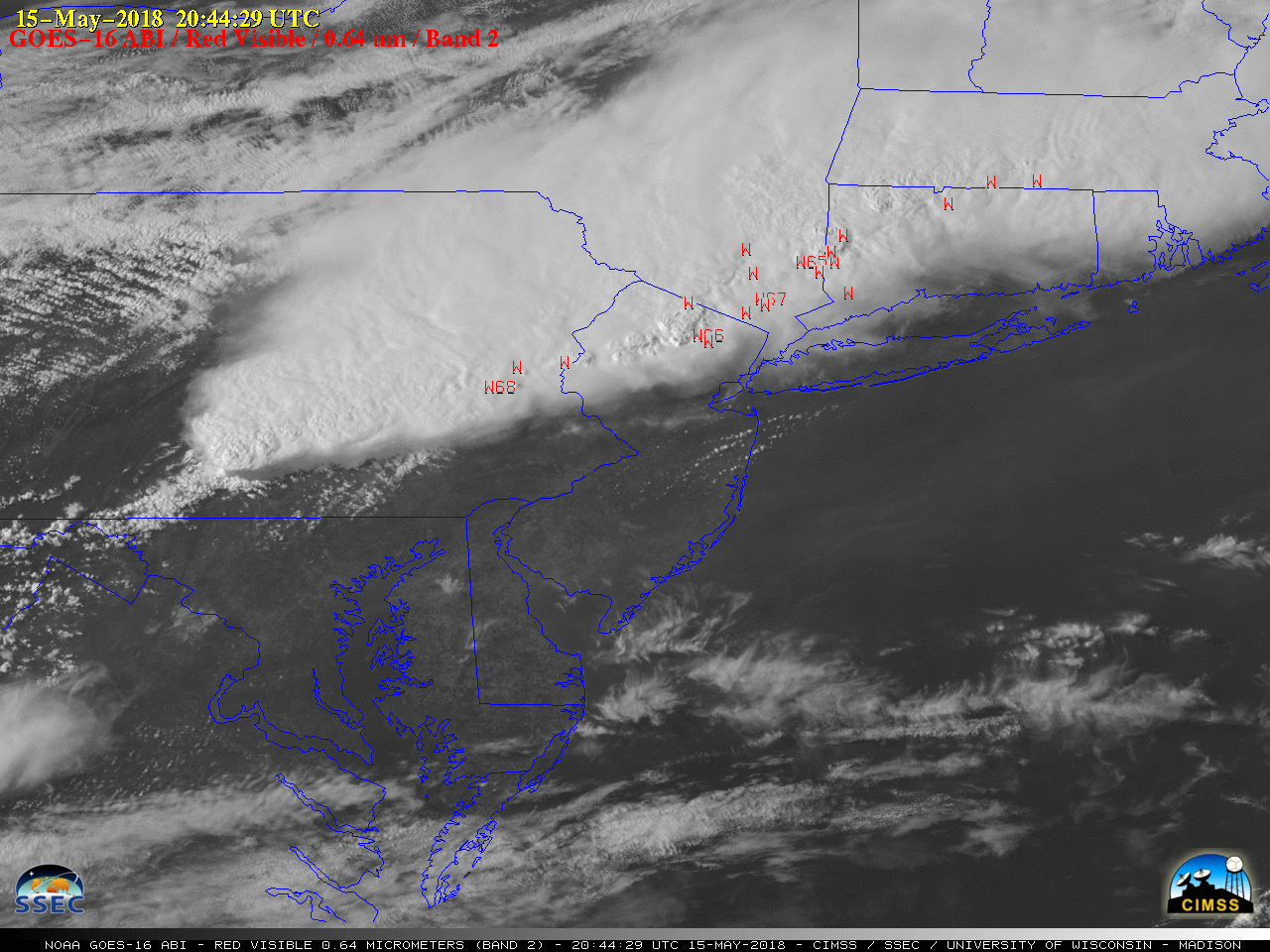
Severe weather in the Northeastern US
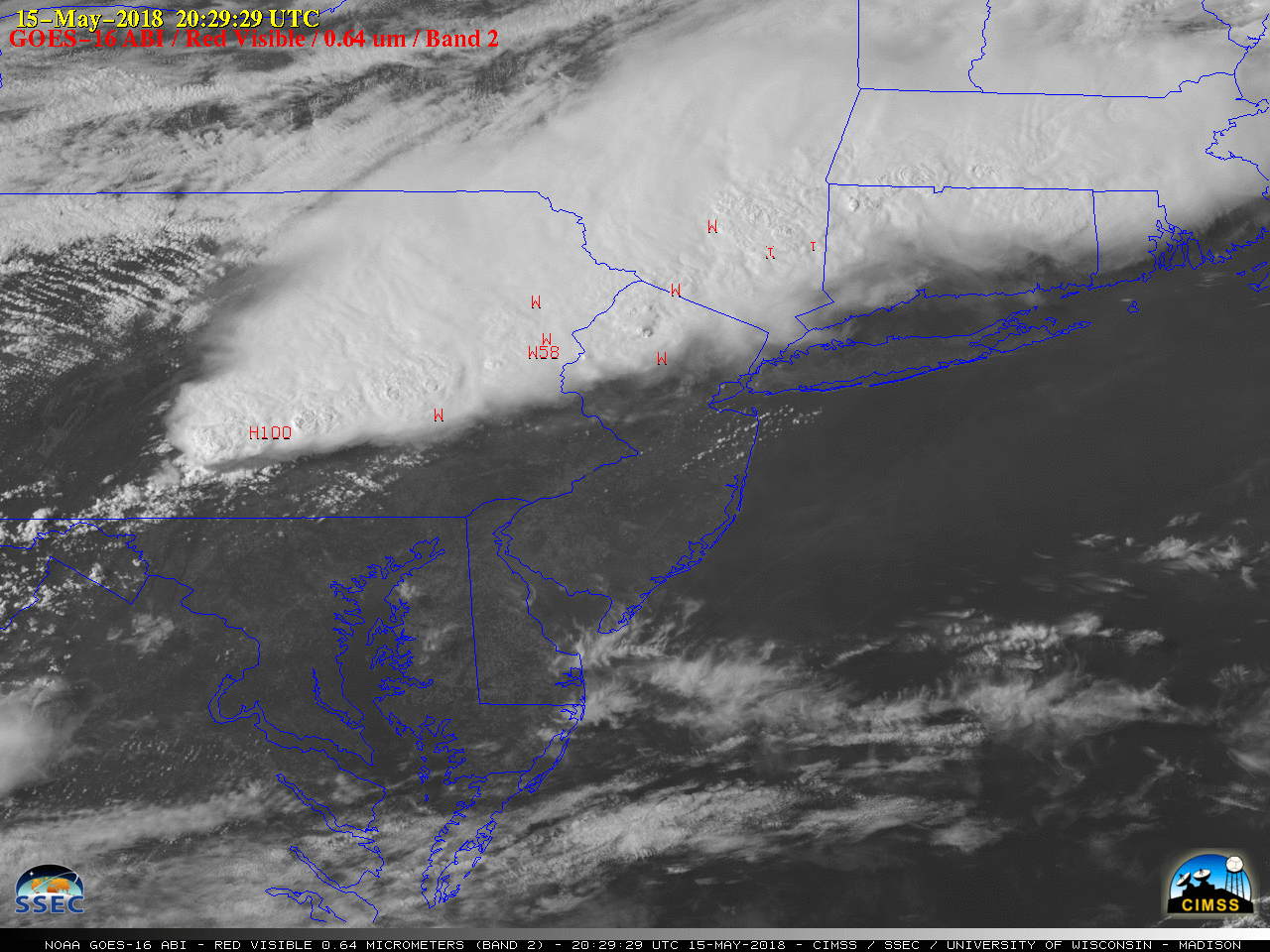
GOES-16 “Red” Visible (0.64 µm) images, with SPC storm reports plotted in red [click to play MP4 animation]
The corresponding GOES-16 “Clean” Infrared Window (10.3 µm) images (below) showed the evolution of cold overshooting tops, as well as the development of a few “enhanced-v” signatures with a pronounced warm wake immediately downwind of the cold overshooting top.
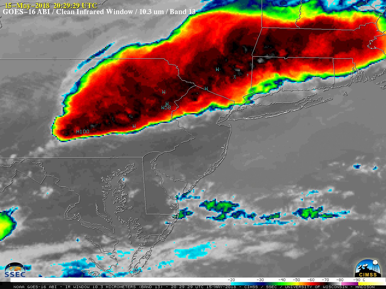
GOES-16 “Clean” Infrared Window (10.3 µm) images, with SPC storm reports plotted in cyan [click to play MP4 animation]
![POES (NOAA-19) Visible (0.86 µm) and Inrared (12.0 µm) images, with plots of SPC storm reports [click to enlarge]](https://cimss.ssec.wisc.edu/satellite-blog/wp-content/uploads/sites/5/2018/05/180515_2004utc_poes_avhrr_visible_infrared_spc_storm_reports_anim.gif)
POES (NOAA-19) Near-Infrared “Vegetation” (0.86 µm) and “Dirty” Infrared Window (12.0 µm) images, with plots of SPC storm reports [click to enlarge]