“Stratospheric instrusion vortex” off the US East Coast
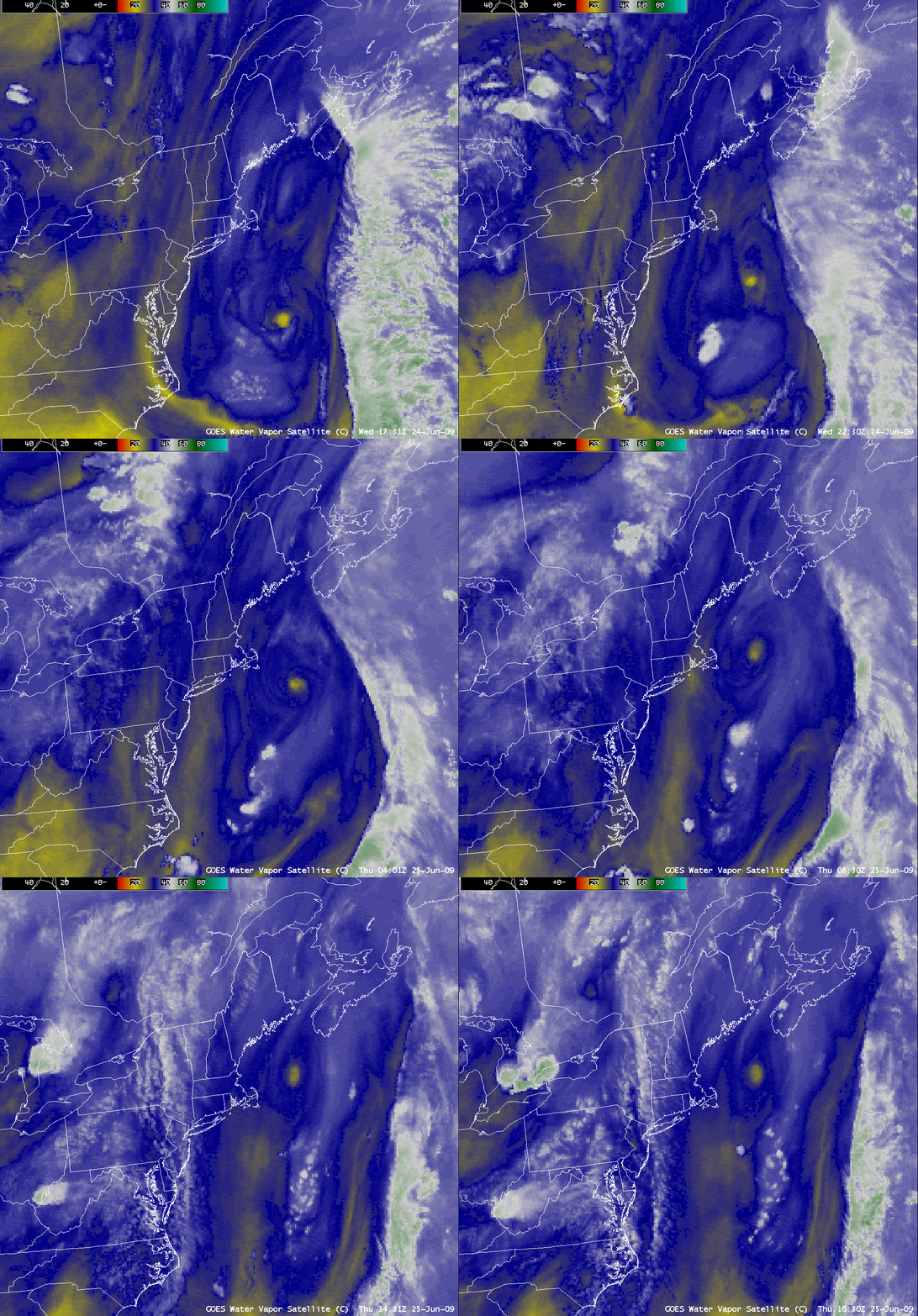
A small “dry swirl” feature (yellow color enhancement) was seen on AWIPS images of the GOES-12 6.5 µm water vapor channel (above) off the East Coast of the US on 24 June – 25 June 2009.
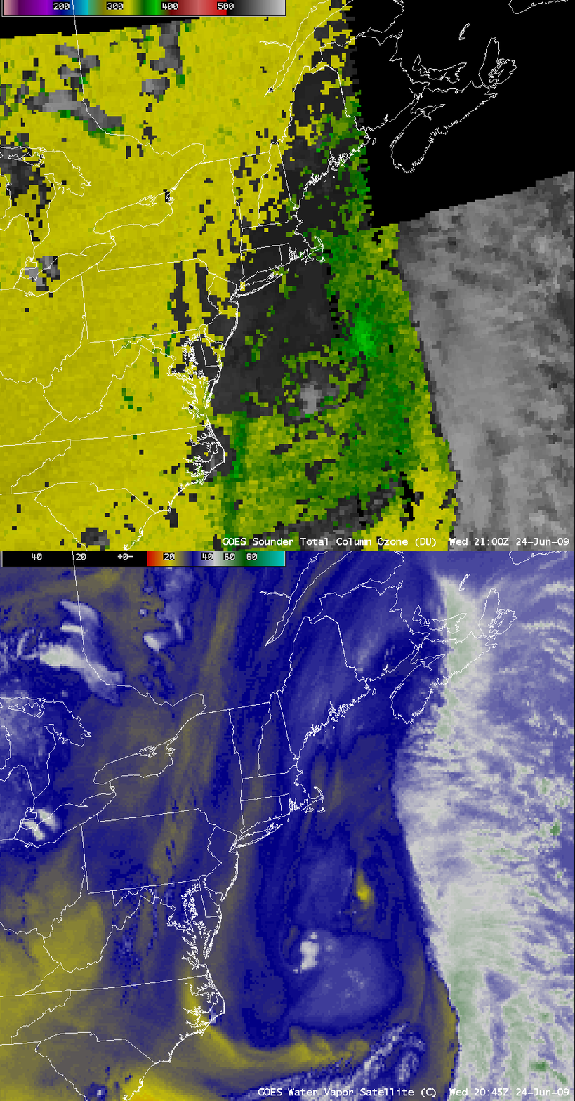
A comparison of a GOES-12 water vapor image with the corresponding GOES-12 sounder Total Column Ozone product at 21:00 UTC on 24 June (below) confirmed that this was a small-scale “stratospheric intrusion vortex”, with ozone values greater than 370 Dobson Units (lighter green color enhancement) in the vicinity of the dry feature on the water vapor imagery.
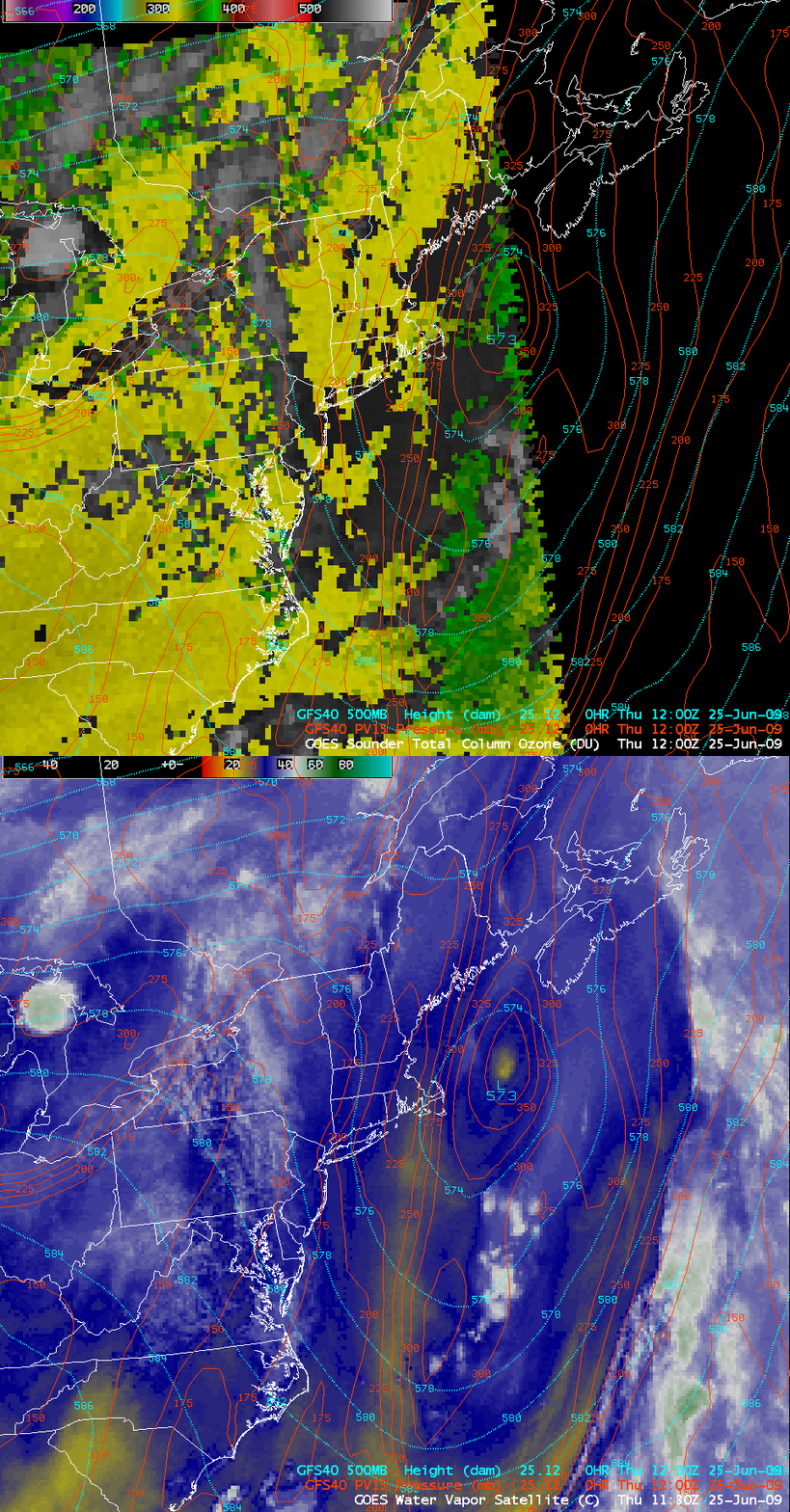
An overlay of GFS40 model fields on GOES-12 water vapor and Total Column Ozone images (below) indicated that the dynamic tropopause (taken to be the pressure of the PV1.5 potential vorticity surface) was as low as the 400 hPa level at 12:00 UTC on 25 June.
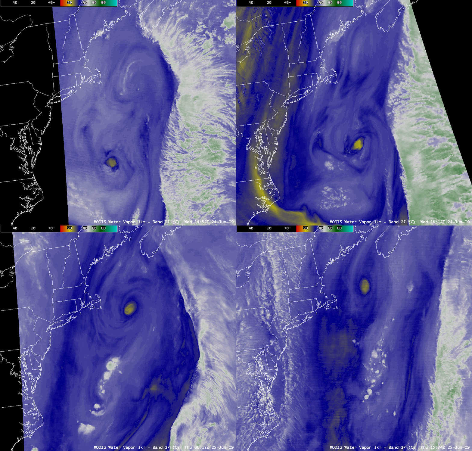
A more detailed view of the vortex could be seen using 1-km resolution MODIS 6.7 µm water vapor images (below).
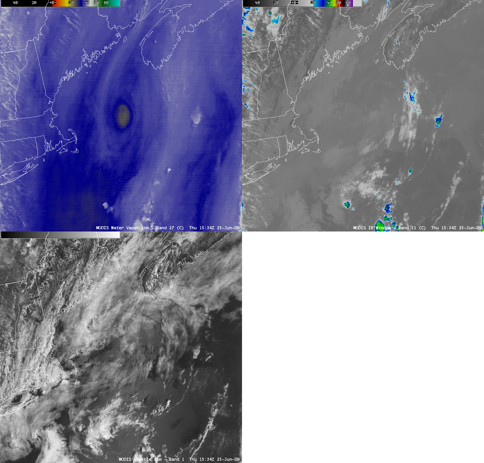
A comparison of MODIS water vapor, IR window, and visible images (below) showed that there was a lack of high clouds with this stratospheric intrusion vortex — only low-level clouds existed over the region in the vicinity of the vortex.
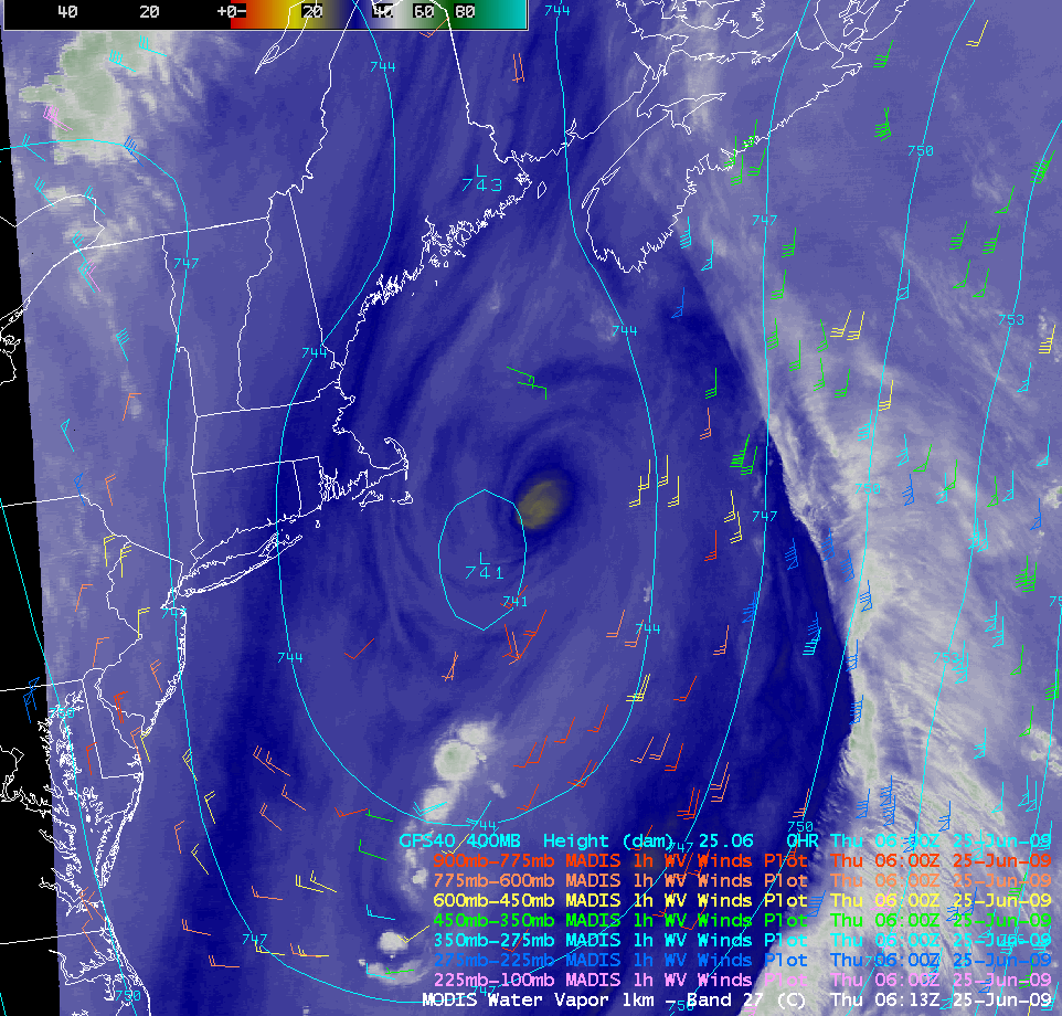
A comparison of a MODIS water vapor image with 1-hour MADIS satellite winds and GFS40 400 hPa height (below) showed that the stratospheric intrusion vortex was located just to the northeast of the closed low that was off the US East Coast during the period.


