Contrails off the coast of Southern California
It looks like someone was having fun flying in circles. Check out the contrails southwest of San Diego captured by #GOES16 yesterday afternoon. You can even see its shadow on the low clouds early in the animation. pic.twitter.com/PvUr2jNack
— NWS San Diego (@NWSSanDiego) April 24, 2018
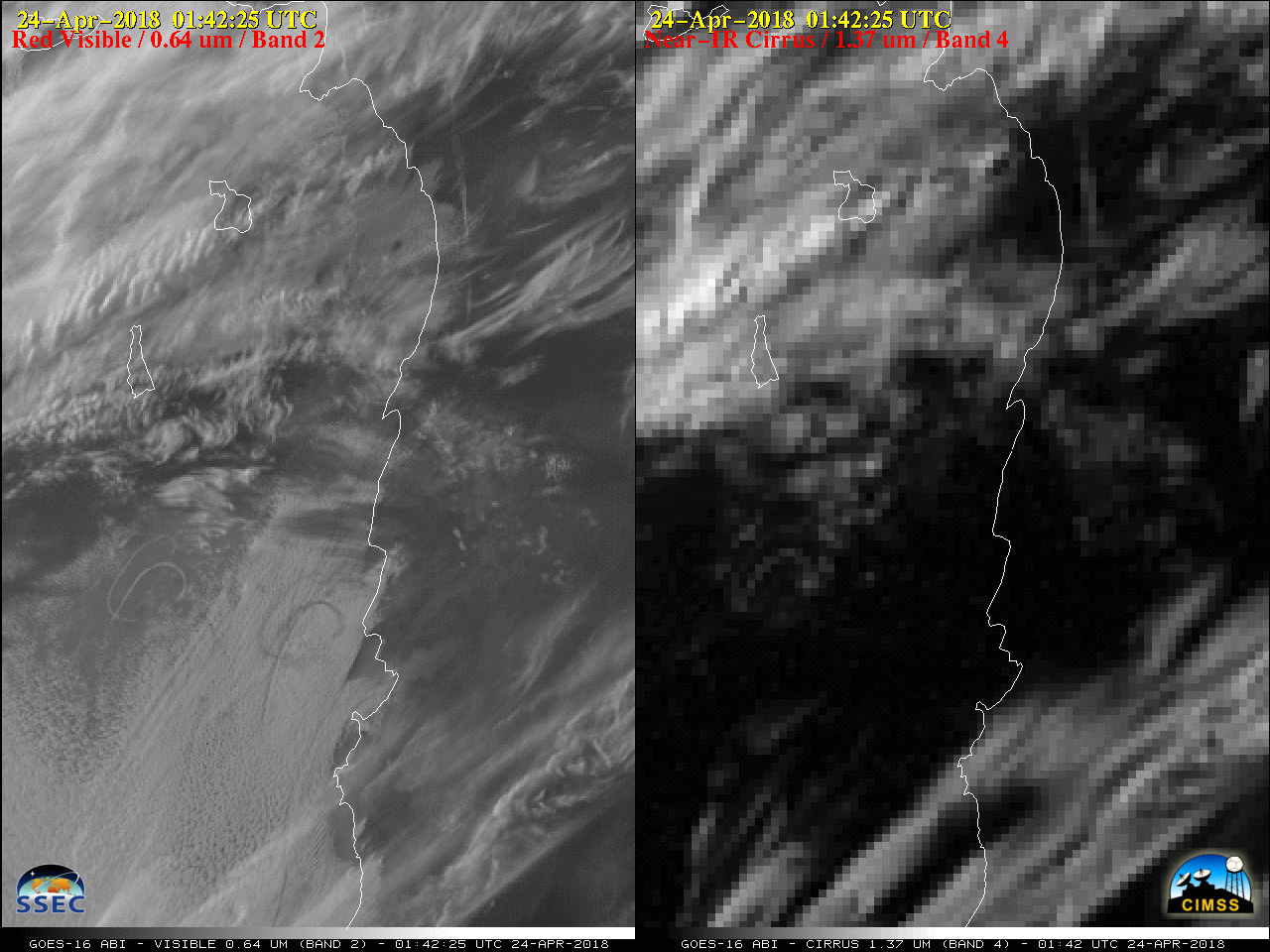
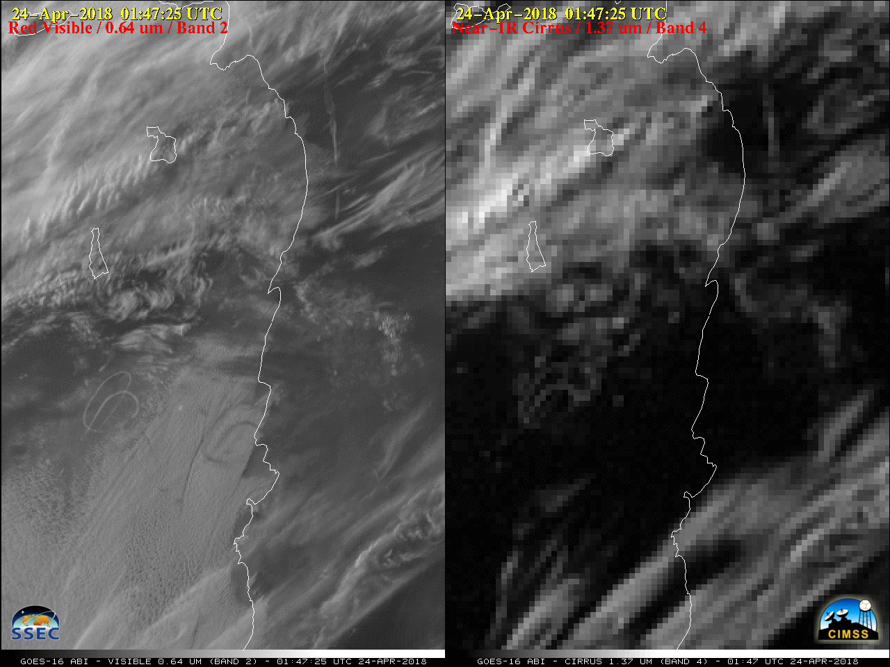
As pointed out by NWS San Diego, an interesting pattern of contrails formed off the coast late in the day on 23 April 2018. A comparison of GOES-16 (GOES-East) “Red” Visible (0.64 µm), Near-Infrared “Cirrus” (1.37 µm) and “Clean” Infrared Window (10.3 µm) images (below) showed signatures during the daylight hours — Visible images revealed contrail shadows being cast upon the low-altitude cloud tops at 0142 and 0147 UTC — with an Infrared signature persisting after sunset. These contrails were likely caused by military aircraft performing training exercises, since chaff was seen with radar in that same area on the previous day.
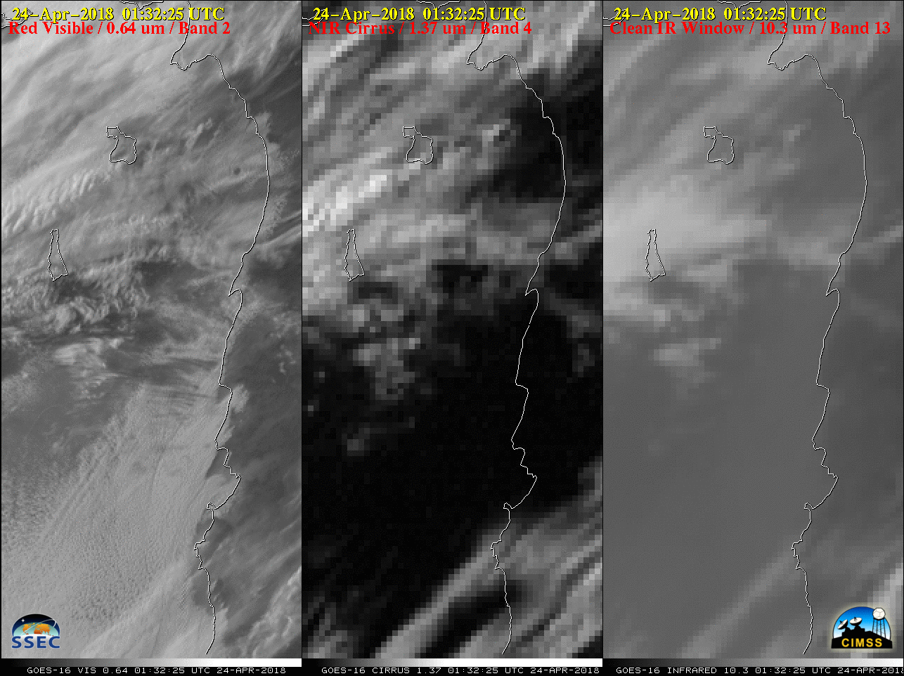
GOES-16 “Red” Visible (0.64 µm, left), Near-Infrared “Cirrus” (1.37 µm, center) and “Clean” Infrared Window (10.3 µm, right) images [click to play animation | MP4]
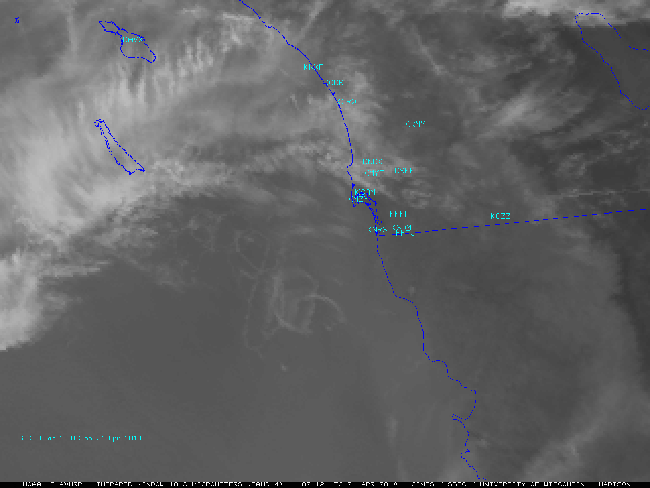
NOAA-15 AVHRR Infrared Window (10.8 µm) and GOES-16 ABI “Clean” Infrared Window (10.3 µm) images [click to enlarge]
![GOES-16 Low-level (7.3 µm, left), Mid-level (6.9 µm, center) and Upper-level (6.2 µm, right) Water Vapor images [click to play animation | MP4]](https://cimss.ssec.wisc.edu/satellite-blog/wp-content/uploads/sites/5/2018/04/180423_goes16_water_vapor_SoCal_contrails_anim.gif)
GOES-16 Low-level (7.3 µm, left), Mid-level (6.9 µm, center) and Upper-level (6.2 µm, right) Water Vapor images [click to play animation | MP4]
![GOES-16 Water Vapor weighting functions, calculated using rawinsonde data from San Diego CA [click to enlarge]](https://cimss.ssec.wisc.edu/satellite-blog/wp-content/uploads/sites/5/2018/04/180424_00utc_knkx_wv_wf.jpeg)
GOES-16 Water Vapor weighting functions, calculated using rawinsonde data from San Diego CA [click to enlarge]