Grass fires in northwest and southwest Oklahoma
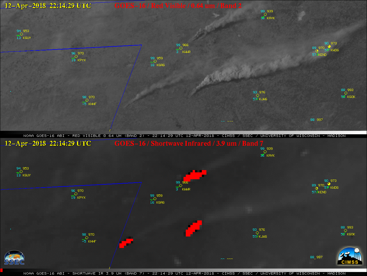
GOES-16 “Red” Visible (0.64 µm, top) and Shortwave Infrared (3.9 µm, bottom) images, with hourly plots of surface reports [click to play MP4 animation]
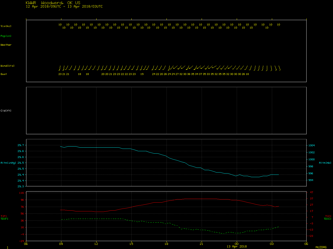
SPC had highlighted parts of New Mexico, Colorado, Texas and Oklahoma as having conditions favorable for Extreme wildfire behavior due to strong winds, hot temperatures and very dry air behind a dryline boundary (below). Note that the surface temperature / dew point depression at Woodward, Oklahoma (KWWR) at 2255 UTC on 12 April was 100 ºF (temperature = 97 ºF, dew point = -2 ºF), with southwesterly winds gusting to 35 knots or 40 mph.
![SPC Day 1 Fire Outlook [click to enlarge]](https://cimss.ssec.wisc.edu/satellite-blog/wp-content/uploads/sites/5/2018/04/180412_spc_day1_fire_outlook.jpeg)
SPC Day 1 Fire Outlook [click to enlarge]
===== 13 April Update =====
![Suomi NPP VIIRS Day/Night Band (0.7 µm) and Shortwave Infrared (3.9 µm) images [click to enlarge]](https://cimss.ssec.wisc.edu/satellite-blog/wp-content/uploads/sites/5/2018/04/180413_0837utc_suomi_npp_viirs_ShortwaveInfrared_DayNightBand_OK_fires_anim.gif)
Suomi NPP VIIRS Day/Night Band (0.7 µm) and Shortwave Infrared (3.9 µm) images [click to enlarge]
During the following daytime hours of 13 April, GOES-16 “Red” Visible (0.64 µm) and Shortwave Infrared (3.9 µm) images (below) showed the smoke plumes and hot pixels of the northwestern Oklahoma fires. The surface cold front moved over these fires around 18 UTC, with smoke transport transitioning more toward the east then southeast.
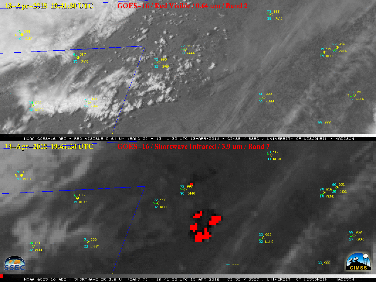
GOES-16 “Red” Visible (0.64 µm, top) and Shortwave Infrared (3.9 µm, bottom) images, with hourly plots of surface reports [click to play MP4 animation]
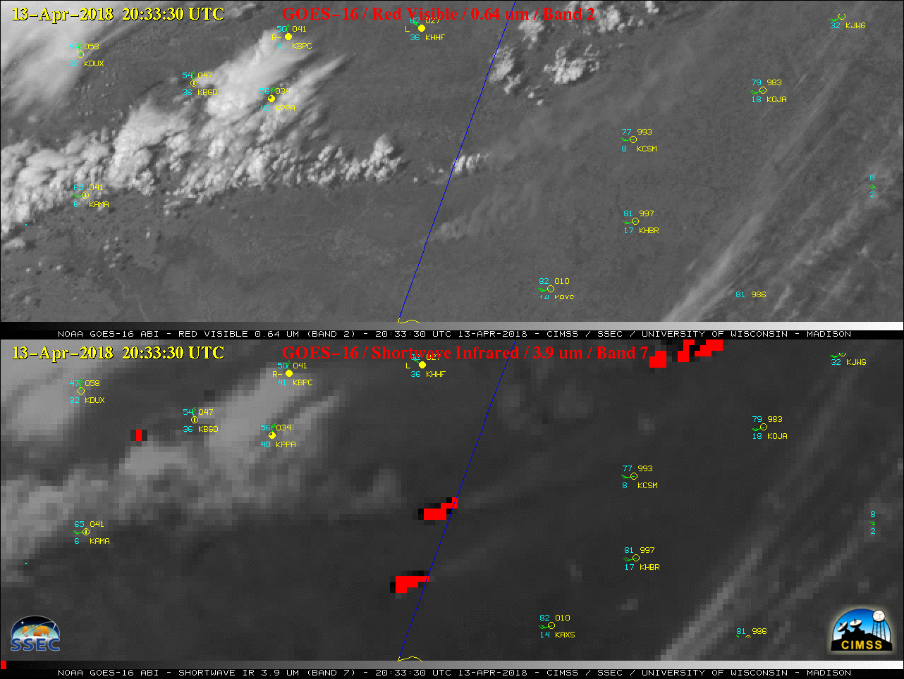
GOES-16 “Red” Visible (0.64 µm, top) and Shortwave Infrared (3.9 µm, bottom) images, with hourly plots of surface reports [click to play MP4 animation]
===== 14 April Update =====
Three nighttime comparisons of (Preliminary, non-operational) NOAA-20 and Suomi NPP VIIRS Day/Night Band (0.7 µm) and Shortwave Infrared (3.75 µm) images — each image pair separated by 50 minutes — (below; courtesy of William Straka, CIMSS) showed the bright glow and thermal hot spots of the ongoing Rhea fire complex.
![NOAA-20 VIIRS Day/Night Band (0.7 µm) and Shortwave Infrared (3.75 µm) images at 0737 UTC [click to enlarge]](https://cimss.ssec.wisc.edu/satellite-blog/wp-content/uploads/sites/5/2018/04/180414_0737utc_viirs_DayNightBand_ShortwaveIR_NW_OK_fires_anim.gif)
NOAA-20 VIIRS Day/Night Band (0.7 µm) and Shortwave Infrared (3.75 µm) images at 0737 UTC [click to enlarge]
![Suomi NPP VIIRS Day/Night Band (0.7 µm) and Shortwave Infrared (3.75 µm) images [click to enlarge]](https://cimss.ssec.wisc.edu/satellite-blog/wp-content/uploads/sites/5/2018/04/180414_0827utc_viirs_DayNightBand_ShortwaveIR_NW_OK_fires_anim.gif)
Suomi NPP VIIRS Day/Night Band (0.7 µm) and Shortwave Infrared (3.75 µm) images [click to enlarge]
![NOAA-20 VIIRS Day/Night Band (0.7 µm) and Shortwave Infrared (3.75 µm) images [click to enlarge]](https://cimss.ssec.wisc.edu/satellite-blog/wp-content/uploads/sites/5/2018/04/180414_0917utc_viirs_DayNightBand_ShortwaveIR_NW_OK_fires_anim.gif)
NOAA-20 VIIRS Day/Night Band (0.7 µm) and Shortwave Infrared (3.75 µm) images [click to enlarge]
===== 15 April Update =====
250-meter resolution Terra MODIS true-color and false-color Red-Green-Blue (RGB) images from MODIS Today (below) showed the burn scars from the 34 Complex and the larger Rhea Fire at 1719 UTC on 15 April 2018.
![Terra MODIS true-color and false-color RGB images [click to enlarge]](https://cimss.ssec.wisc.edu/satellite-blog/wp-content/uploads/sites/5/2018/04/180415_1719utc_terra_modis_truecolor_falsecolor_northwestern_OK_fires_anim.gif)
Terra MODIS true-color and false-color RGB images [click to enlarge]