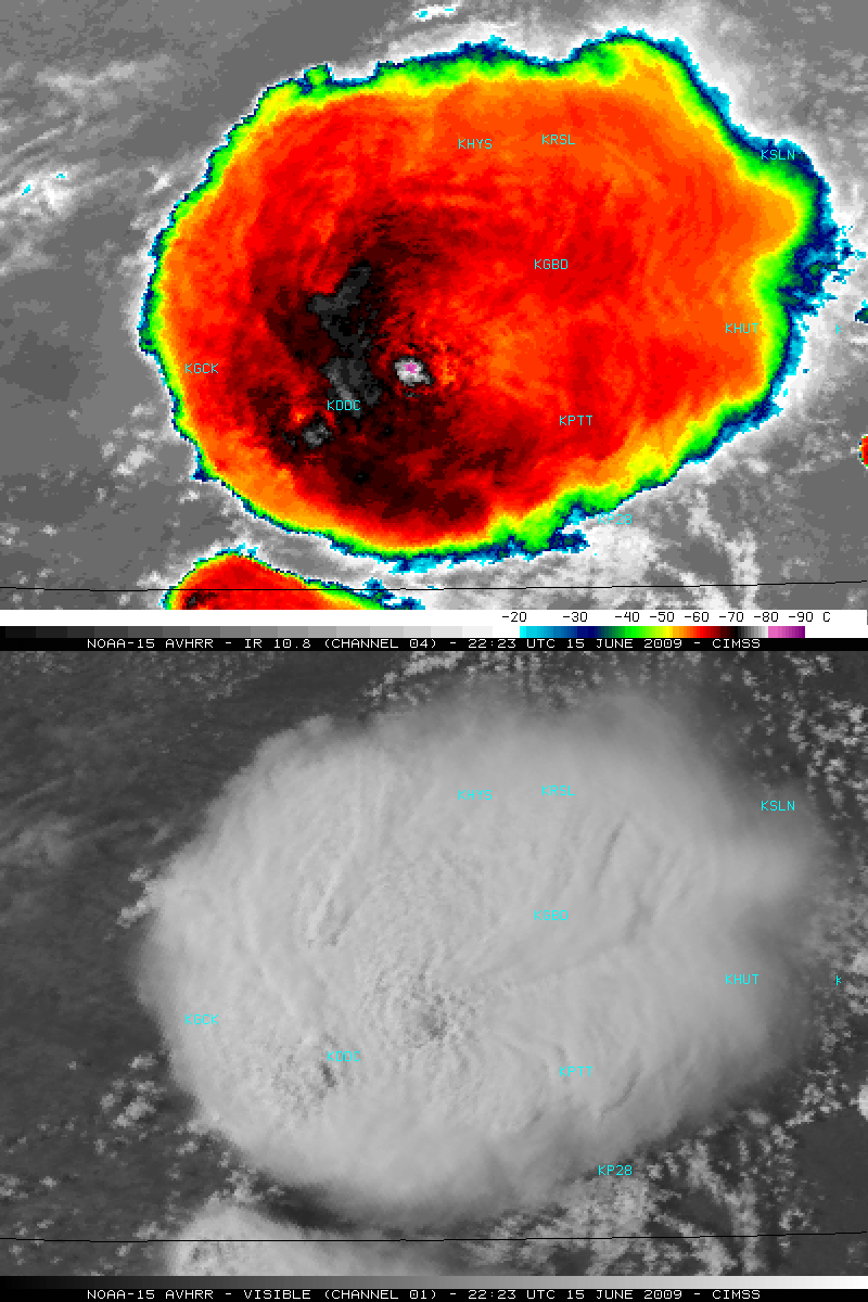
Severe thunderstorm in Kansas
A large severe thunderstorm that was developing in southern Kansas during the afternoon hours on 15 June 2009 had a very nice satellite presentation on NOAA-15 visible and 10.8 µm IR imagery (above). A “warm trench” signature appeared to be surrounding the cluster of coldest pixels associated with the strongest overshooting top located to the northeast of Dodge City, Kansas (station identifier KDDC). Around the time of these images, SPC storm reports included a tornado, hail of 1.75 inch in diameter, and wind gusts to 60 mph just to the east of Dodge City.
A comparison of the 1-km resolution NOAA-15 10.8 µm IR and the 4-km resolution GOES-12 10.7 µm IR data (below) showed that the coldest cloud top IR brightness temperature was -86º C on the NOAA-15 image (versus -73º C on the corresponding GOES-12 image). In addition, a significant parallax shift was seen on the GOES-12 image, due to the large viewing angle of the geostationary satellite — image features were located several miles to the north-northwest on the GOES-12 image.


