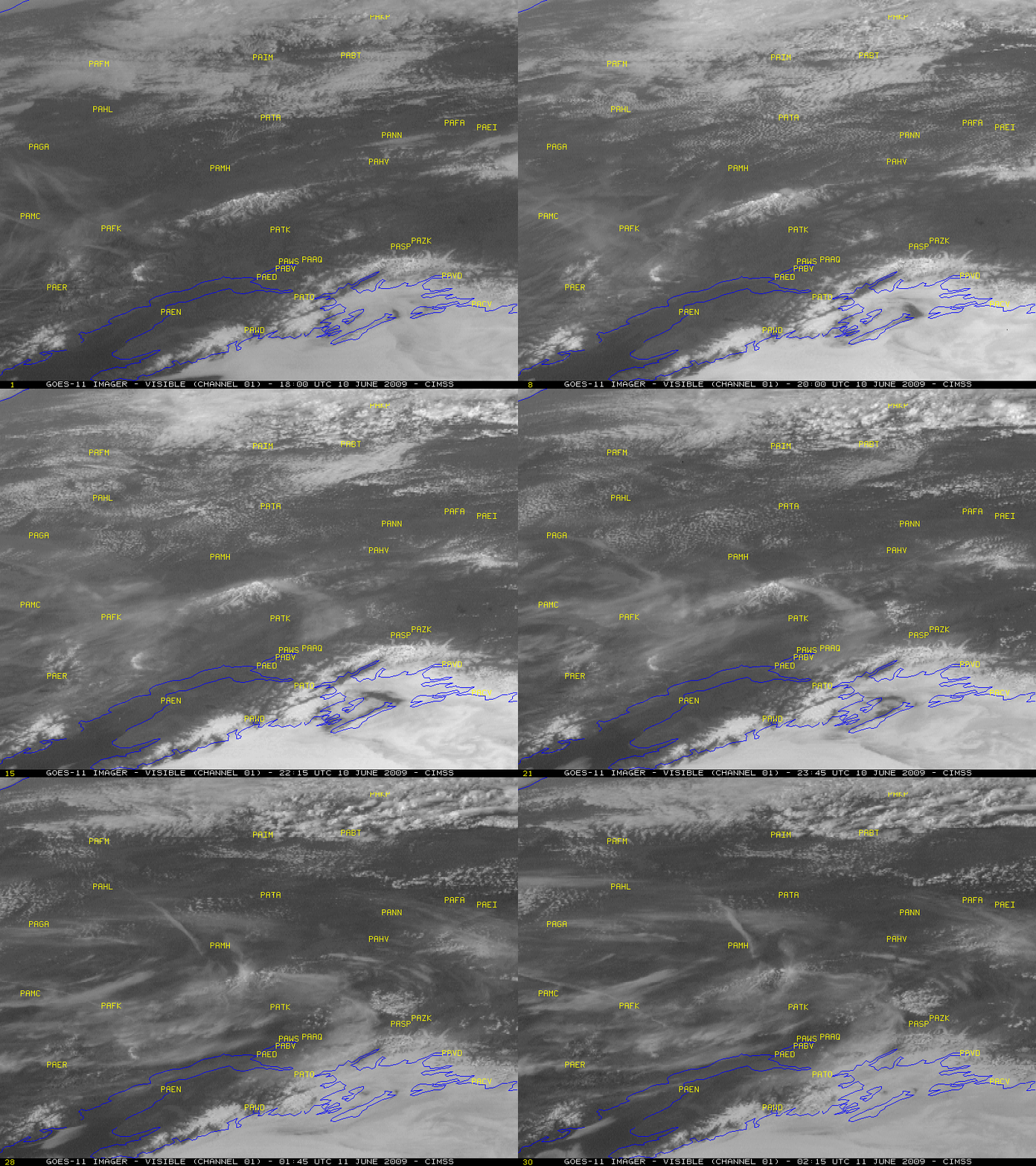
Denali (“Mt. McKinley”) erupts!
Well, not really — but a very interesting cloud plume formed yesterday and streamed off the 20,318-ft (6194-m) summit of Denali (“Mt. McKinley”) in southern Alaska on 10 June 2009, which almost had the appearance of a volcanic eruption plume. GOES-11 visible images (above) showed this thin cloud plume spreading out as it curved to the southeast and then to the south, eventually moving over Anchorage and then the Kenai Peninsula.
A 1-km resolution NOAA-18 AVHRR 10.8 µm IR image (below) indicated that IR brightness temperatures were quite warm for such a high-altitude cirrus plume, barely reaching the -15 to -20º C range. Due to the thin nature of this cloud plume, a significant amount of radiation from the warmer ground surfaces below was bleeding upward through the thin cloud layer and reaching the satellite detectors.
A false-color NOAA-18 Red/Green/Blue (RGB) image (below) showed the “transparent” nature of the cloud plume, with snow cover features on the ground clearly recognizable beneath the cloud.
Tracking the location of the leading edge of the thin cloud plume feature was difficult using single-channel satellite imagery, which underscores the importance of using multi-spectral satellite products such as the 10.8 – 12.0 µm IR difference (below) to correctly analyze the cloud location. Areas where the IR difference product reached +7 to +10 K (cyan colors) corresponded to the thicker portions of the cloud plume.
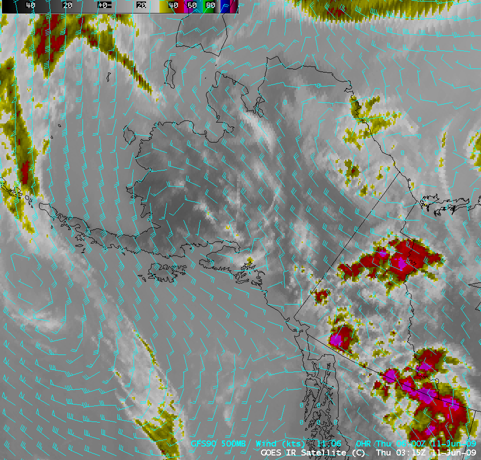
The cloud plume was curving to the southeast and then to the south due to the presence of a ridge of high pressure aloft over southern Alaska, as seen on an AWIPS image of the GOES-11 IR channel with an overlay of the GFS model 500 hPa winds (below).
A tip of the hat to Emily Niebuhr, UW-Madison / AOS graduate student, who is currently up in Alaska and brought this to our attention!


