Water vapor signatures of compensating subsidence around thunderstorms
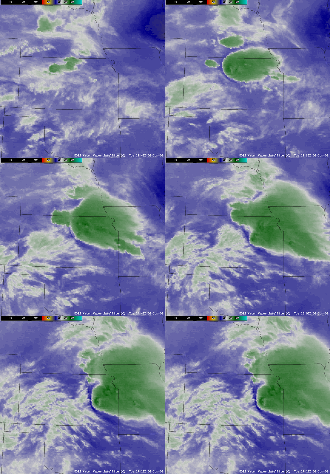
AWIPS images of the GOES-12 6.5 µm “water vapor channel” (above) showed the development of widespread severe convection across parts of Kansas on 09 June 2009. Of particular interest was the appearance of an arc of significantly warmer/drier air (signified by the darker blue colors) along the upwind (western) edge of the thunderstorm cloud as the convection continued to intensify. This water vapor image signature likely indicates areas of well-defined compensating subsidence along with the possible “detrainment” of dry stratospheric air around the cloud edge. Note that the upstream cirrus cloud features also appeared to erode and disappear as they arrived at this region of subsidence along the western cloud edge.
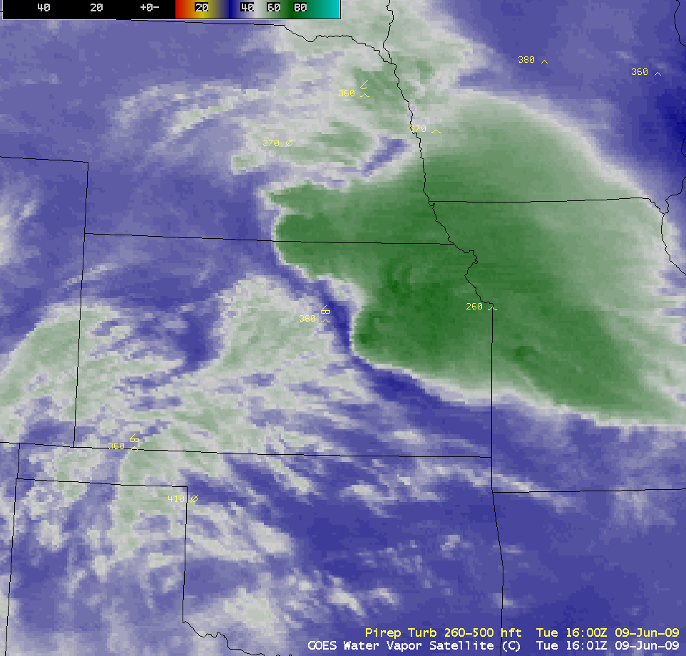
There was one pilot report of moderate turbulence at an altitude of 38,000 feet around 16:00 UTC (below), which was near the water vapor signature of compensating subsidence.
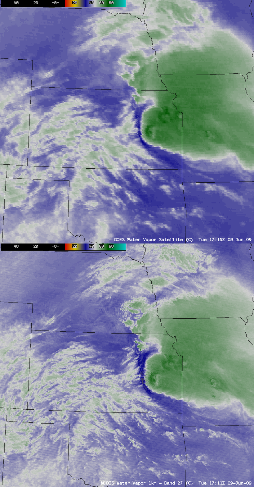
A comparison of the 1-km resolution MODIS 6.7 µm water vapor channel and the 4-km resolution GOES-12 6.5 µm water vapor channel data (below) shows that MODIS water vapor brightness temperature values were as warm as -26.5º C (yellow color enhancement) just to the west of the thunderstorm edge — the warmest GOES-12 water vapor brightness temperature value was -29º C.
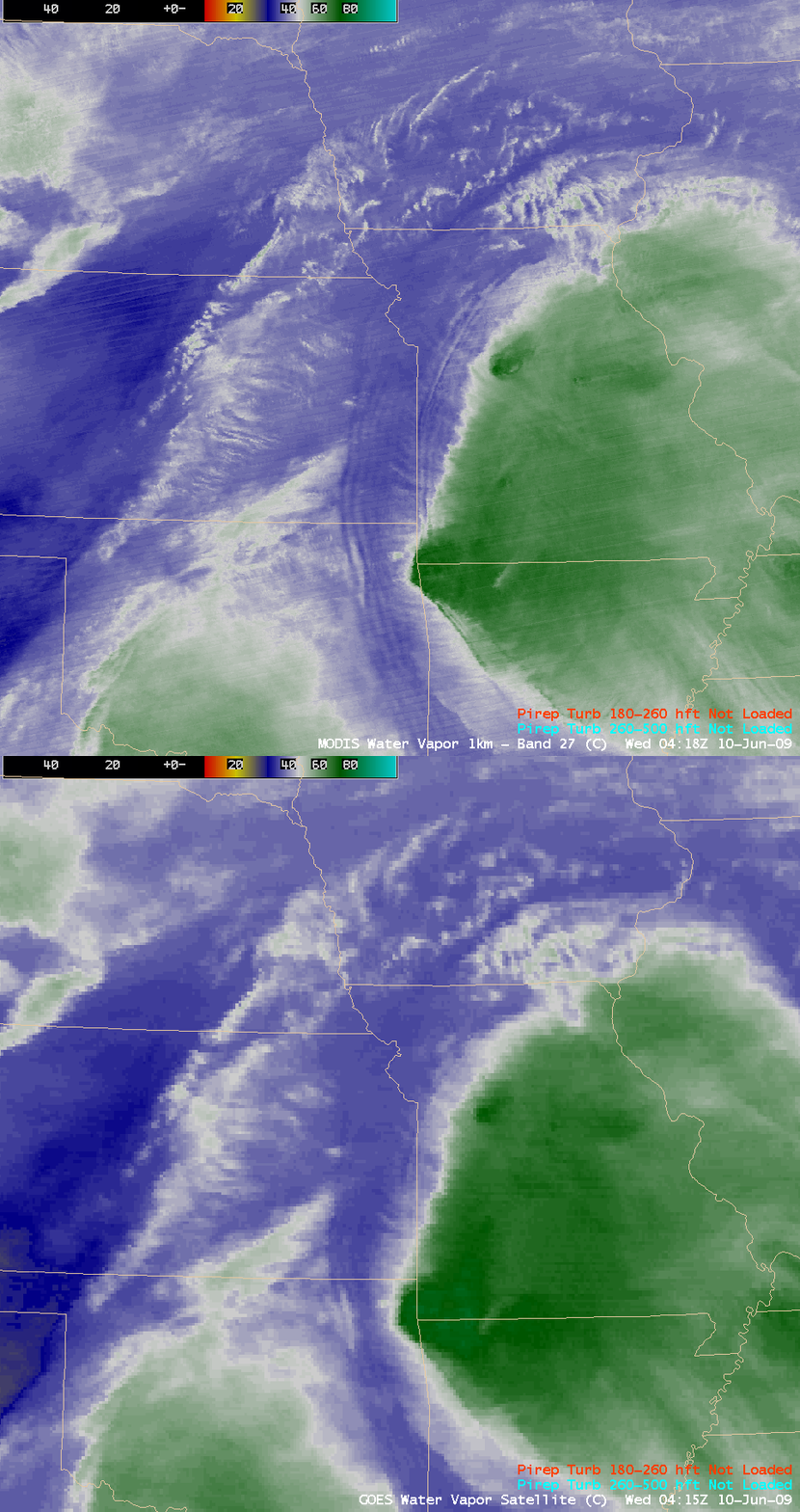
A similar comparison of MODIS and GOES-12 water vapor images about 10 hours later (below) displayed a very pronounced signature of a gravity wave train along the western edge of the ongoing thunderstorm complex. There were no pilot reports of turbulence in that particular region at that time.


