Blowing dust in Texas and Oklahoma
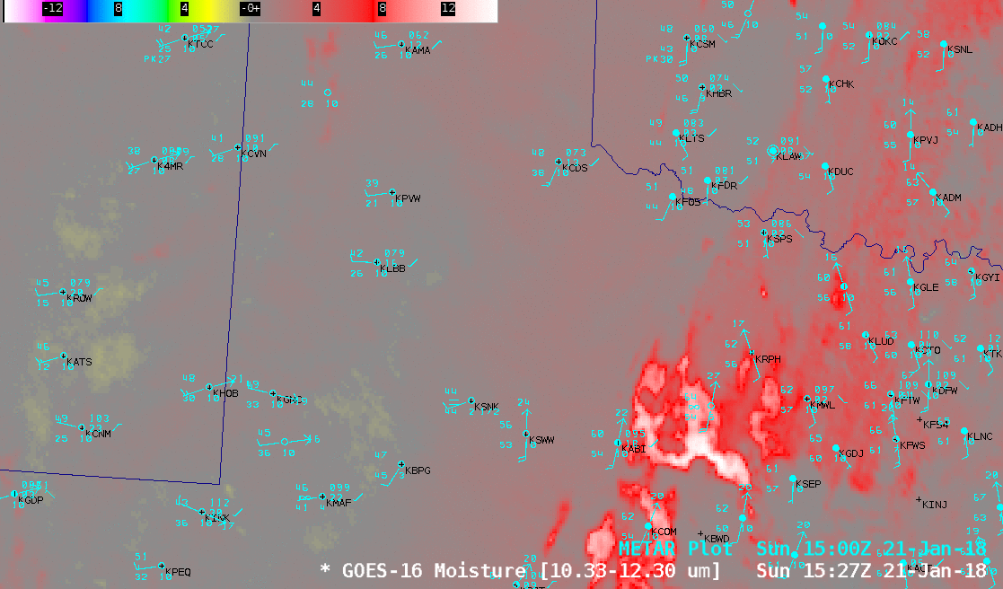
GOES-16 “Moisture” Infrared brightness temperature difference (10.3-12.3 µm) images, with hourly surface reports plotted in cyan [click to play animation]
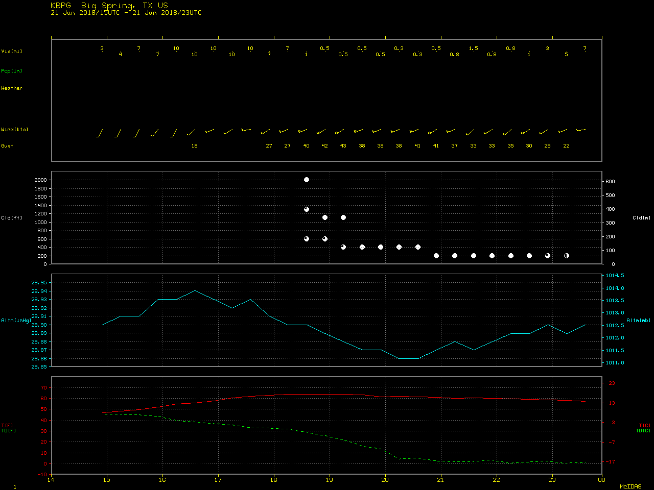
GOES-16 “Red” Visible (0.64 µm) and Near-Infrared “Cirrus” (1.37 µm) images (below) also displayed blowing dust signatures; the surface visibility was restricted to 2-3 miles at some locations, with Big Spring briefly reporting only 1/4 mile from 20-21 UTC. The dust signature was apparent on the Cirrus imagery because this spectral band can be used to detect any airborne particles that are effective scatterers of light (such as cirrus ice crystals, volcanic ash, dust/sand or haze).
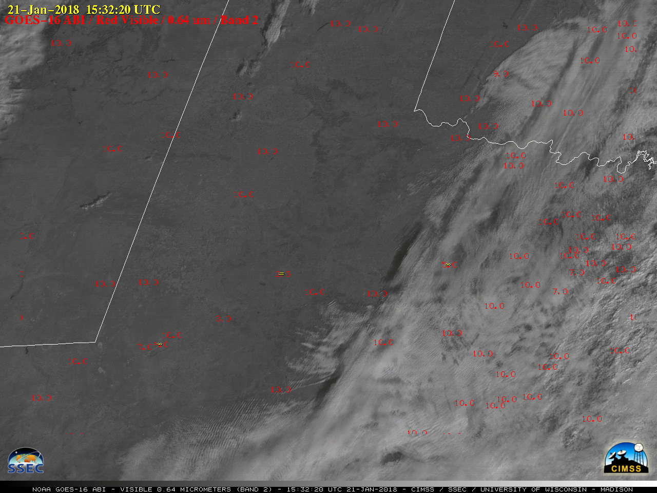
GOES-16 “Red” Visible (0.64 µm) images, with hourly reports of surface weather plotted in red and surface visibility (miles) plotted in red [click to play animation]
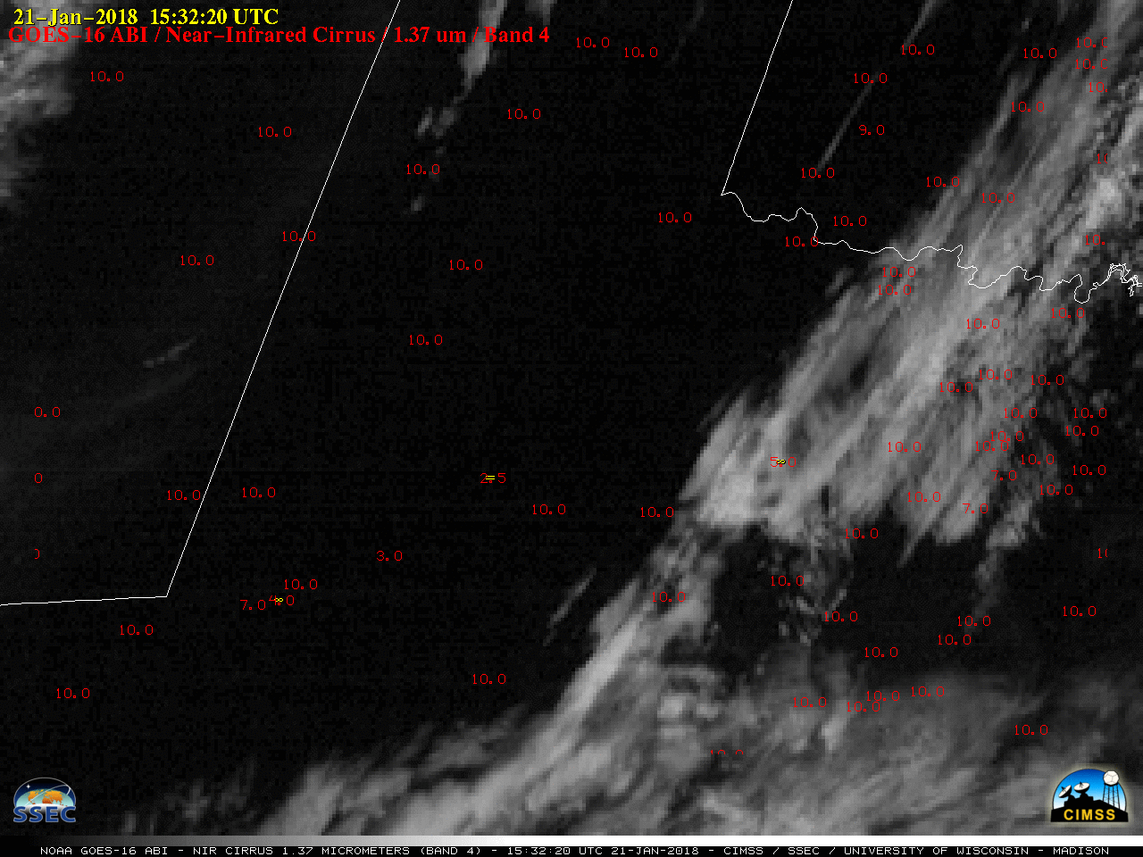
GOES-16 Near-Infrared “Cirrus” (1.37 µm) images, with hourly reports of surface weather plotted in red and surface visibility (miles) plotted in red [click to play animation]
![Terra MODIS Visible (0.65 µm), Cirrus (1.37 µm), Shortwave Infrared (3.7 µm) and Infrared Window (11.0 µm) images, with surface reports plotted in cyan [click to enlarge]](https://cimss.ssec.wisc.edu/satellite-blog/wp-content/uploads/sites/5/2018/01/180121_1732utc_terra_modis_Visible_Cirrus_ShortwaveInfrared_InfraredWindow_TX_bldn_anim.gif)
Terra MODIS Visible (0.65 µm), Cirrus (1.37 µm), Shortwave Infrared (3.7 µm) and Infrared Window (11.0 µm) images, with surface reports plotted in cyan [click to enlarge]
![Aqua MODIS Visible (0.65 µm), Cirrus (1.37 µm), Shortwave Infrared (3.7 µm) and Infrared Window (11.0 µm) images, with surface reports plotted in cyan [click to enlarge]](https://cimss.ssec.wisc.edu/satellite-blog/wp-content/uploads/sites/5/2018/01/180121_1912utc_aqua_modis_Visible_Cirrus_ShortwaveInfrared_InfraredWindow_TX_bldn_anim.gif)
Aqua MODIS Visible (0.65 µm), Cirrus (1.37 µm), Shortwave Infrared (3.7 µm) and Infrared Window (11.0 µm) images, with surface reports plotted in cyan [click to enlarge]
/na2018_01_21_021.gif)
![Terra MODIS Infrared Window (11.0 µm) image, with a pilot report of turbulence highlighted in red [click to enlarge]](https://cimss.ssec.wisc.edu/satellite-blog/wp-content/uploads/sites/5/2018/01/180121_1732utc_modis_ir_pirep_turbulence.jpeg)
Terra MODIS Infrared Window (11.0 µm) image, with a pilot report of turbulence highlighted in red [click to enlarge]
![Terra MODIS Infrared Window (11.0 µm) image, with a pilot report of dust layer top and flight level visibility highlighted in red [click to enlarge]](https://cimss.ssec.wisc.edu/satellite-blog/wp-content/uploads/sites/5/2018/01/180121_1732utc_modis_ir_pirep_visibility.jpeg)
Terra MODIS Infrared Window (11.0 µm) image, with a pilot report of dust layer top and flight level visibility highlighted in red [click to enlarge]