Long “atmospheric rivers” of moisture
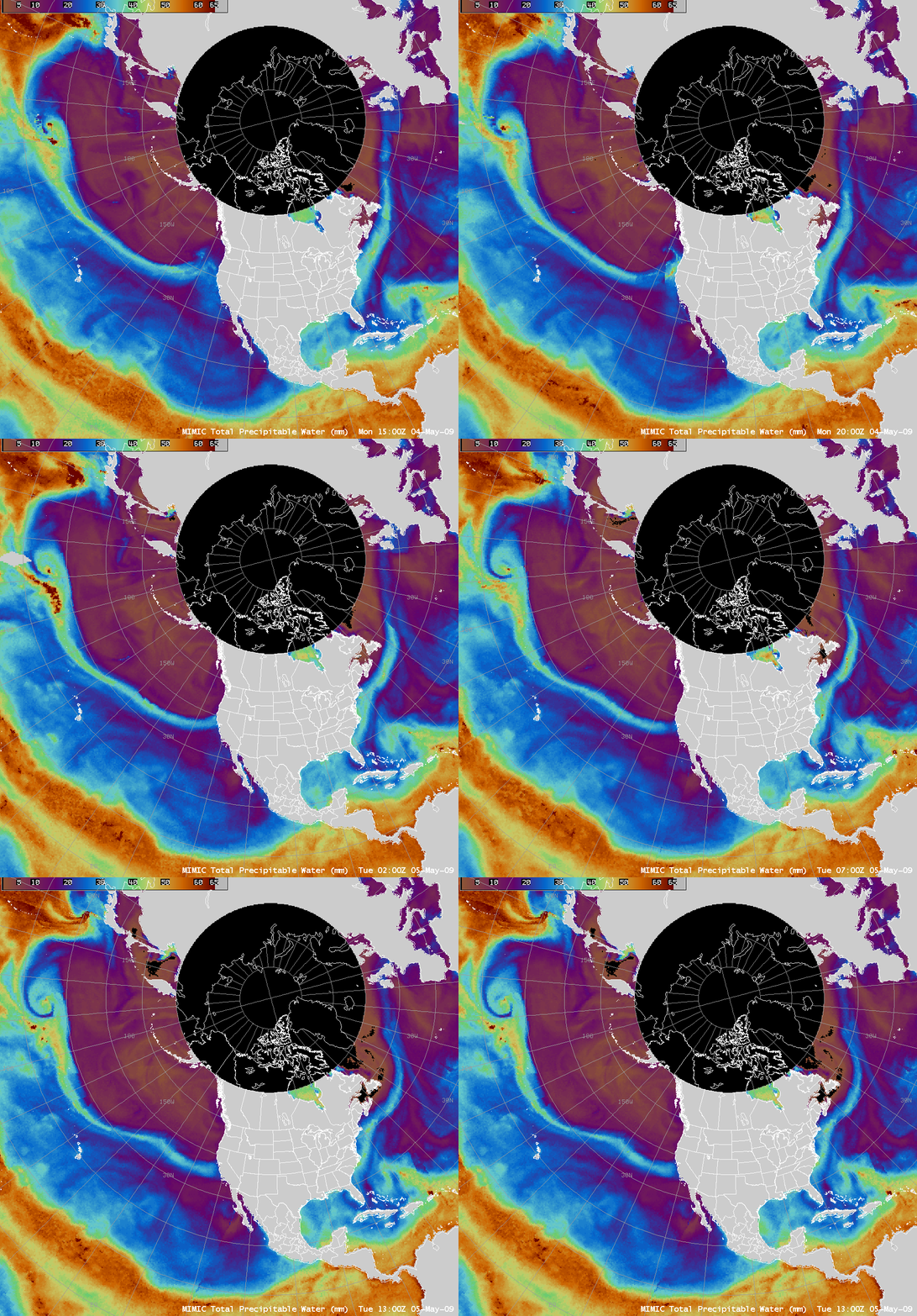
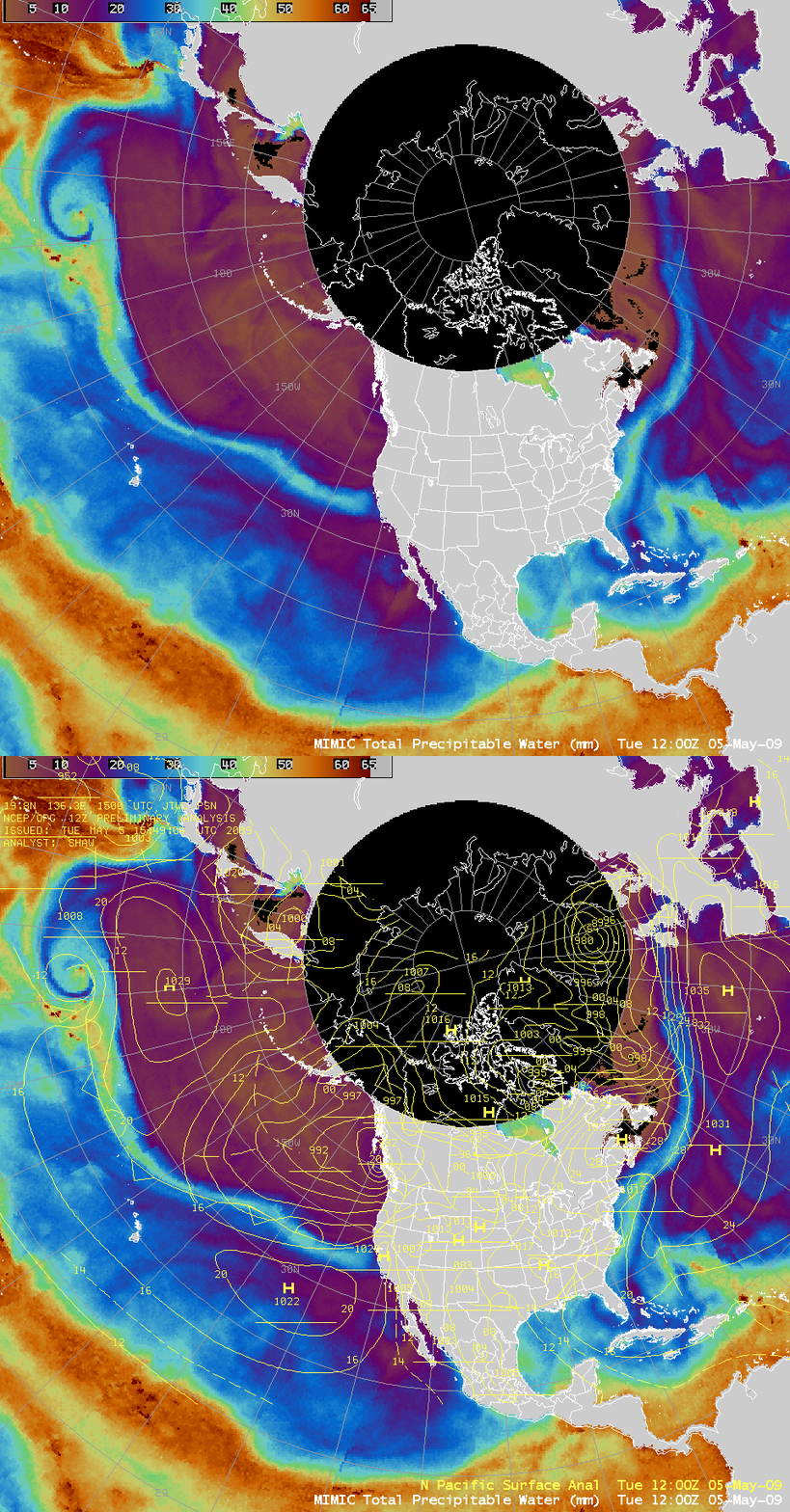
AWIPS images of the MIMIC Total Precipitable Water (TPW) product (above) showed the presence of long, narrow filaments of moisture (often described as “atmospheric rivers“) that were moving across the North Pacific Ocean and the North Atlantic Ocean during the 04 May – 05 May 2009 period. Studies by Newell and others suggest that these atmospheric rivers can persist for more than 10 days, and are capable of transporting as much water as the Amazon River!
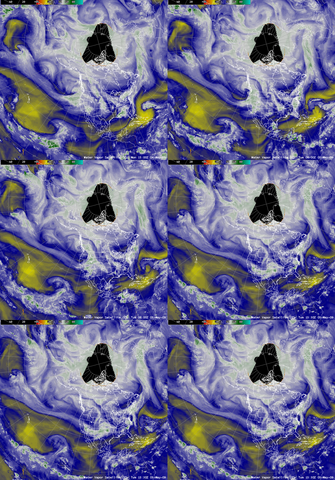
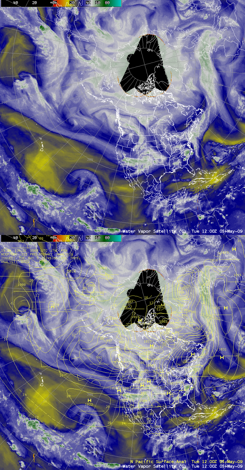
Composite geostationary satellite water vapor imagery (below) showed a similar signature of enhanced clouds and moisture along the axis these two atmospheric rivers — however, the presentation on the water vapor imagery was a bit different in terms of width and location.
Note that the surface frontal structure was more closely aligned with the atmospheric rivers seen on the TPW imagery (above), but there was more of a mismatch with the corresponding water vapor image features (below). This is due to the fact that the water vapor imagery is generally sensing a signal from moisture located within a fairly deep layer aloft in the middle to upper troposphere, at a level above which the bulk of the total column precipitable water is located.
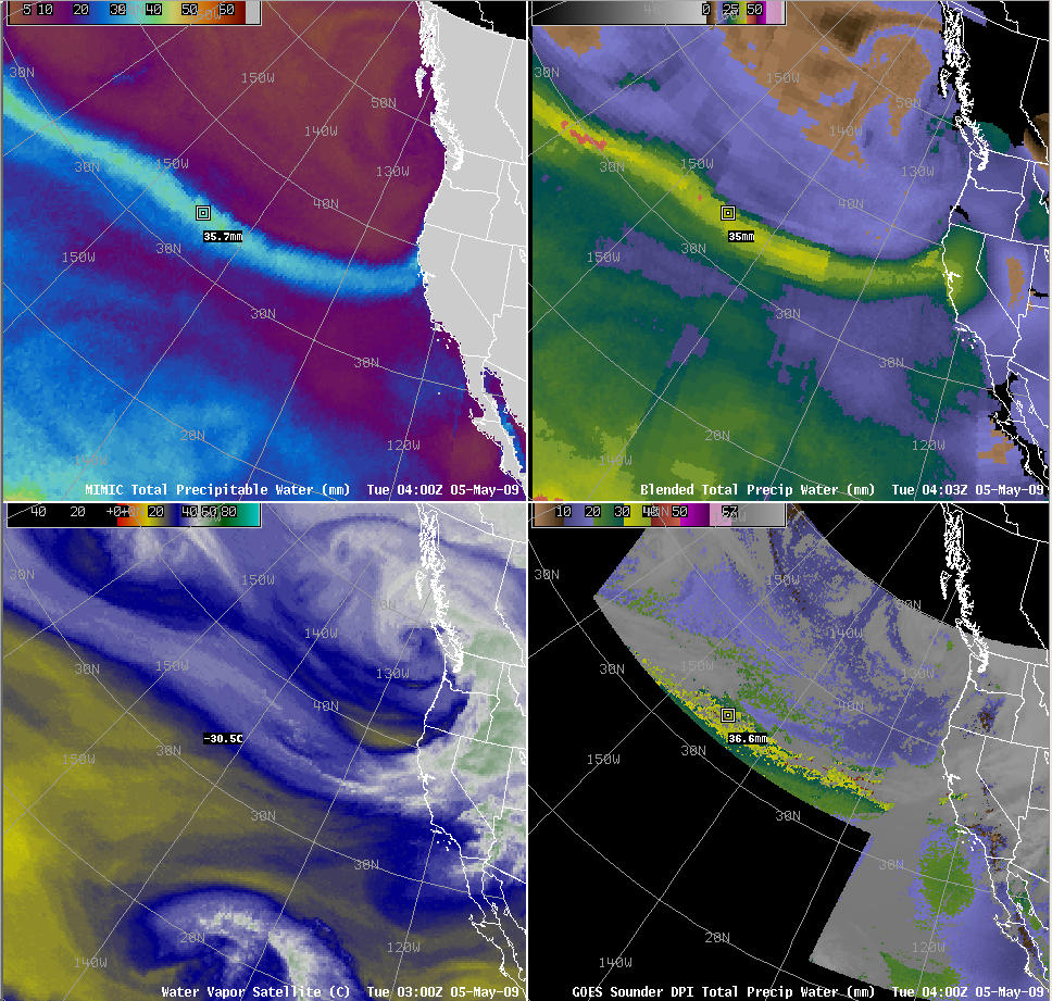
A 4-panel comparison of the MIMIC TPW, the Blended TPW, GOES Imager water vapor channel, and the GOES Sounder TPW products (below) shows that there is good agreement to the general magnitude of the TPW values between the various products. An animation shows the various strengths and weaknesses of each in terms of their utility for tracking atmospheric rivers. The MIMIC and Blended TPW products (top 2 panels) had better temporal continuity, while the GOES water vapor imagery and the GOES Sounder TPW product (bottom 2 panels) suffered from gaps in coverage due to either Spring eclipse or the variable GOES Sounder scanning strategy.


