Three Tropical Cyclones in the Atlantic Basin
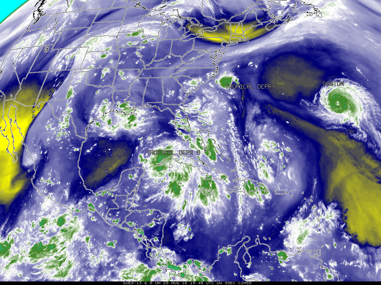
![GOES-13 Water Vapor Infrared (6.5 µm) Imagery, 2345 UTC 23 August - 1945 UTC 29 August [click to animate]](https://cimss.ssec.wisc.edu/satellite-blog/wp-content/uploads/sites/5/2016/08/WV_23Aug2016_2345_29Aug2016_1945anim.gif)
GOES-13 Water Vapor Infrared (6.5 µm) Imagery, 2345 UTC 23 August – 1945 UTC 29 August [click to animate]
Of more interest to the United States are Tropical Depression #8, a small system just southeast of Cape Hatteras, represented as a circular cluster of thunderstorms at the end of the animation, and Tropical Depression #9 near western Cuba. (Click here for an annotated water vapor imagery identifying the storms) Tropical Depression #9 has emerged from the system discussed here. Interests along the coast of North Carolina and Virginia should pay close attention to forecasts on Tropical Depression #8, and those on the Gulf Coast from Louisiana eastward should monitor Tropical Depression #9. For the latest information, see the webpages of the National Hurricane Center.
MIMIC Total Precipitable Water, below, for the 72 hours ending at 1800 UTC on 29 August (from this site), shows that Tropical Depression #8 and Hurricane Gaston, are near regions of dry air that might influence their evolution. In contrast, Tropical Depression #9 is embedded within an atmosphere rich in moisture.
The next two names for tropical cyclones in the Atlantic are Hermine and Ian.
![Total Precipitable Water, 1900 UTC 26 August - 1800 UTC 29 August 2016 [click to enlarge]](https://cimss.ssec.wisc.edu/satellite-blog/wp-content/uploads/sites/5/2016/08/OLDMIMICTPW_72hrs_ending_18UTC_29August.gif)
Total Precipitable Water, 1900 UTC 26 August – 1800 UTC 29 August 2016 [click to enlarge]