Southwest US summer solstice: smoke, and solar panels
![Suomi NPP VIIRS Day/Night Band (0.7 µm), Shortwave Infrared (3.74 µm) and Infrared Window (11.45 µm) images [click to enlarge]](https://cimss.ssec.wisc.edu/satellite-blog/wp-content/uploads/sites/5/2016/06/160620_0853utc_suomi_npp_viirs_DayNightBand_ShortwaveIR_IRWindow_Cedar_Fire_Arizona_anim.gif)
Suomi NPP VIIRS Day/Night Band (0.7 µm), Shortwave Infrared (3.74 µm) and Infrared Window (11.45 µm) images [click to enlarge]
During the following afternoon hours, a toggle between 2117 UTC Aqua MODIS Near-Infrared “Cirrus detection” (1.61 µm), Visible (0.65 µm), Infrared Window (11.0 µm) and Topography images (below) showed that the smoke aloft had moved northward during the day and was over far northwestern Arizona and southwestern Utah. On the Visible image, the dense layer of smoke obscured the view of surface features that are normally seen on a cloud-free day, but the edges of the smoke feature were difficult or impossible to identify. However, the smoke feature was quite evident on the Near-Infrared “Cirrus detection” image — due to the fact that this spectral band (which will be on the GOES-R ABI instrument) is useful for detecting features composed of particles that are efficient scatterers of light (such as cirrus cloud ice crystals, airborne dust or volcanic ash, and in this case, smoke). As was seen in the VIIRS example above, there was no signature of the smoke on the Infrared Window image — the cooler (lighter gray) shades seen in that region were a result of higher terrain that exhibited cooler brightness temperatures due to more abundant vegetation.
![Aqua MODIS Near-Infrared Cirrus (1.16 µm), Visible (0.65 µm), Infrared Window (11.0 µm), and Topography images [click to enlarge]](https://cimss.ssec.wisc.edu/satellite-blog/wp-content/uploads/sites/5/2016/06/160620_2117utc_modis_visible_cirrus_ir_topo_AZ_anim.gif)
Aqua MODIS Near-Infrared Cirrus (1.61 µm), Visible (0.65 µm), Infrared Window (11.0 µm), and Topography images [click to enlarge]
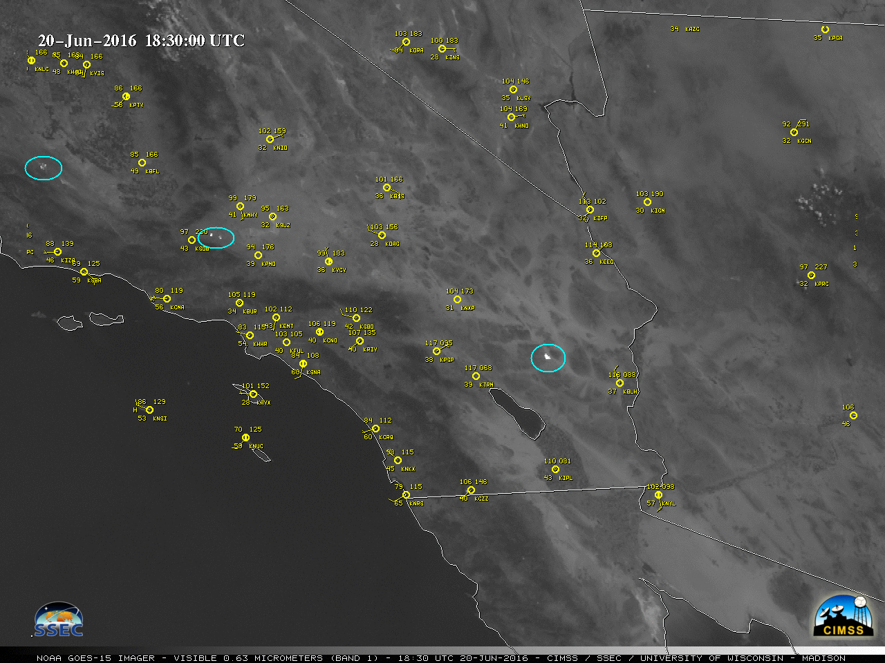
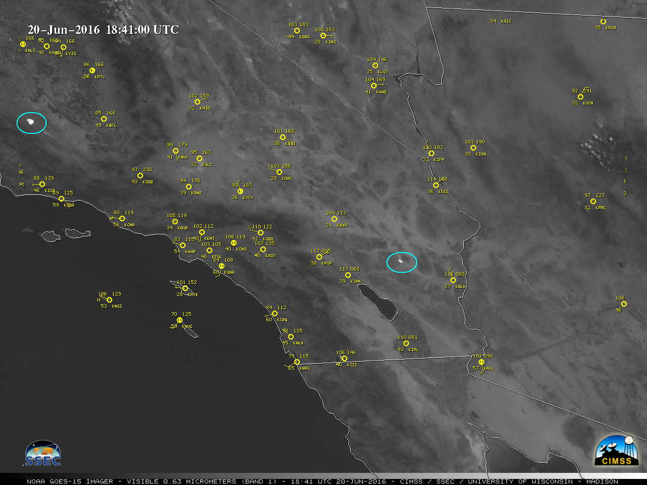
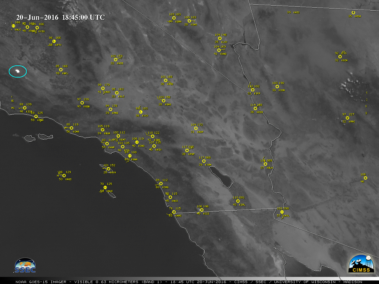
![GOES-15 Visible (0.63 µm) images [click to play animation]](https://cimss.ssec.wisc.edu/satellite-blog/wp-content/uploads/sites/5/2016/06/160620_goes15_visible_CA_NV_AZ_anim.gif)
GOES-15 Visible (0.63 µm) images [click to play animation]