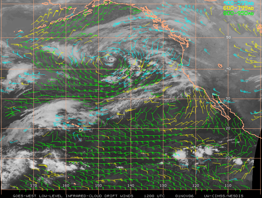
Subtropical cyclone in the North Pacific??

What appeared to be a rather unusual example of a subtropical cyclone was evident over the northern East Pacific Ocean on 01 November (AWIPS surface analysis + buoys) — however, this compact cyclone was likely associated with a deep cold-core cutoff low that had been over that region for a few days (HPC 500 hPa analyses). GOES-11 IR cloud drift winds (above) showed the broad cyclonic flow around the periphery of the surface low (closer view of AWIPS low-level winds | AWIPS upper-level winds). GOES-11 visible channel imagery (QuickTime animation) showed a cloud structure that almost resembled the eye of a tropical cyclone.
A similar signature was also seen on the GOES-11 10.7µm IR window channel imagery (below), with a ring-like feature of cold cloud top temperatures (-50 to -55 C, yellow to orange enhancement) that was very persistent for much of the day (QuickTime animation). Additional satellite imagery can be found by selecting the Central Pacific 91C.INVEST link at the NRL Tropical Cyclones site.

