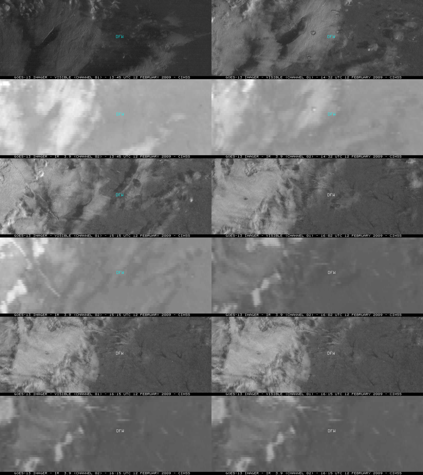
Aircraft “hole punch” and “distrail” cloud features over Texas
We received the following in an email from the National Weather Service forecast office at Fort Worth, Texas:
Some of our forecasters noted an interesting feature on visible satellite imagery on Thursday, Feb 12, 2009. I would like to get an expert opinion on what was causing the observed features. There was a layer of ~ 15kft altocumulus along with some scattered-broken areas of cirrus.
Excellent question…and we appreciate the heads-up on this event. An animation of GOES-13 visible and 3.9 µm “shortwave IR” images (above; QuickTime animation) showed the evolution of two “hole punch” cloud features that were drifting eastward across northern Texas on 12 February 2009. The first hole punch cloud feature moved just to the north of Dallas/Fort Worth (DFW) around 14:45 UTC, while the second feature moved just south of DFW about an hour later (around 15:45 UTC). In addition, an elongated aircraft dissipation trail (or “distrail”) could be seen to the west of the first hole punch feature (oriented west-to-east on the 14:15 and 14:32 UTC visible images), with a second distrail forming about an hour later (oriented northwest-to-southeast on the 15:15 and 15:32 UTC visible images).
These aircraft “hole punch” and “distrail” cloud features form when an aircraft ascends or descends through a layer of supercooled water droplet cloud, with the engine exhaust causing the droplets to glaciate — the resulting ice crystals then fall toward the ground, creating a visible hole or trail in the cloud layer. Note that there is a subtle “brighter white” signal evident on the GOES-13 3.9 µm shortwave IR images in the area of the hole punch features — this colder signal confirms the idea that the aircraft engine exhaust was causing the supercooled water droplets to glaciate.
A NOAA-17 false color Red/Green/Blue (RGB) composite image using channels 01/02/04 (below) showed the second hole punch cloud as it was moving to the south of DFW at 15:58 UTC. Similar aircraft hole punch and distrail cloud features have been seen in the past: for example, over the southcentral US and also over Wisconsin.
GOES-13 10.7 µm IR data (above) showed cloud top brightness temperatures in the -20 to -30º C range (cyan to dark blue color enhancement) over much of the cloud patch where the initial hole punch feature was seen. Rawinsonde data from both Midland and Fort Worth in Texas (below) displayed a moist layer centered around 425 hPa that corresponded to those temperatures — this indicates that the hole punch and distrail features were at a fairly high altitude (around 20,000 feet or so). Dallas/Fort Worth METAR reports listed cloud bases at 15,000 feet during the period.


