Strong July storm “Zeljko” affects parts of central Europe
EUMETSAT Meteosat-10 6.25 µm water vapor channel images (above; click image to play animation; also available as an MP4 movie file) showed the well-defined circulation associated with an unusually strong (for July) storm centered just north of the Netherlands on 25 July 2015. Some locations experienced hurricane-force surface winds with this storm — which was given the name “Zeljko” by the Free University of Berlin (surface analyses) — and it was described as the most violent July storm on record for the Netherlands, where a wind gust of 121 km/hour (65 knots, or 75 mph) was reported. Peak wind gusts at major airports are plotted on the water vapor imagery above, which showed 55 knots or 63 mph at Amsterdam in the Netherlands at 13 UTC, and 47 knots or 54 mph at Münster-Osnabrück in northern Germany at 17 UTC. Strong winds disrupted both rail and air traffic in some areas; the winds made for some challenging landings at the Amsterdam Schiphol airport (one of which was documented in this YouTube video).Meteosat-10 0.8 µm High Resolution Visible images (below; click image to play animation; also available as an MP4 movie file) displayed better detail of the center of the storm circulation when it was immediate off the coast of the Netherlands during the middle of the day.
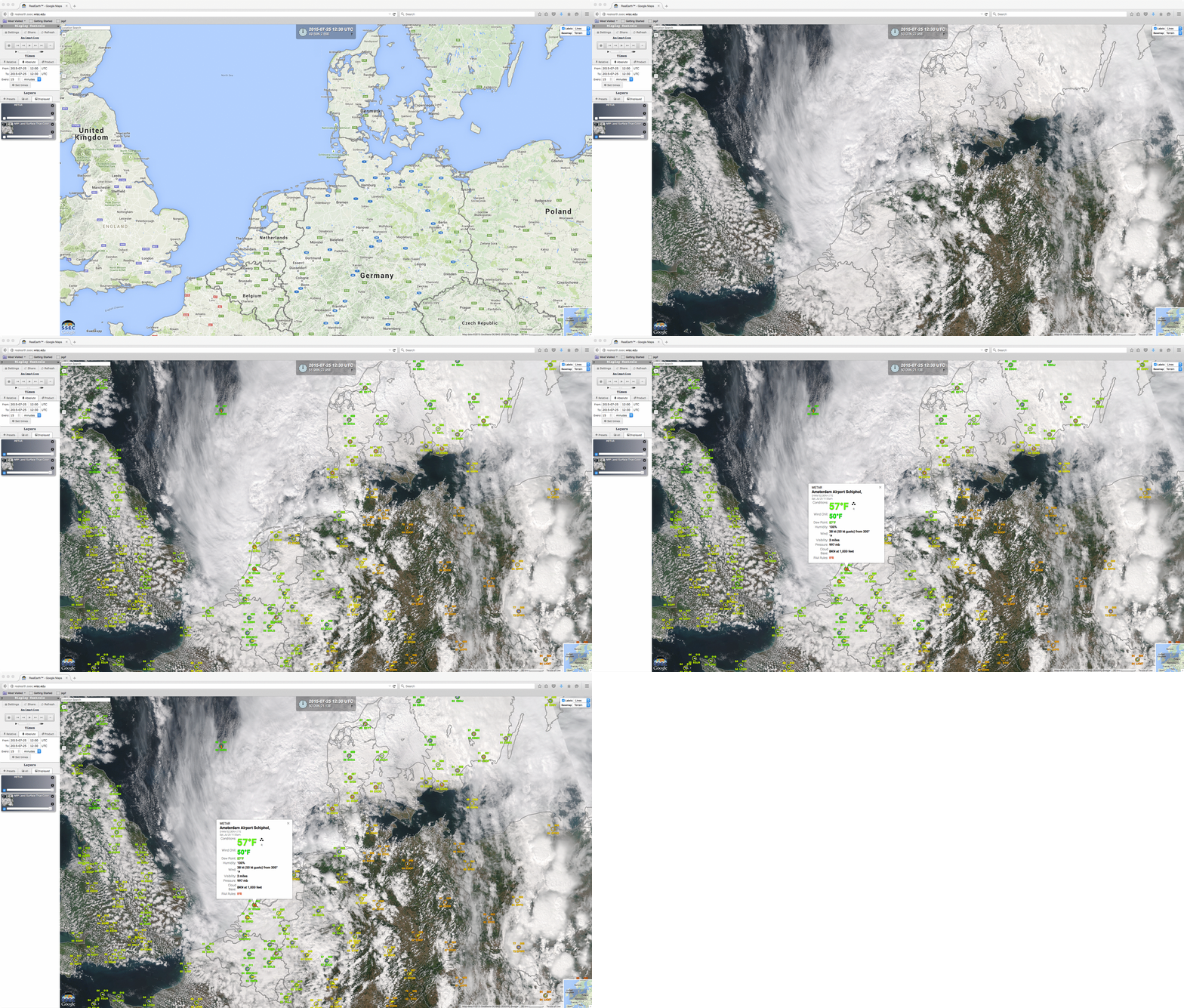
A Suomi NPP VIIRS true-color Red/Green/Blue (RGB) image visualized using the SSEC RealEarth web map server (below) showed the center of the strong mid-latitude cyclone just off the coast of the Netherlands; at the time, winds were gusting to 50 knots at the Amsterdam Schiphol airport.

