Eruption of the Wolf Volcano in the Galapagos Islands
![GOES-13 0.63 µm visible channel (left) and 3.9 µm shortwave IR channel (right) images [click to play animation]](https://cimss.ssec.wisc.edu/satellite-blog/wp-content/uploads/sites/5/2015/05/150525_goes13_visible_shortwaveIR_Wolf_Galapagos_anim.gif)
GOES-13 0.63 µm visible channel (left) and 3.9 µm shortwave IR channel (right) images [click to play animation]
With the arrival of daylight at 1215 UTC, a portion of the volcanic cloud could be seen at times (although identification was difficult with widespread meteorological clouds present in the area).
An Aqua MODIS false-color Red/Gren/Blue (RGB) image at 0800 UTC (below; courtesy of Michael Pavolonis, NOAA/NESDIS/CIMSS) displayed a signal of SO2 (green enhancement) along the edges of the larger volcanic cloud as it was moving southward.
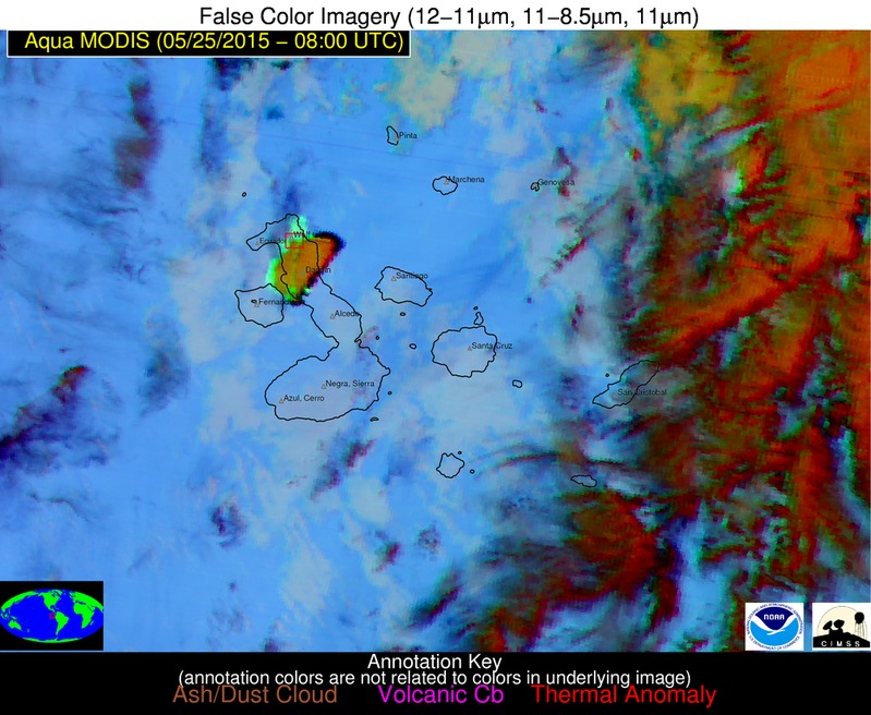
Aqua MODIS false-color RGB image
GOES-13 10.7 µm IR channel images (below; click to play animation; also available as an MP4 movie file) indicated that the coldest cloud-top IR brightness temperature of -65º C appeared at 1015 UTC with the larger plume moving south-southwestward.
![GOES-13 10.7 µm IR channel images [click to play animation]](https://cimss.ssec.wisc.edu/satellite-blog/wp-content/uploads/sites/5/2015/05/150525_goes13_IR_Wolf_Galapagos_anim.gif)
GOES-13 10.7 µm IR channel images [click to play animation]
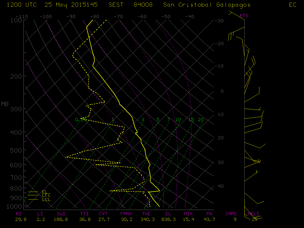
San Cristobal, Galapagos Islands rawinsonde data profile
The latest advisories issued by the Washington Volcanic Ash Advisory Center can be found here.