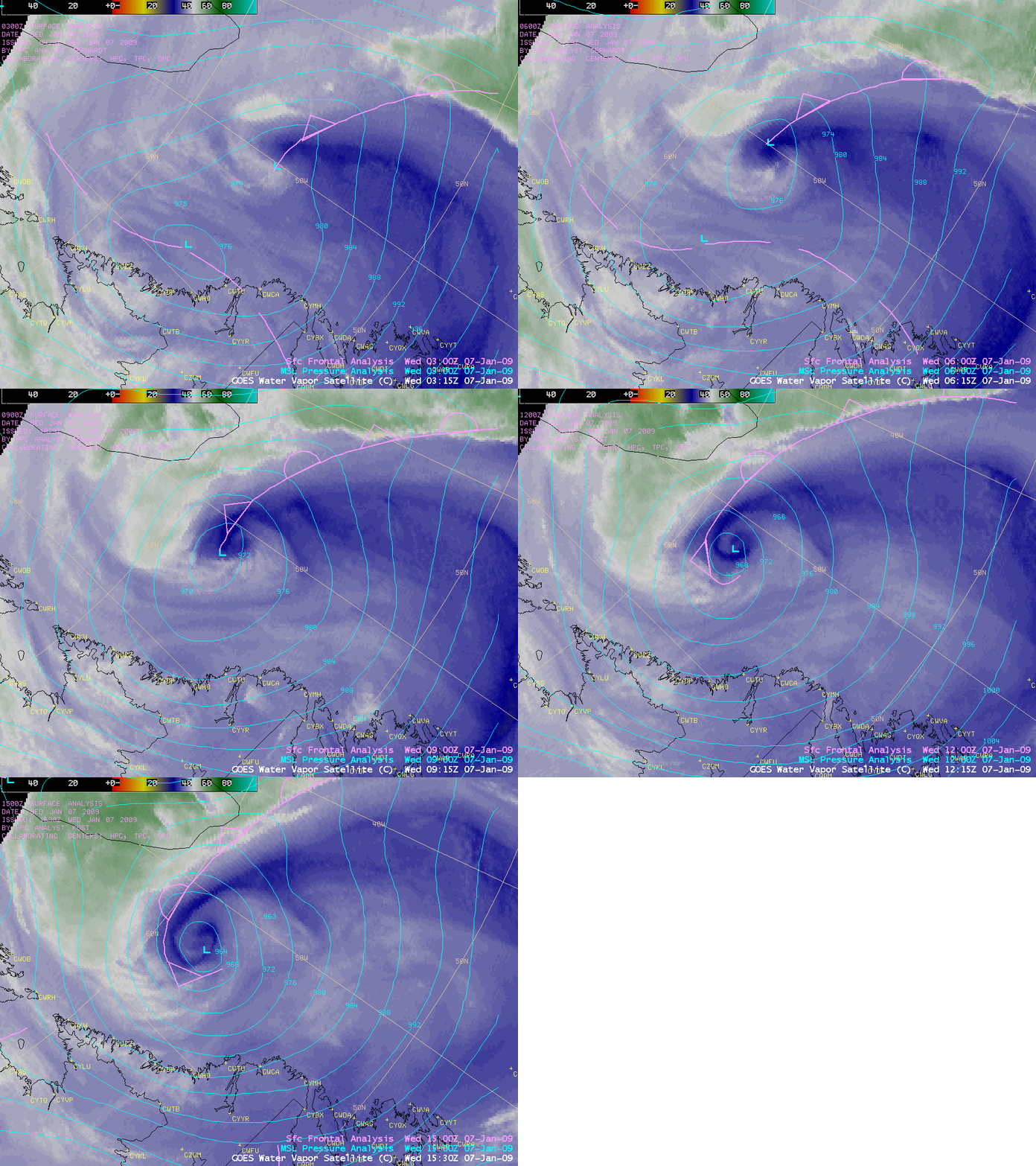
Occluding cyclone over the Labrador Sea
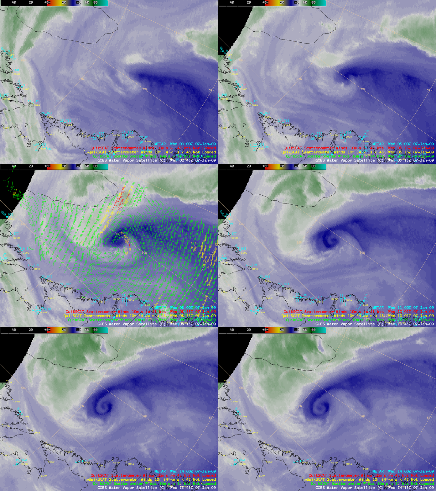
AWIPS images of the GOES-12 6.5 µm water vapor channel data with an overlay of polar-orbiting QuikSCAT winds (above) showed the a rapidly-occluding cyclone over the Labrador Sea on 07 January 2009. The classic “dry swirl” signature on the water vapor imagery is a tell-tale indicator that a mature cyclone has reached the occluded phase. Note that the GOES-12 satellite had just returned to service as the operational GOES-East satellite on the previous day.
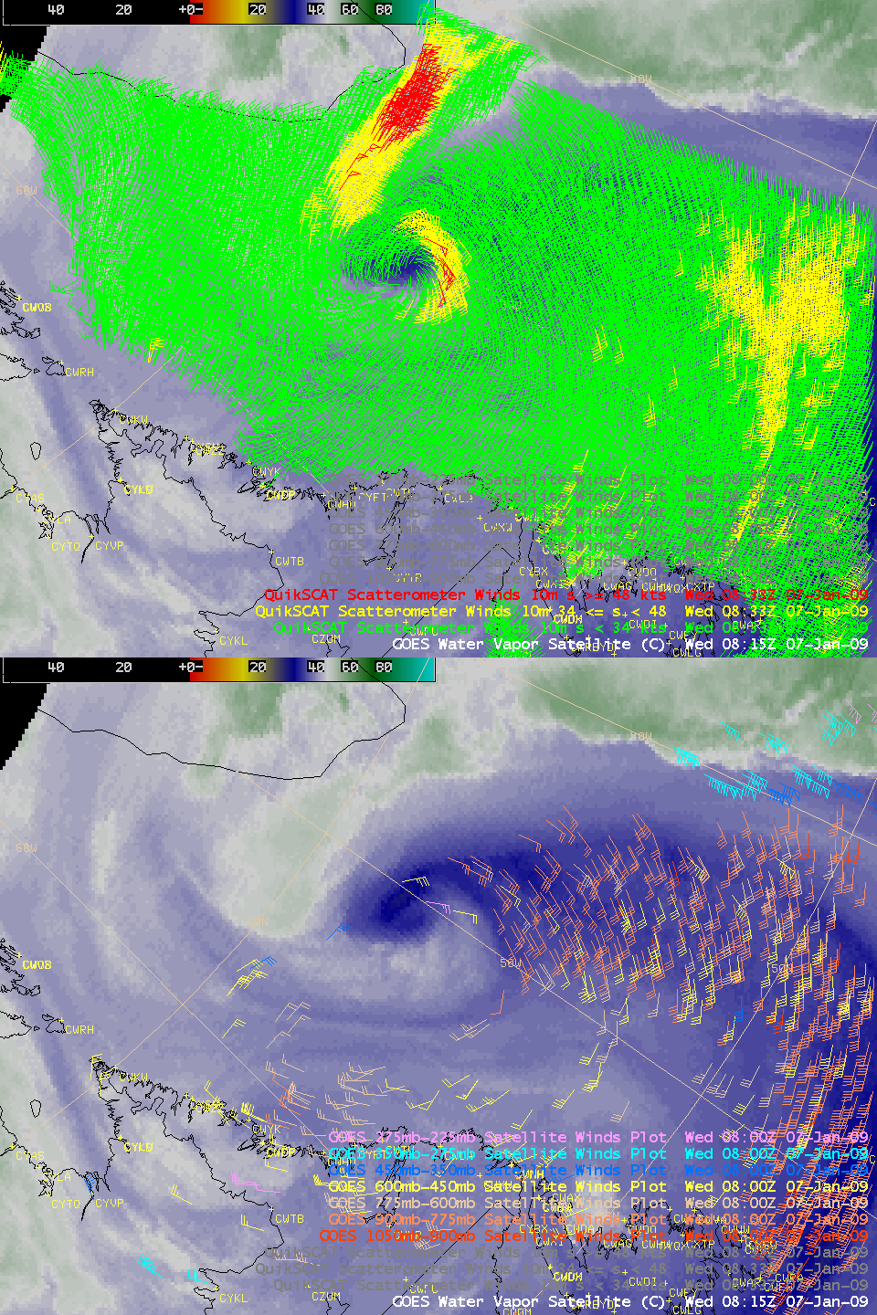
QuikSCAT wind speeds were as high as 58 knots (red wind barbs) off the southern tip of Greenland at 09:00 UTC. A comparison of the atmospheric motion vector coverage derived from GOES-12 IR and water vapor channel data with those derived from the WindSat instrument on the polar-orbiting QuikSCAT satellite (below) demonstrate the advantage of the 12.5 km resolution data from the QuikSCAT satellite — however, the QuikSCAT winds are valid near the surface, while the GOES-12 winds are valid at higher levels within the lower, middle, and even upper the troposphere.
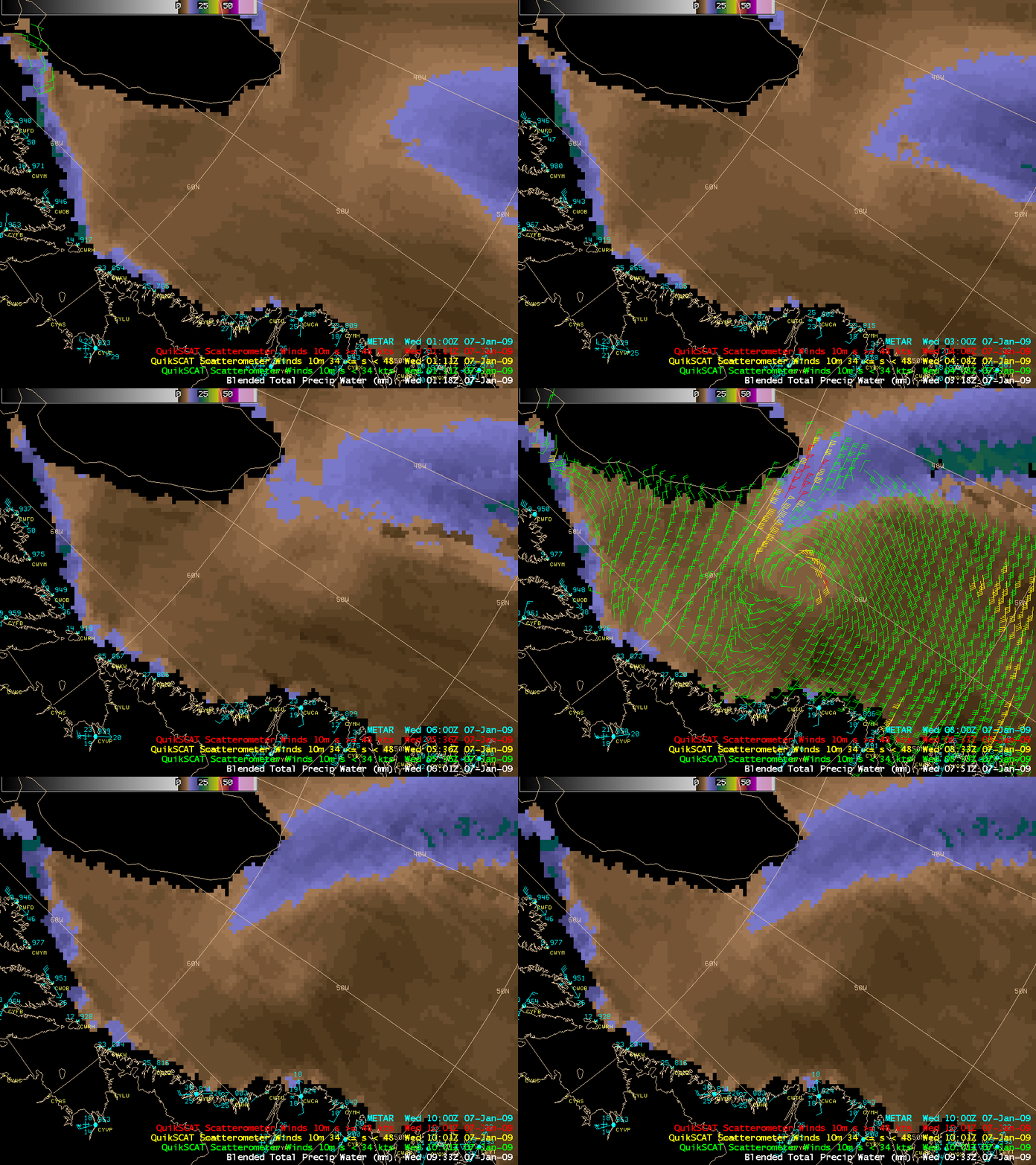
The Blended Total Precipitable Water product (below) depicted a plume of higher PW values (in the 15-25 mm range) wrapping around the eastern and northern periphery of the occluding cyclone. The polar-orbiting AMSU instrument indicated that rainfall rates were as high as 7-9 mm/hour within this plume of PW.
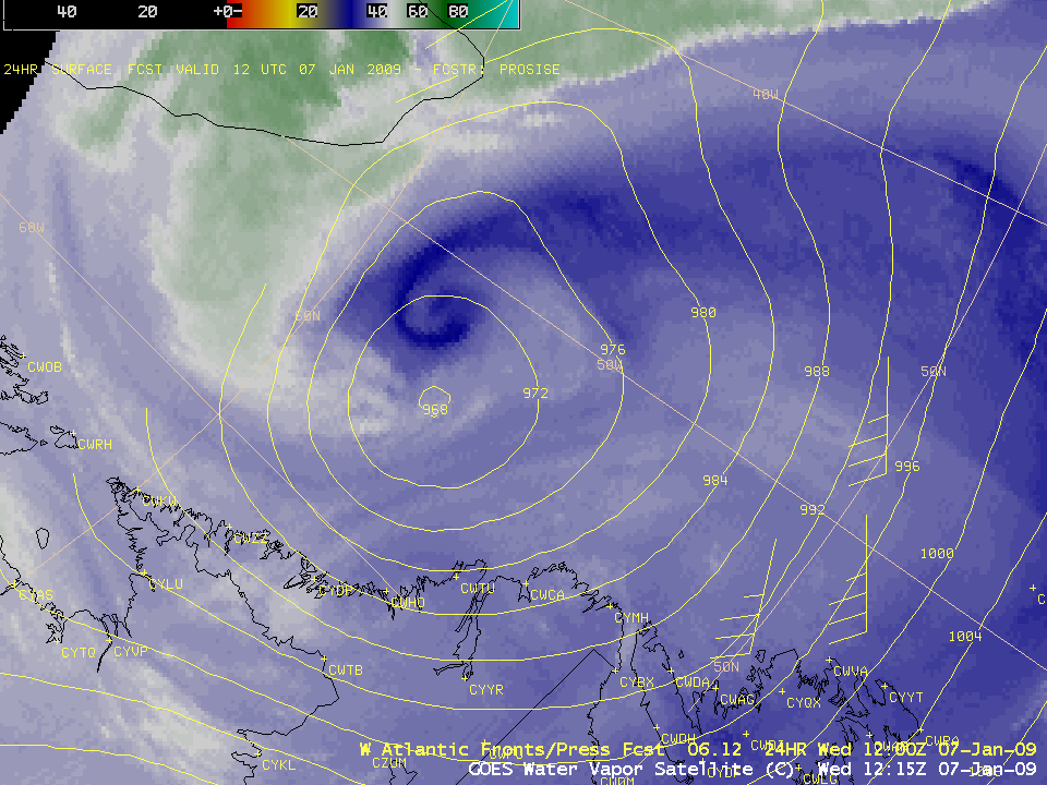
The 24-hour forecast had the position of the surface low a bit far to the southwest (above) — however, using the “dry swirl” signature on the water vapor imagery, the well-trained analysts at HPC were able to accurately depict the location of the surface low center as it moved northwestward across the Labrador Sea (below).


