Hurricane Gonzalo moves towards Bermuda
Small and intense Hurricane Gonzalo is moving north-northeastward out of the western tropical Atlantic towards Bermuda (Bermuda is located at 32.3º N, 64.8º W). (See the National Hurricane Center Website for the latest Advisories on Gonzalo) GOES-13 Visible imagery (0.63 µm) from the morning of 16 October shows a well-defined eye, intense convection and good outflow in all quadrants. Mesovortices within the eye are also apparent as shown in a storm-centered animation of the eye, below, until mid- and high-level clouds develop near the end of the animation.
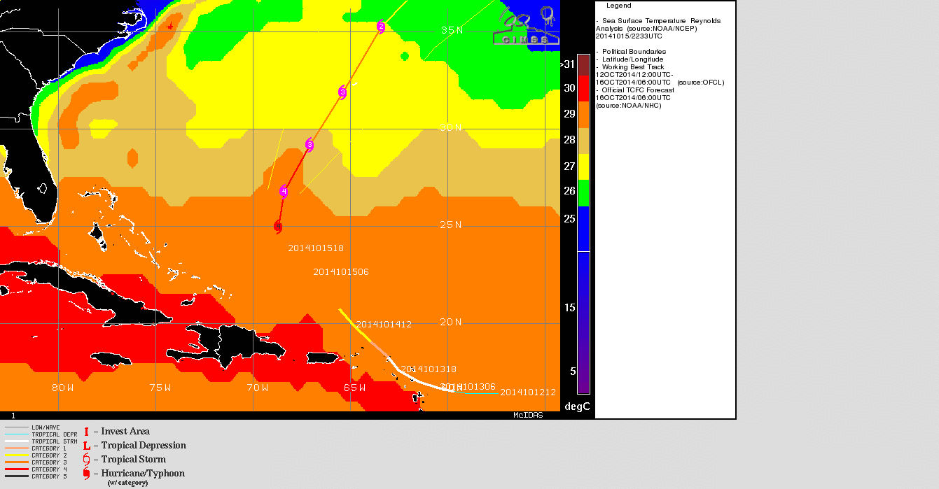
Gonzalo’s track will take it over sea surface temperatures that are not quite so warm (see image below, taken from the CIMSS Tropical Cyclones site). Cooler SSTs argue against any further strengthening, and the official forecast suggests peak intensity has already occurred.
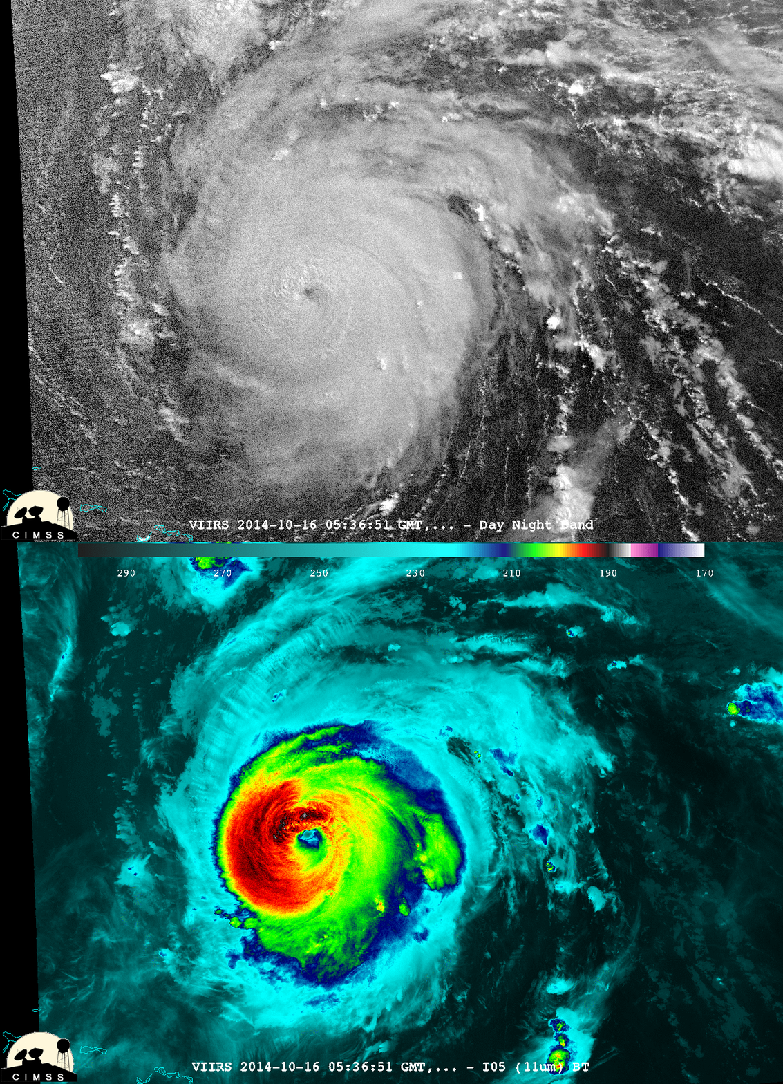
Suomi NPP overflew the storm at 0536 UTC in 16 October. A toggle between the VIIRS Day/Night Band and the 11.45 µm imagery is below. Note that lunar illumination is dropping as the Moon phase wanes so visible features are less distinct than they would be during a more Full Moon. A ragged eye is obvious in both images, however, and there is evidence of a lightning streak well east of the eye in the Day/Night Band.
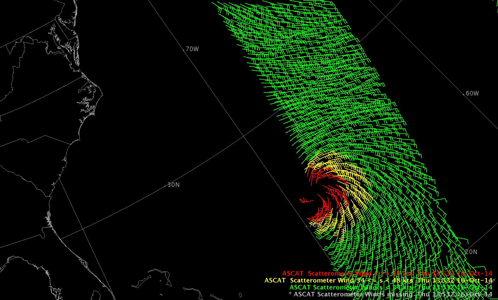
Both Aqua and Metop-A overflew Gonzalo during the day on 16 October. The Aqua True-Color image (from the MODIS Today website) shows the storm and the cold front that will help guide Gonzalo’s future path. The ASCAT scatterometer data from METOP-A, below, showed a tight region of hurricane-force winds.
===== 18 October Update =====
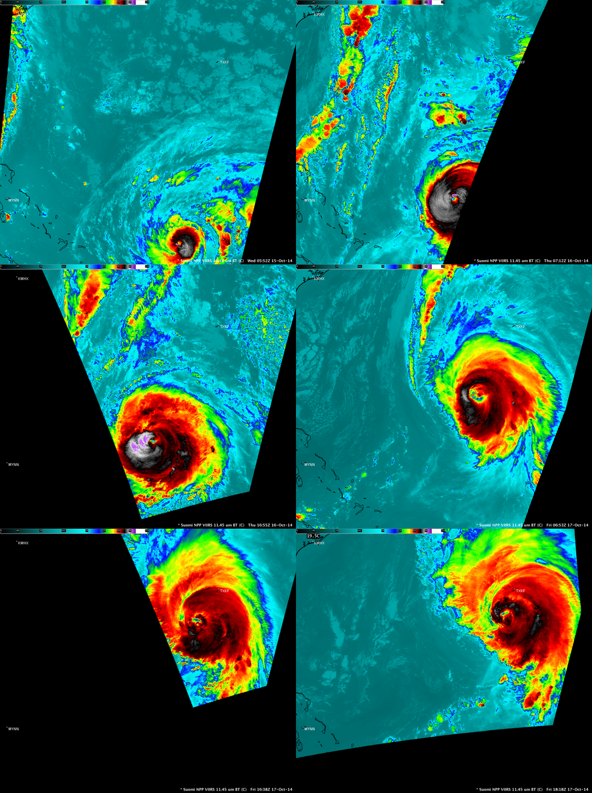
A sequence of Suomi NPP VIIRS 11.45 µm IR channel images during the 15-17 October period (above) showed the pattern of very cold cloud-top IR brightness temperatures at various times as the storm curved northward toward Bermuda (station identifier TXKF); IR brightness temperatures of -80º C and colder (violet color enhancement) were seen on 15 and 16 October. A close-up view shows Gonzalo on 2 consecutive VIIRS IR images (16:38 and 18:18 UTC) on 17 October.
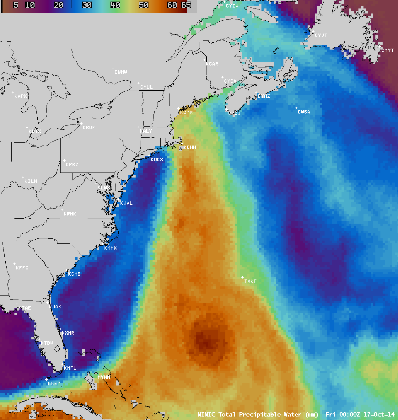
The MIMIC Total Precipitable Water (TPW) product (below; click image to play animation) showed a plume of high TPW ahead of a cold front moving off the East Coast of the US, which was then reinforced by a northward surge of high TPW from Ganzalo. As a result, the TPW value calculated using the morning rawinsonde data from Caribou, Maine (station identifier KCAR) was 1.68 inches — the highest for so late in the season.
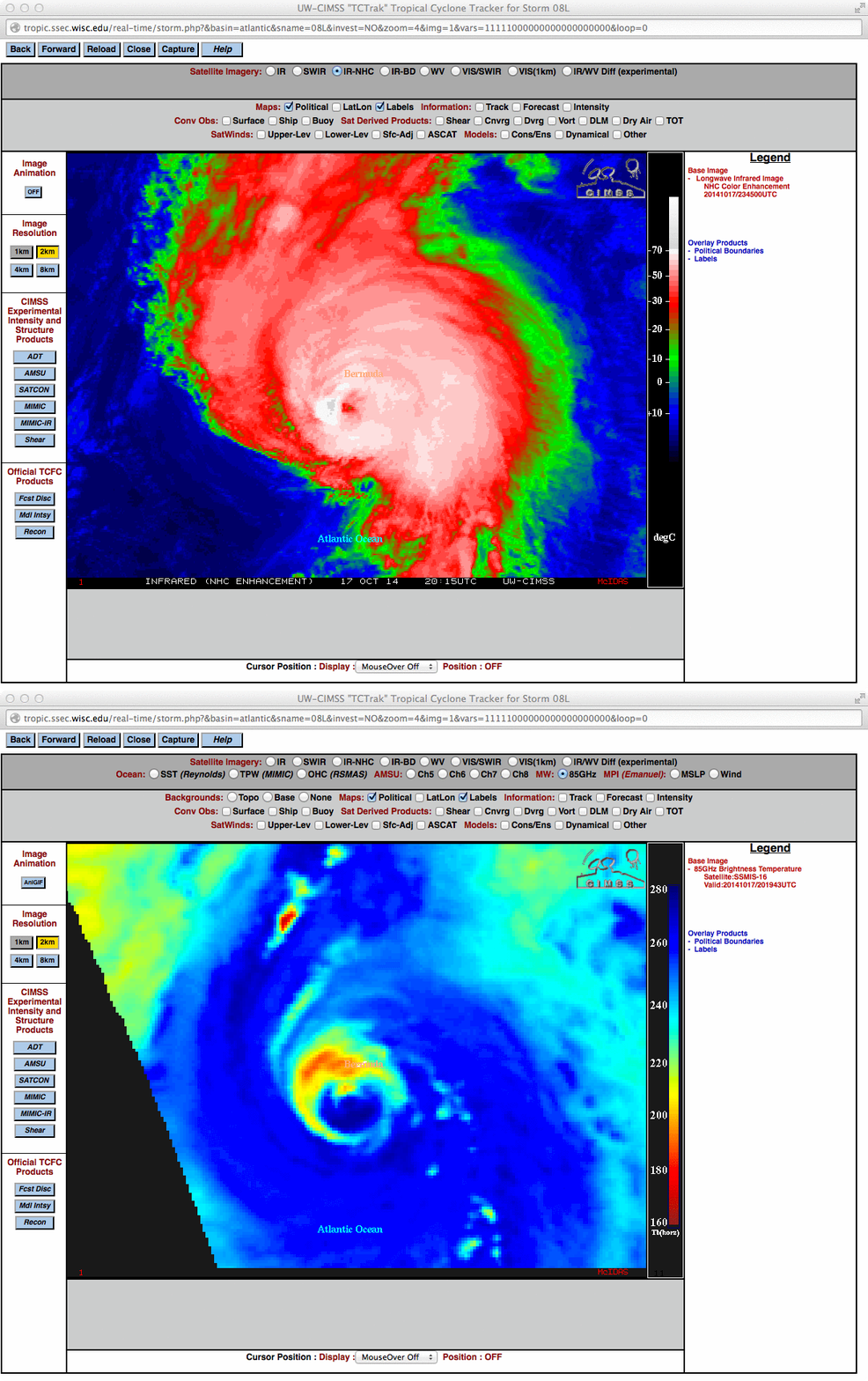
Around 20:15 UTC on 17 October, a comparison of GOES-13 10.7 µm IR channel and SSMIS 85 GHz microwave images from the CIMSS Tropical Cyclones site (below), the microwave image revealed the very large size of the eye of Hurricane Gonzalo (which was not as apparent on conventional IR imagery).
A close-up view of GOES-13 10.7 µm IR channel images with overlays of wind barbs and wind gusts from Bermuda International Airport (below; click image to play animation) showed the development of a convective burst just as the eye of Gonzalo was approaching the island. The airport observations (text listing | time series plot) showed a wind gust to 83 knots (96 mph) as the northern eyewall passed, and a stronger gust to 98 knots (113 mph) as the southern eyewall passed over Bermuda.
GOES-13 10.7 µm IR channel images, with overlays of wind barbs and wind gusts at Bermuda (click to play animation)
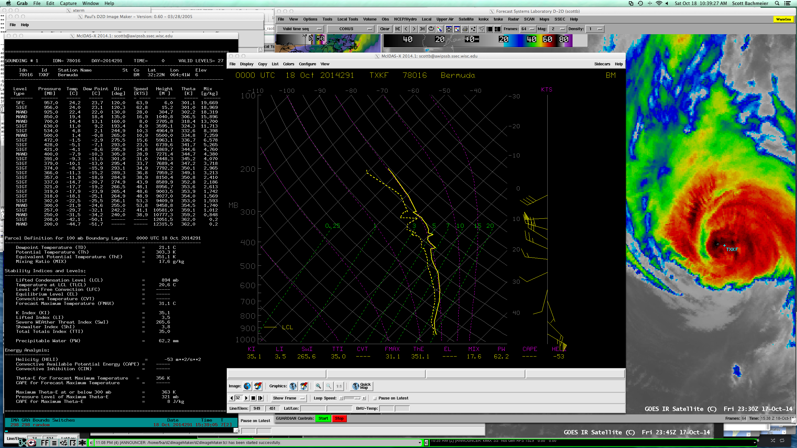
The Bermuda Weather Service launched a rawinsonde balloon at 00 UTC on 18 October; winds at the surface were from the southeast at 64 knots (74 mph), which carried the instrument package into the eye of Gonzalo for a portion of its ascent. Note the the temperature profile was nearly moist adiabatic from about 700 hPa to 200 hPa (below).


