Severe thunderstorm over the Black Hills of South Dakota
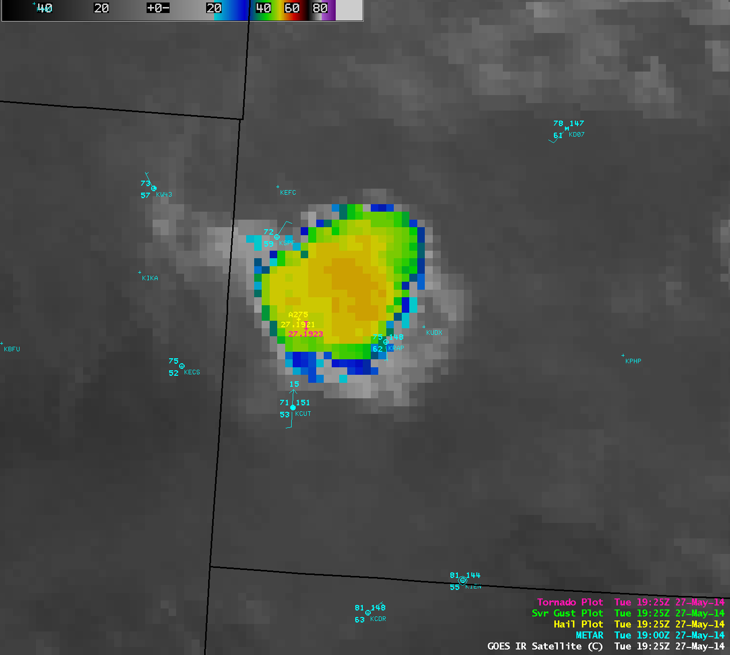
An isolated severe thunderstorm developed over the northern portion of the Black Hills of South Dakota around 18 UTC (Noon local time) on 27 May 2014, and moved southeastward producing hail as large as 2.75 inches in diameter and a tornado (SPC storm reports), as well as up to 3 inches of heavy rainfall. 4-km resolution GOES-13 10.7 µm IR channel images (above; click image play animation) showed the cold cloud-top IR brightness temperatures associated with the storm (which reached a minimum of -59º C at 21:40 UTC). Convective initiation was aided by convergence of a surface cold frontal boundary with the topography of the Black Hills, as seen here.
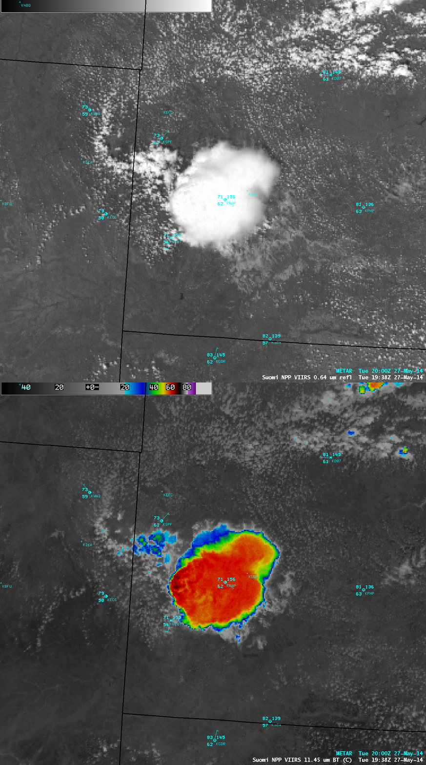
A comparison of 375-meter resolution Suomi NPP VIIRS 0.64 µm visible channel and 11.45 µm IR channel images at 19:38 UTC (below) revealed a minimum cloud-top IR brightness temperature of -68º C. Subsequent cumulus cloud development is seen to be suppressed in the stable outflow region in the wake of the storm.
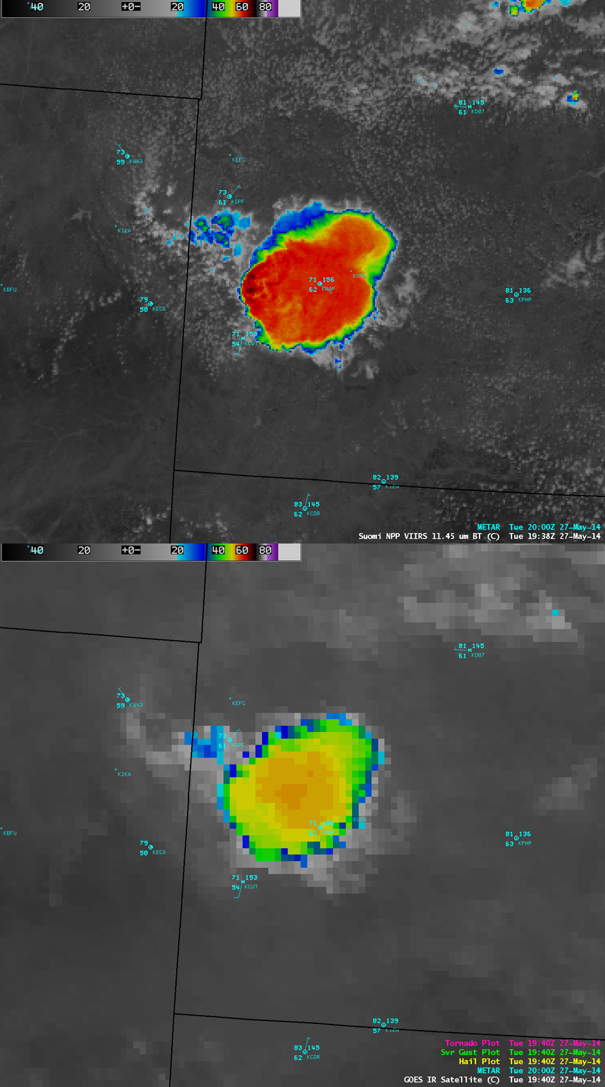
A comparison of the VIIRS IR image with the closest available GOES-13 IR image (below) demonstrated the advantage of higher spatial resolution of polar-orbiting satellite imagery, as well as the lack of parallax error associated with the geostationary-orbit GOES imagery. The coldest cloud-top IR brightness temperature on the GOES-13 image was -57º C, compared to -68º C on the VIIRS image.
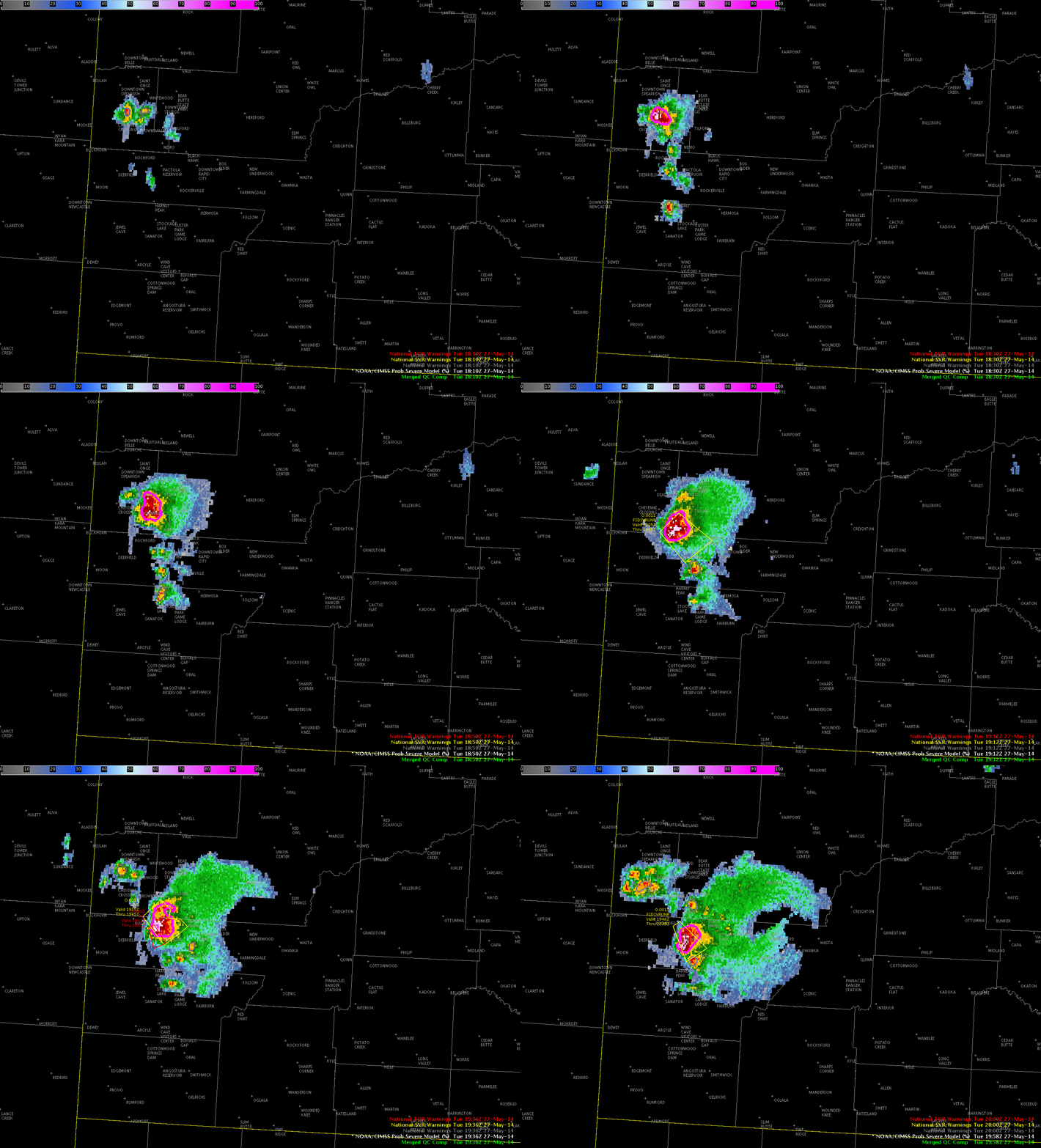
The NOAA/CIMSS ProbSevere model identified this storm as a potential producer of severe weather. The animation below shows the evolution of the MRMS radar signal with ProbSevere overlain from 1812 UTC through 2000 UTC. The Radar object that is highlighted has strong satellite growth rate (observed at 1725 UTC), MUCAPE of 1750 J/kg and Effective Shear of ~19 knots. At 1810 UTC, when MESH values are 0.53″, ProbSevere is 18%; four minutes later at 1814 UTC MESH increased to 0.94″ and ProbSevere increased to 69%. The National Weather Service issued the first warning at 1905 UTC and severe hail (1.5″ in diameter) occurred at 1910 UTC (when MESH was 1.64″ and ProbSevere was 94% and less than an hour after ProbSevere increased above 50%).
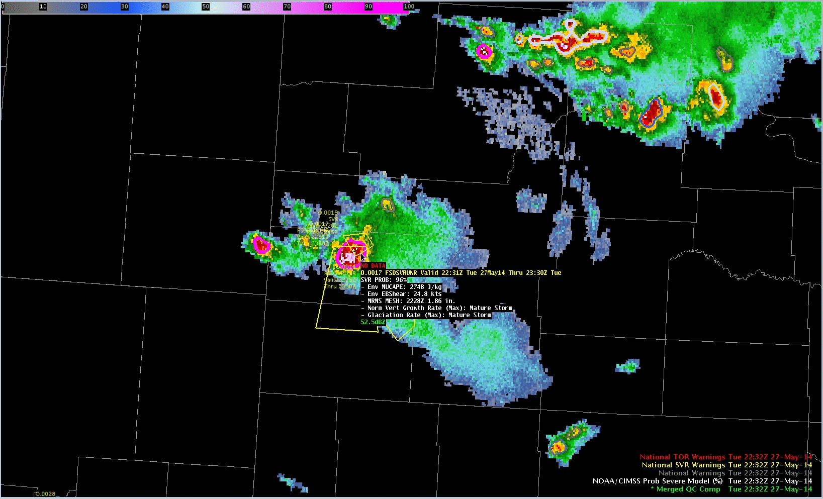
ProbSevere later in the day, after 2200 UTC, continues to track the hail-producing storm in far southwestern South Dakota. Although ProbSevere is designed to show when the first severe reports might occur, it does continue to provide useful information. In time, as below at 2222 UTC, the satellite growth parameters are replaced by ‘Mature Storm’ as a reminder that this tracked feature is not new.


