Rapidly intensifying mid-latitude cyclone off the East Coast of the US
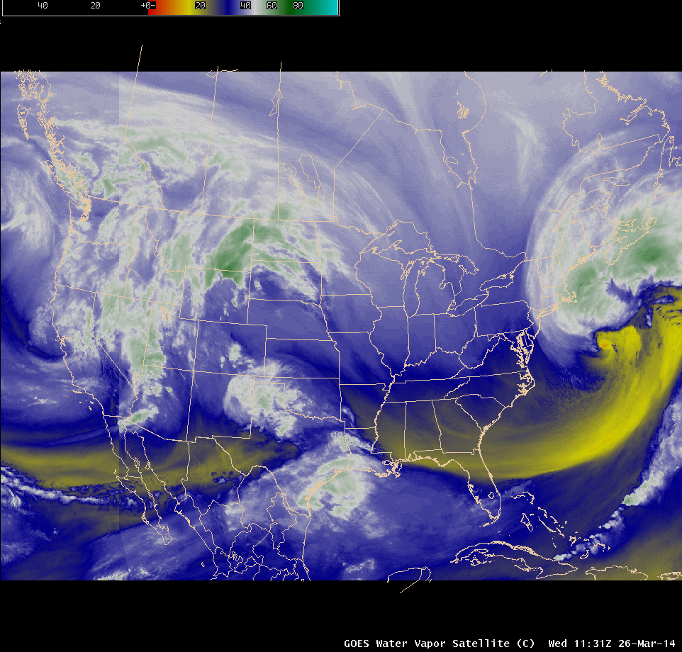
Composite of GOES-15 (GOES-West) and GOES-13 (GOES-East) 6.5 µm water vapor channel images (click to play animation)
AWIPS images of a composite of 4-km resolution GOES-15 (GOES-West) and GOES-13 (GOES-East) 6.5 µm water vapor channel data (above; click image to play animation) showed the development of a large mid-latitude cyclone off the East Coast of the US on 26 March 2014. This cyclone underwent rapid intensification as it moved northeastward, with the storm’s central pressure deepening 43 hPa in 24 hours and reaching a minimum value of 955 hPa (which was lower than the 960 hPa minimum central pressure of the March 1993 “Storm of the Century”). Wind gusts in excess of 100 mph were observed both on offshore buoys (44027) and at coastal sites: as the storm approached the Canadian Maritimes, Wreckhouse in Newfoundland experienced an all-time record maximum wind gust of 116 mph (186 km/hour).
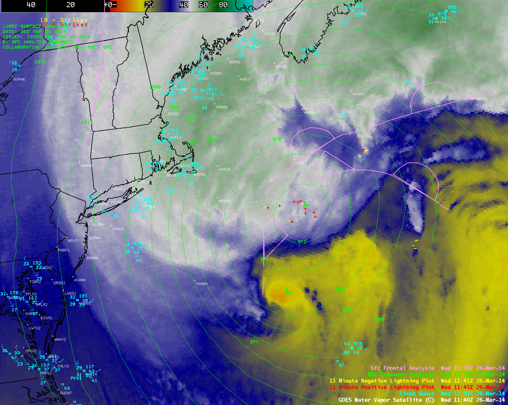
A closer view of the storm’s evolution on GOES-13 6.5 µm water vapor channel imagery with overlays of buoy reports, cloud-to-ground lightning strikes, and analyzed surface pressure and surface fronts is shown below.
McIDAS images of 1-km resolution GOES-13 0.63 µm visible channel data (below; click image to play animation) revealed greater detail in the cloud structures near the center of the storm circulation. The appearance of dual vortices can be seen, with the northernmost vortex appearing to be the dominant one associated with the true storm center.
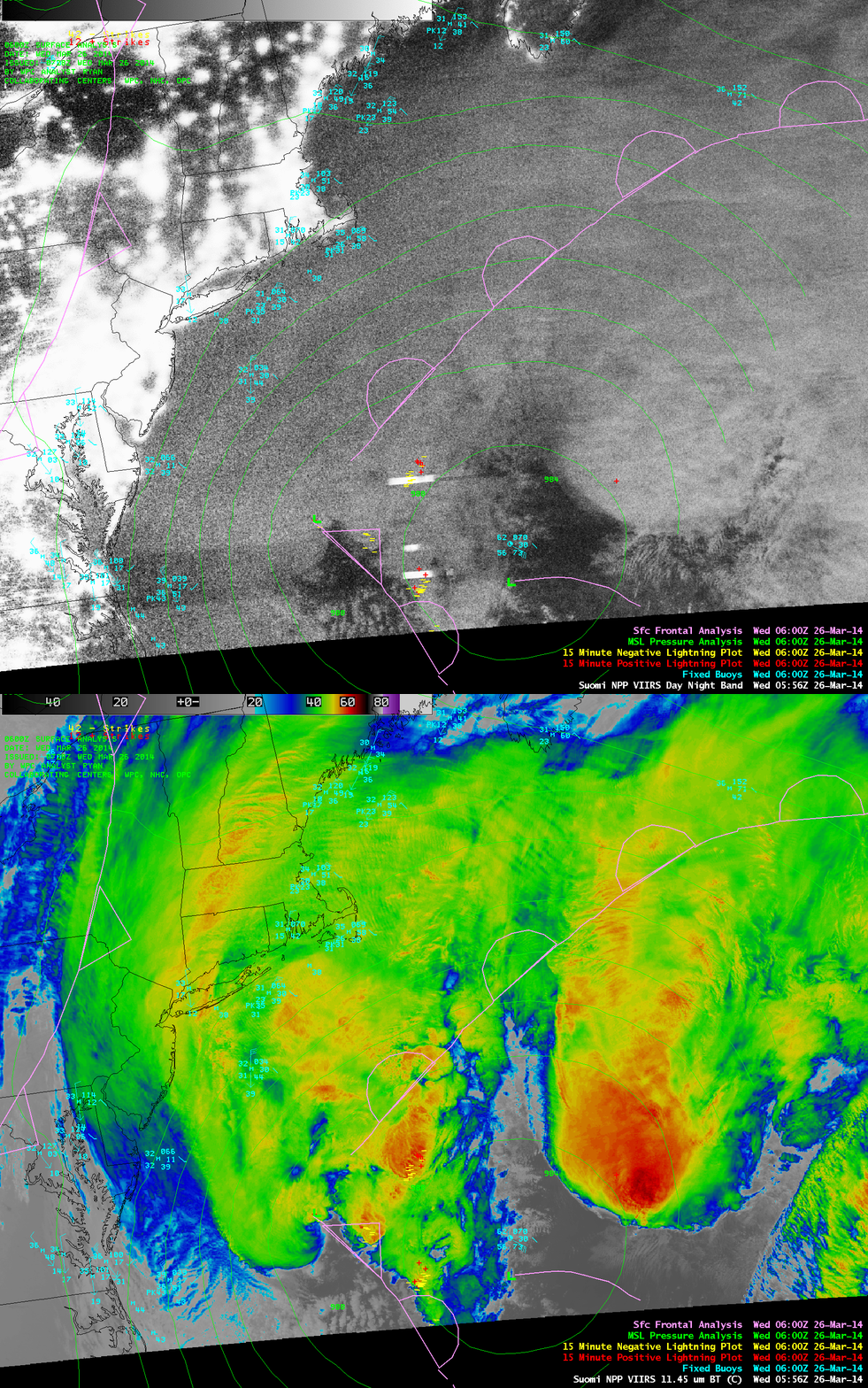
A night-time view of the storm as it was beginning to intensify off the coast of Virginia at 05:56 UTC or 12:56 AM Eastern Time is seen in a comparison of Suomi NPP VIIRS 0.7 µm Day/Night Band (DNB) and 11.45 µm IR channel images (below). The bright white streaks appearing offshore on the DNB image are portions of the cloud illuminated by intense lightning — and there were a number of cloud-to-ground lightning strikes detected in the vicinity of these DNB lightning streaks.
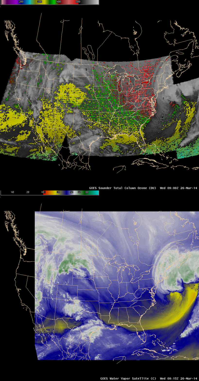
As the period of rapid intensification continued off the eastern coast of the US, the GOES-13 sounder Total column Ozone product (animation) depicted very high values (400-450 Dobson Units, shades of red) just south of the storm center at 09:00 UTC, which was a signature of a potential vorticity anomaly (a lowering of the dynamic tropopause caused by an intrusion of dry, ozone-rich stratospheric air into the upper and middle troposphere). According to the GFS40 model, the height of the dynamic tropopause (taken to be the pressure of the PV1.5 surface) had descended to around the 450 hPa level at 06 UTC. The image comparison below shows that this pocket of high ozone was co-located with a pocket of dry middle-tropospheric air on the water vapor imagery, which became even drier with time to the point that it exhibited a light orange color enhancement around 12 UTC on the closer-view GOES-13 6.5 µm water vapor channel image animation seen above.
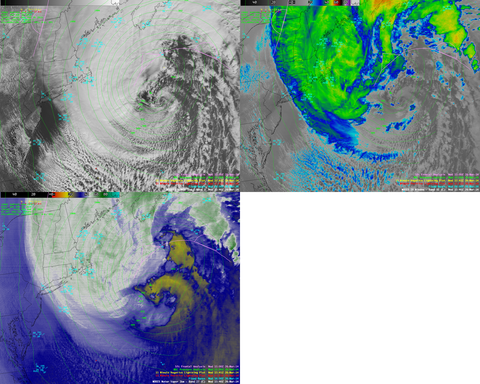
MODIS 0.65 µm visible channel, 11.0 µm IR channel, and 6.7 µm water vapor channel images at 15:40 UTC
Daytime views of the storm structure were provided by comparisons of 1-km resolution MODIS 0.65 µm visible channel, 11.0 µm IR channel, and 6.7 µm water vapor channel images at 15:40 UTC or 10:40 AM Eastern Time (above) and 17:19 UTC or 12:19 PM Eastern Time (below).
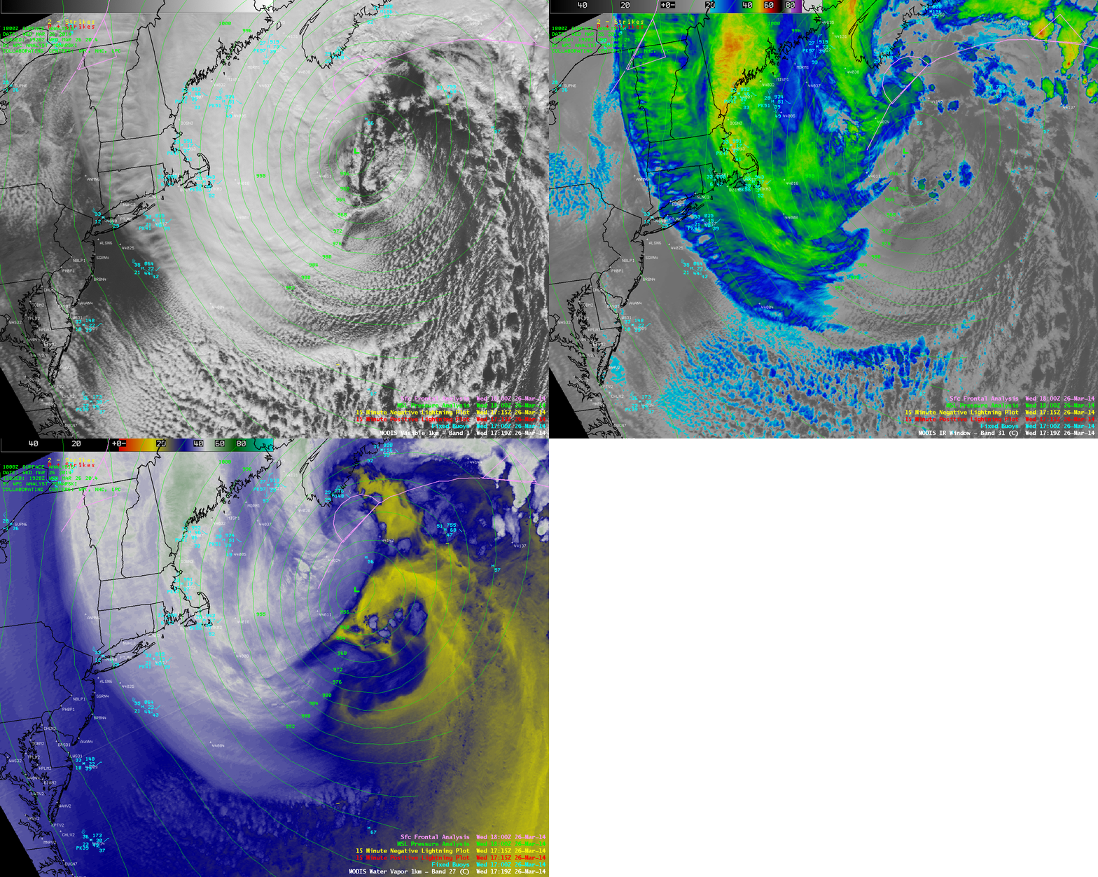
MODIS 0.65 µm visible channel, 11.0 µm IR channel, and 6.7 µm water vapor channel images at 17:19 UTC
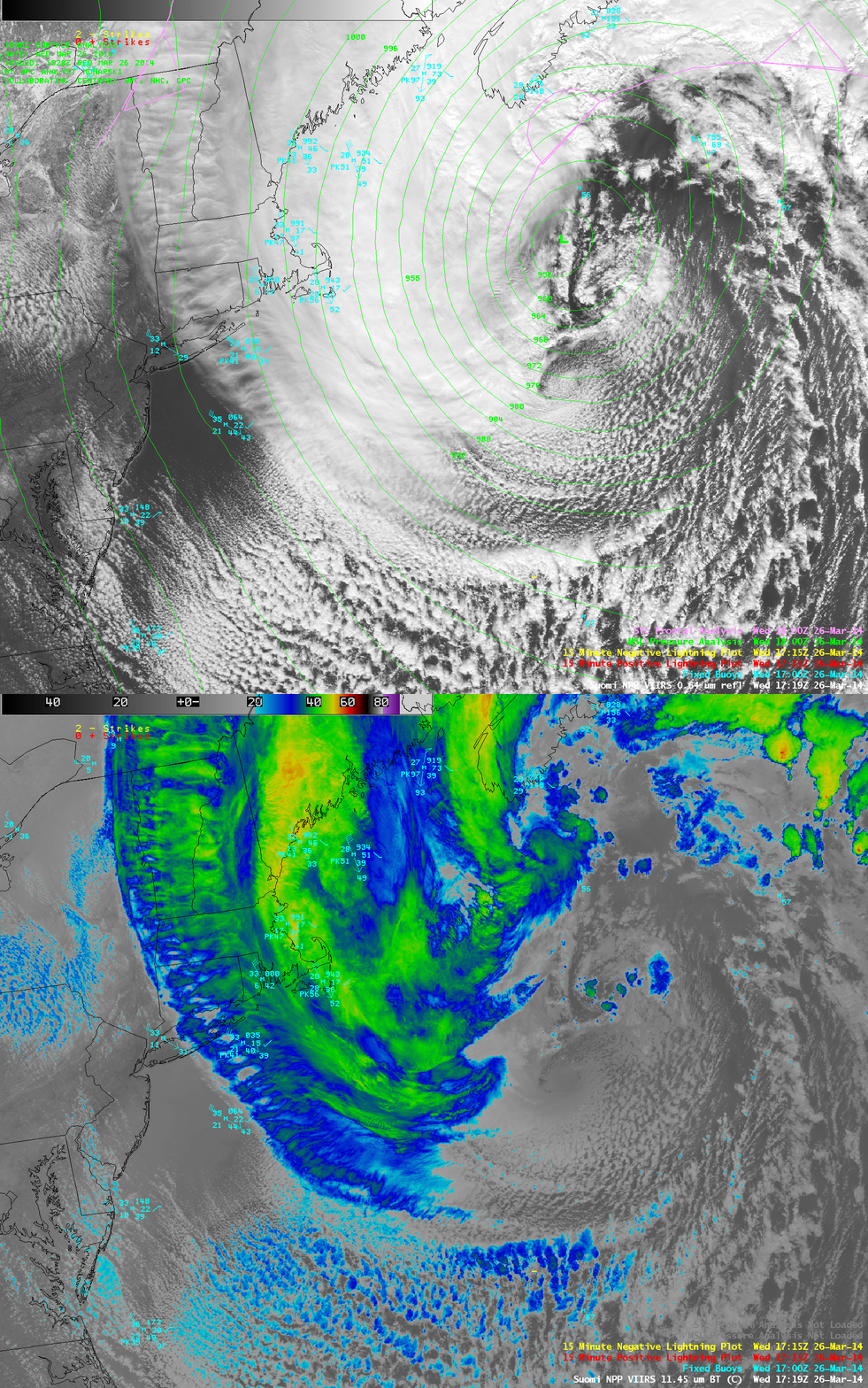
A comparison of 375-meter resolution (projected onto a 1-km AWIPS grid) Suomi NPP VIIRS 0.64 µm visible channel and 11.45 µm IR channel images at 17:19 UTC or 12:19 PM Eastern Time is shown below.
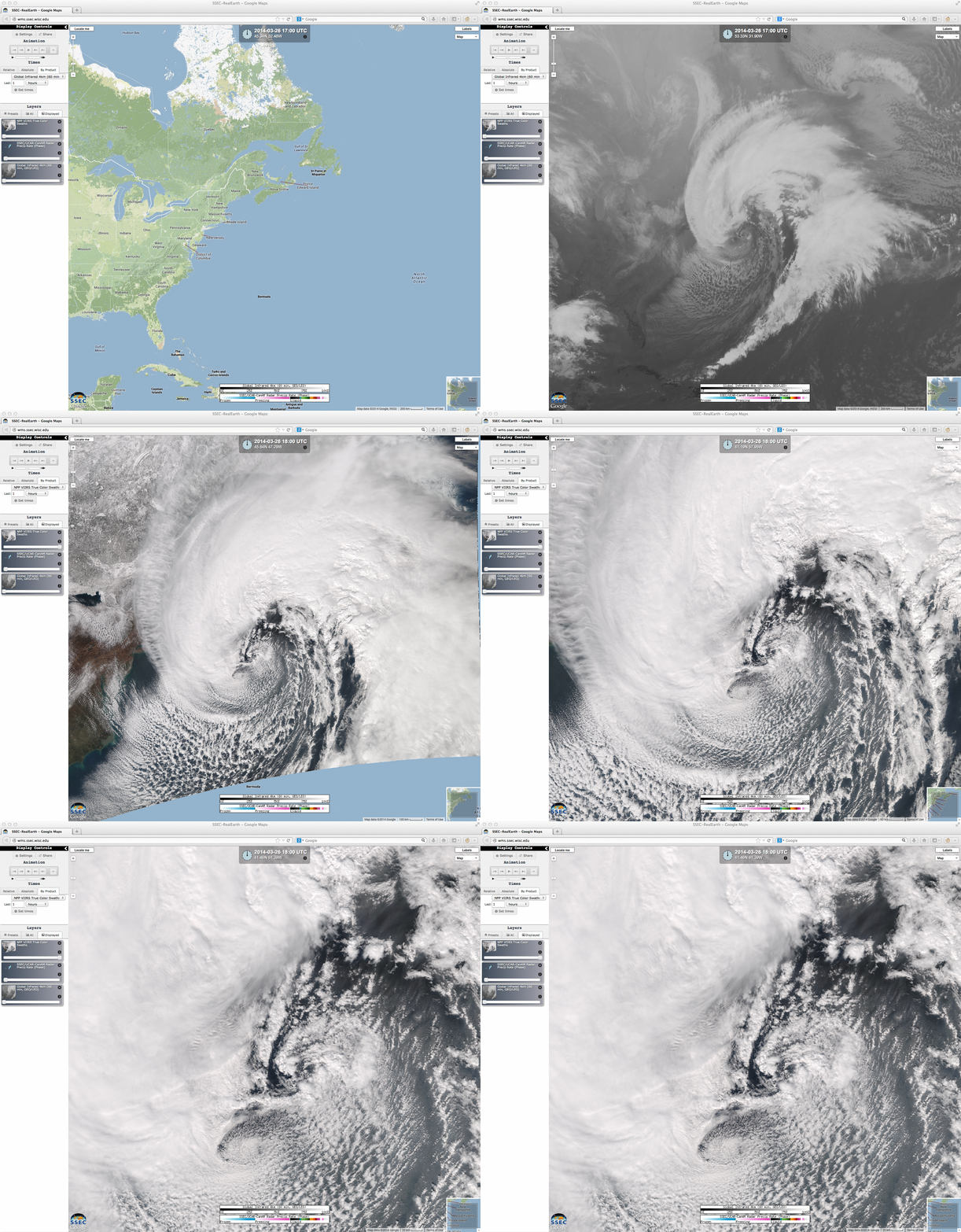
The images above demonstrate using the SSEC RealEarth web map server to compare GOES-13 IR and Suomi NPP VIIRS true-color Red/Green/Blue (RGB) images of the storm, zooming in on the true-color image for more detail of dual vortex cloud features near the circulation center. The GOES IR image showed the impressively large size of the overall cloud structure associated with the mid-latitude cyclone.
The large size of the cyclone is also apparent in the VIIRS 1.38 µm imagery shown here. This wavelength highlights ice crystals — that is, high clouds — within the storm.
Additional details and satellite images of this storm can be found on the GOES-R and JPSS Satellite Liaison Blog.


