Monsoon low over northwestern Australia
McIDAS images of MTSAT-2 daytime 0.675 µm visible channel data and night-time 10.8 µm IR channel data (above; click image to play animation; also available as an MP4 animation) showed a monsoon low which exhibited a well-defined circulation for several days as it slowly tracked southwestward across the northwestern portion of Australia during the 15-21 January 2014 time period.
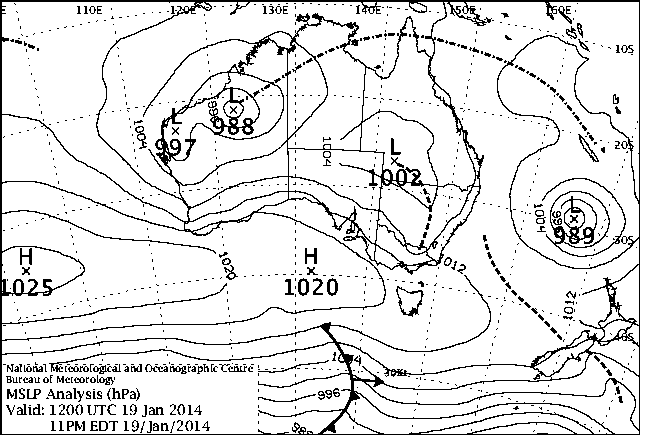
The mean seal level pressure analyses from the Australian Bureau of Meteorology (below; click image to play animation) indicated that the monsoon low deepened to a pressure of 988 hPa at 12 UTC on 19 January.
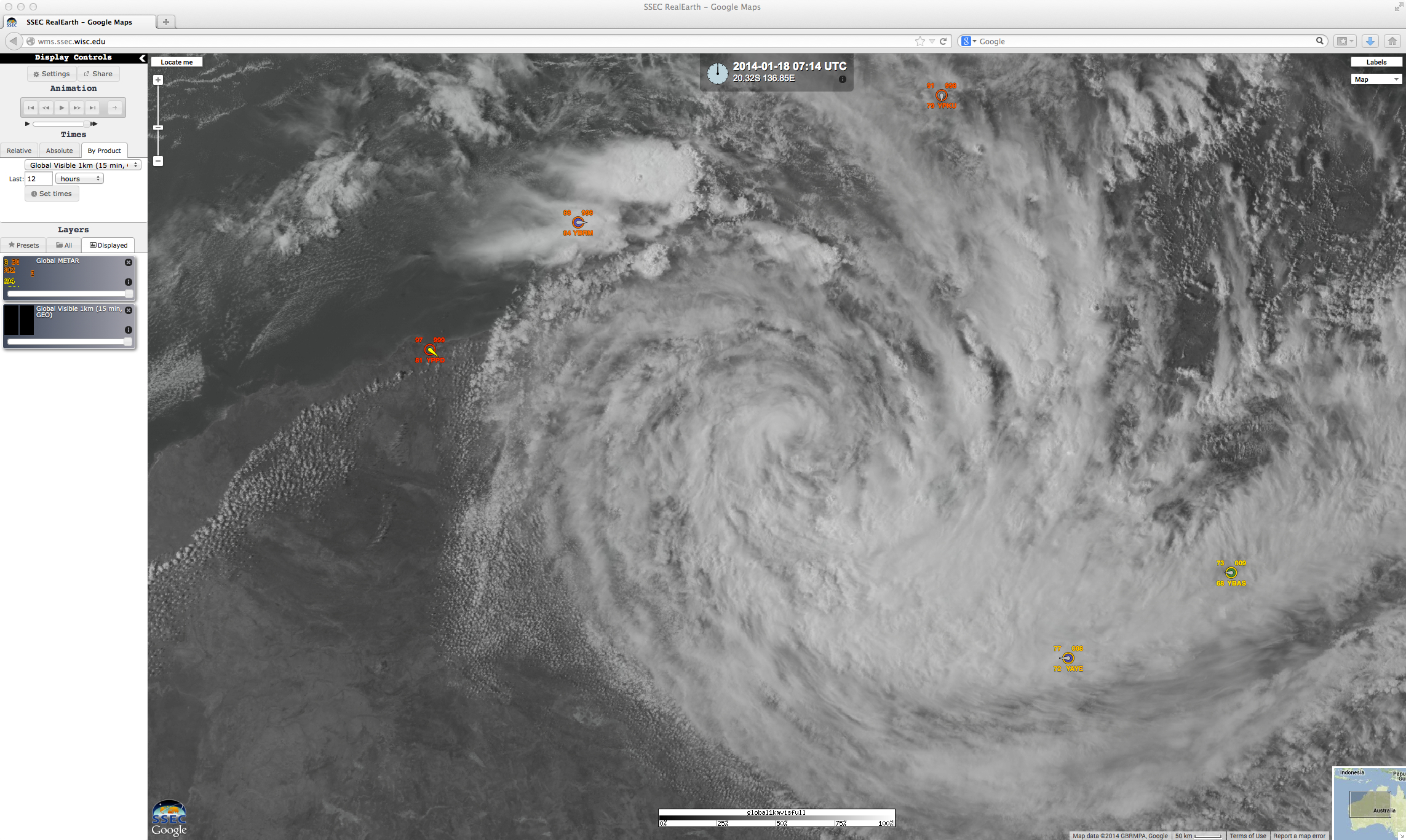
MTSAT-2 visible images and surface observations during the 17-18 January period are shown below (click image to play animation), visualized using the SSEC RealEarth web map server.


