Low-level “barrier jet” along the southeast coast of Greenland
")
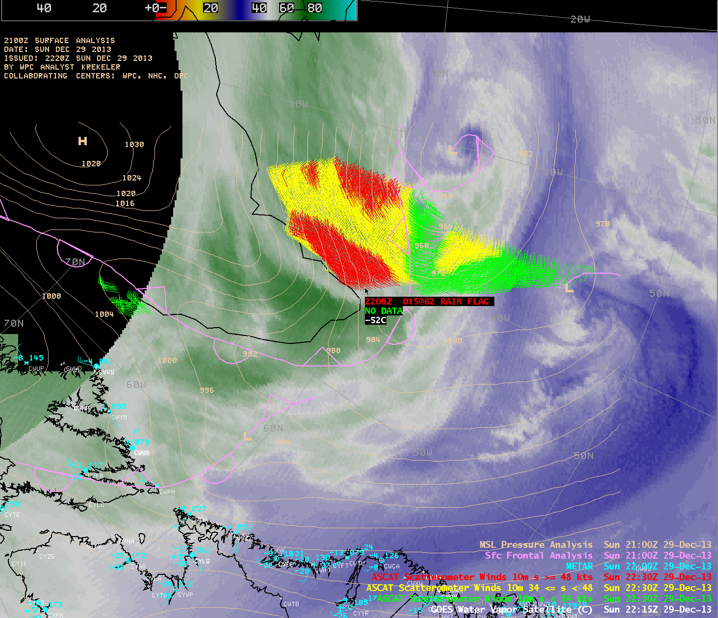
GOES-13 6.5 µm water vapor images with Metop ASCAT scatterometer winds and surface METARs and surface analyses (click to play animation)
AWIPS images of GOES-13 6.5 µm water vapor channel data with available overpasses of Metop ASCAT surface scatterometer winds (above; click image to play animation) revealed the presence of a low-level “barrier jet” along the southeast coast of Greenland on 29 December 2013. Maximum ASCAT wind speeds were 58 knots at 12:16 UTC, 62 knots at 13:57 UTC, and 62 knots at 22:09 UTC. It is interesting to note that a secondary area of low pressure was seen rotating around the primary low, and appeared to be rapidly intensifying judging from the quick development of a “corkscrew” appearance on the water vapor imagery near the end of the animation. ASCAT winds along the northwestern periphery of this secondary low were as high as 53 knots at 22:09 UTC.
The cyclonic circulation around the quasi-stationary area of low pressure located east of Greenland encountered the abrupt rise in topography of the island (below), which caused an acceleration of the flow known as a “barrier jet”.

Topography of Greenland, with Metop ASCAT scatterometer winds and surface METAR reports and surface analysis