Widespread turbulence over the Southwest US
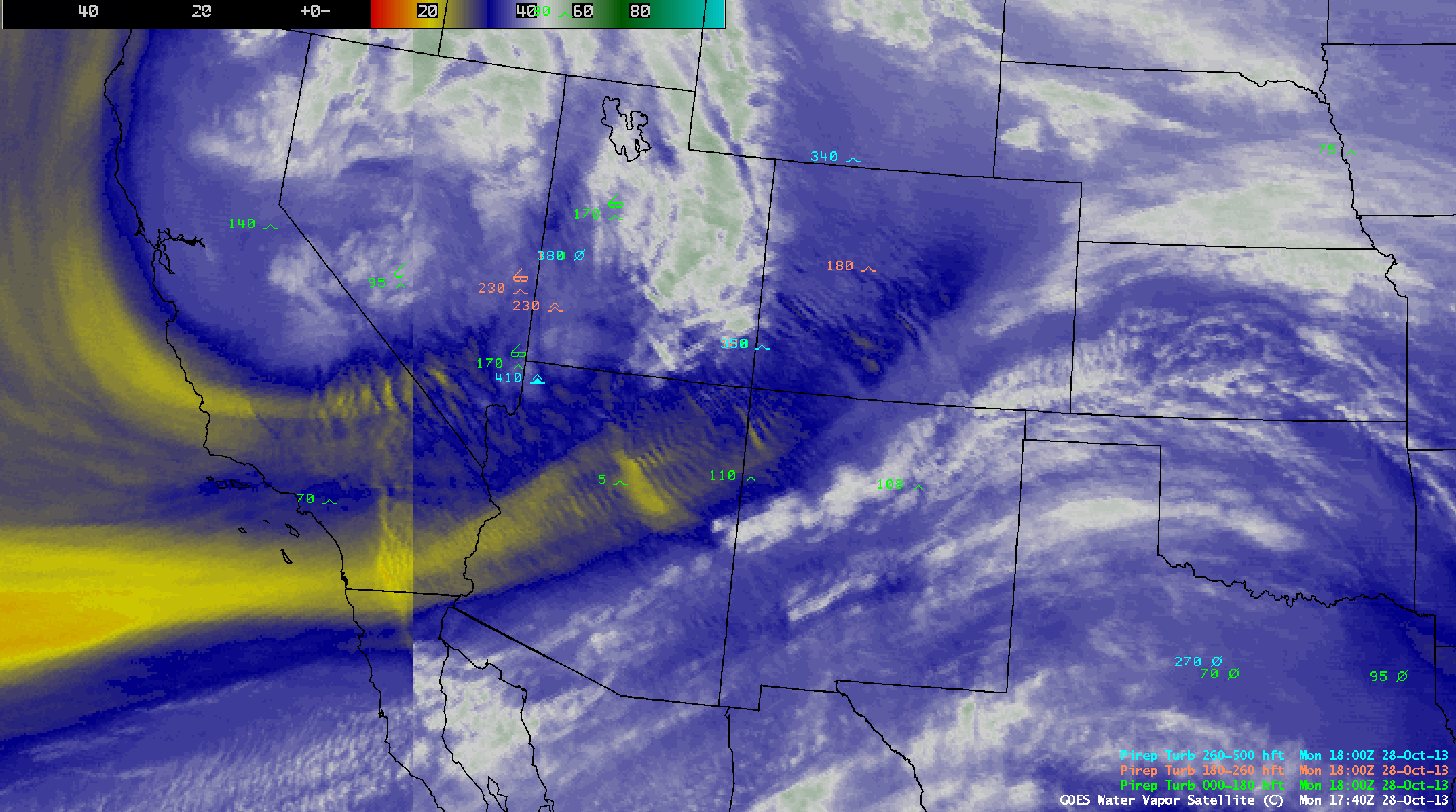
As a large upper-level trough was deepening and moving inland across the western US on 28 October 2013, strong winds interacting with the rugged terrain of the Southwest produced widespread areas of mountain waves, as revealed on McIDAS images of 4-km resolution GOES-13 6.5 µm water vapor data (above; click image to play animation). The fast speed of the animation revealed the non-stationary, “fluid motion” of some of the mountain wave features (especially over northeastern Arizona) — perhaps a clue that they might be associated with turbulence that was of moderate or greater intensity. In general, mountain waves that are quasi-stationary (and non-interfering) do not seem to produce more than light turbulence.
AWIPS images of composites of GOES-15 (GOES-West) and GOES-13 (GOES-East) 6.5 µm water vapor channel data with pilot reports of turbulence (below; click image to play animation) showed numerous reports of moderate to severe turbulence at a wide range of altitudes. In fact, there was even a relatively rare occurrence of a pilot report of Extreme turbulence at 18:01 UTC over far northwestern Arizona (at an altitude of 41,000 feet). Not far to the north, there was also a report of Severe turbulence at 23,000 feet over southwestern Utah.
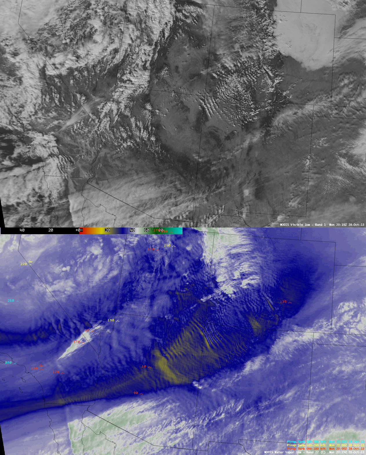
An AWIPS comparison of 1-km resolution MODIS 0.65 µm visible channel and 6.7 µm water vapor channel images at 20:19 UTC (above) showed that while some of the mountain wave features were at least partially marked by roll clouds on the visible image, many of the mountain waves were occurring in clear air.


