Persistent fog and stratus over Lake Superior
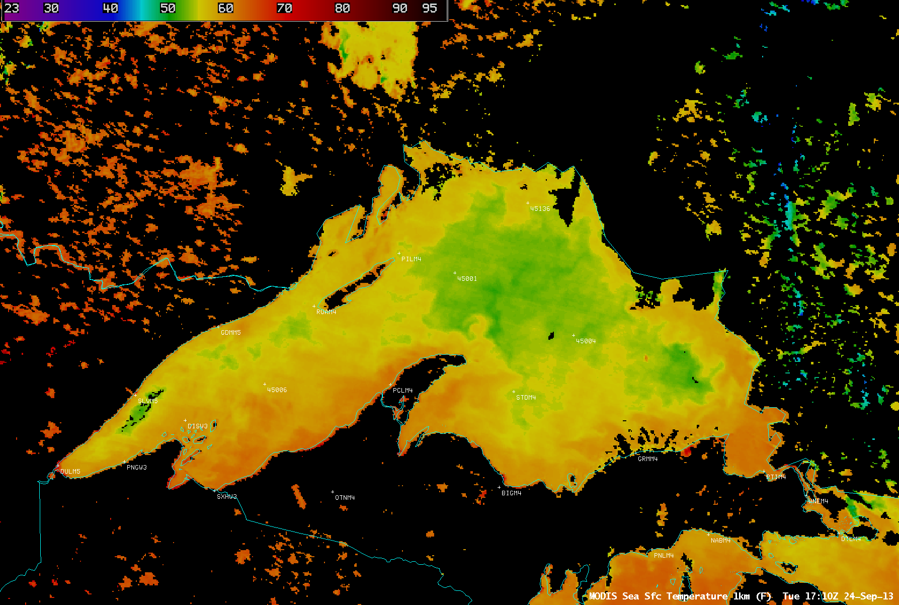
McIDAS images of GOES-13 0.63 µm visible channel data (above; click image to play animation) showed a large area of fog and stratus that persisted for the entire day over the northwestern portion of Lake Superior on 25 September 2013. Morning fog over adjacent parts of Ontario, Michigan, Wisconsin, and Minnesota quickly dissipated as daytime heating and boundary layer mixing increased, but the fog and stratus cloud mass remained over the relatively cool waters of Lake Superior; MODIS Sea Surface Temperature values from the previous day (below) were generally in the lower to middle 50s F (green to yellow color enhancement) over that portion of the lake.
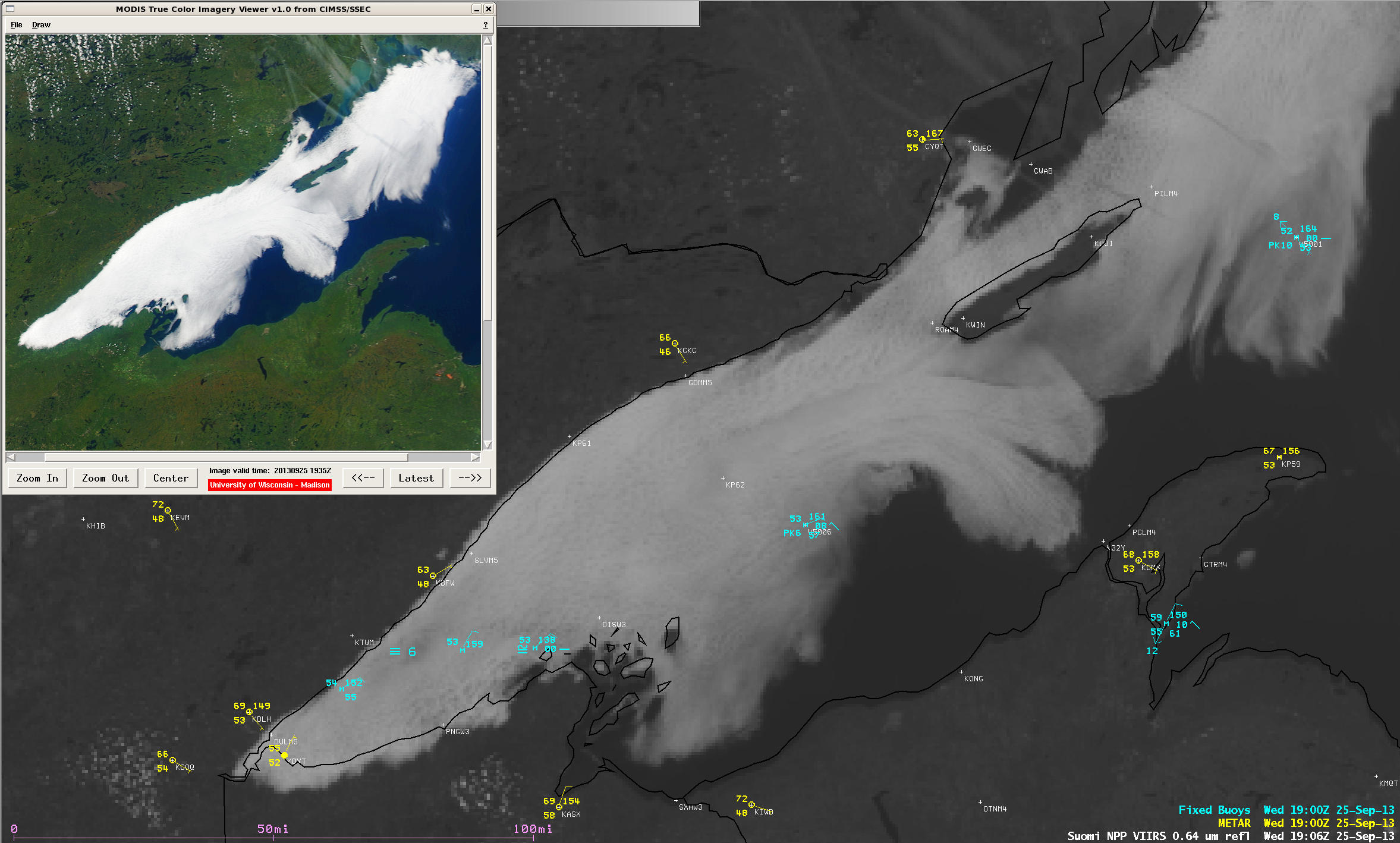
Additional details of the fog/stratus features can be seen in AWIPS images of 375-meter resolution (projected onto a 1-km AWIPS grid) Suomi NPP VIIRS 0.64 µm visible channel data at 19:06 UTC, along with a 250-meter resolution Aqua MODIS true-color Red/Green/Blue (RGB) image at 19:43 UTC (below).
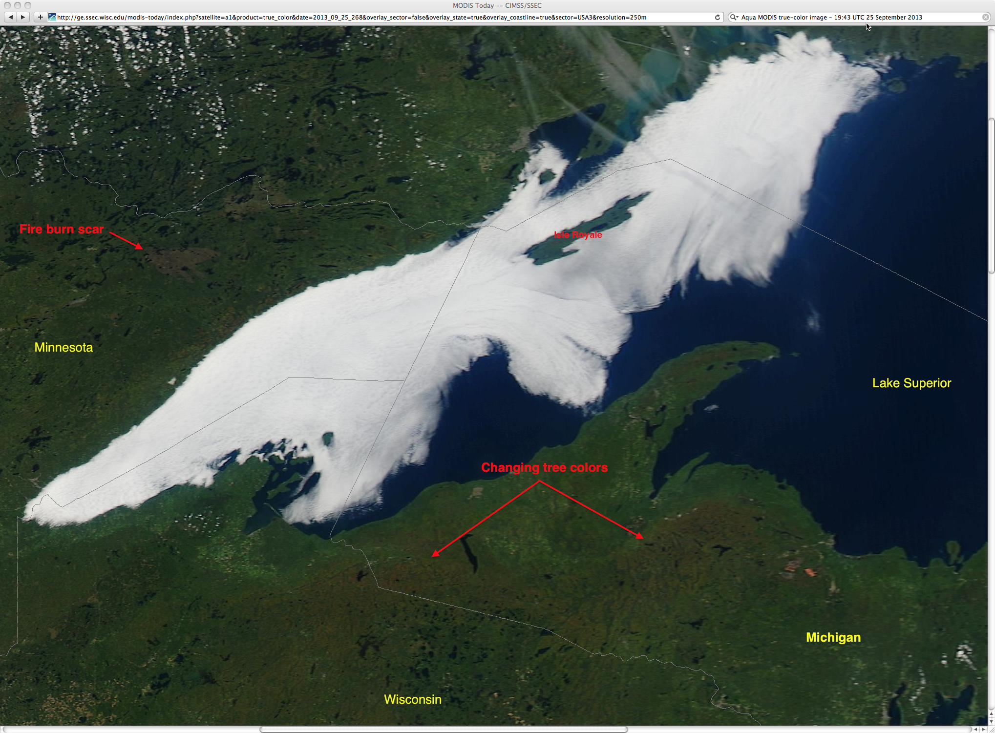
A closer look at the 250-meter resolution Aqua MODIS true-color RGB image from the SSEC MODIS Today site (below) revealed two additional features of interest: (1) a signature of the burn scar that remained from the Pagami Creek Fire that occurred in September 2011, and (2) the first indications of Autumn tree colors over parts of far northern Wisconsin and the western Upper Peninsula of Michigan.
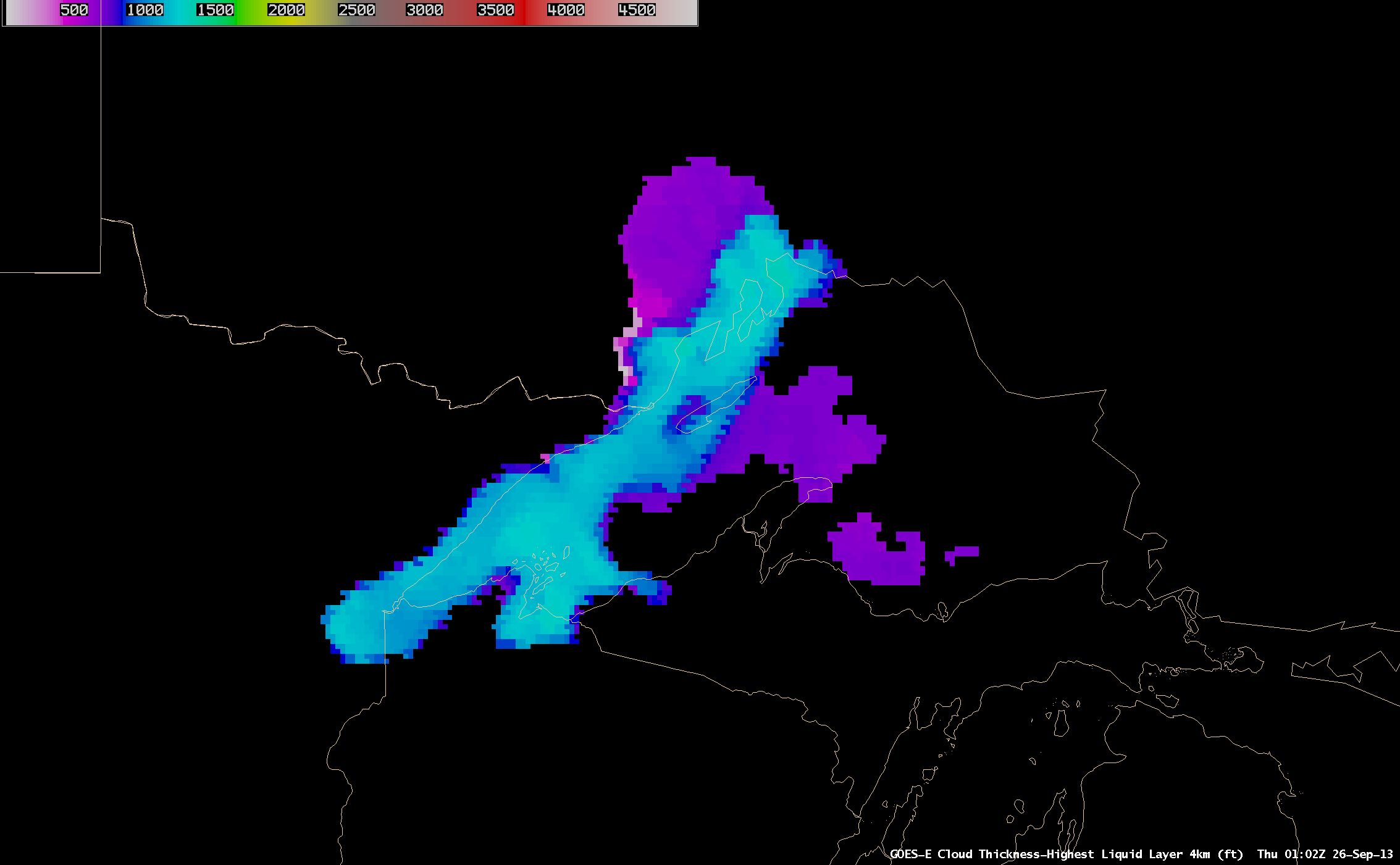
Note that Isle Royale could be seen protruding through the fog/stratus features during much of the day; with the maximum elevation of the island being 1394 feet, this indicates that the fog/stratus depth was less than that value. The GOES-R Cloud Thickness algorithm (applied to GOES-13 data) shortly after sunset depicted values that were generally 1200 feet (cyan color enhancement) or less (below).


