Tropical Storm (formerly Hurricane) Humberto
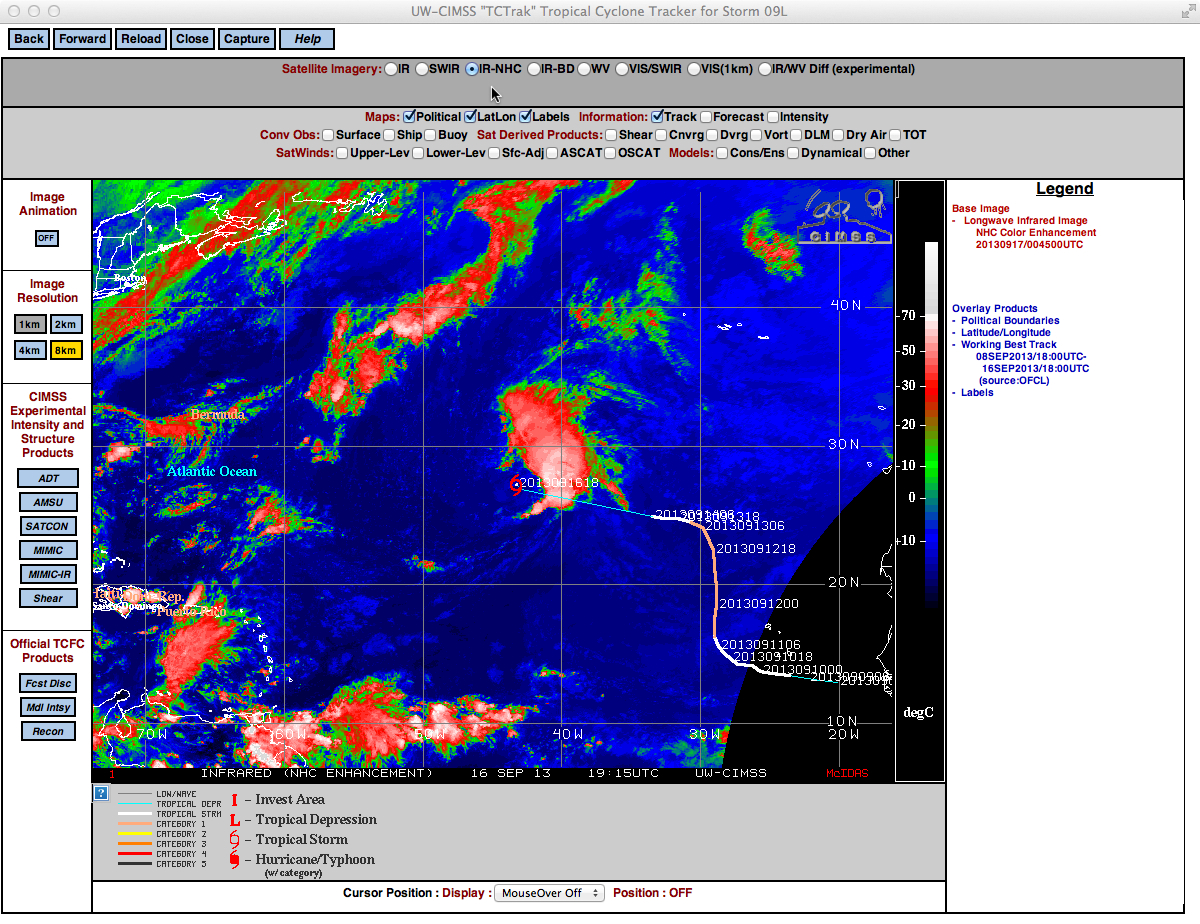
A GOES-13 10.7 µm IR channel image with the track of Humberto from the CIMSS Tropical Cyclones site (above) showed that the storm (which became the first hurricane of the season in the Atlantic Basin on 11 September) had been meandering over the eastern North Atlantic Ocean for several days, eventually weakening to a post-tropical cyclone on 14 September before re-organizing into a tropical storm early in the day on 16 September (NHC advisories archive).
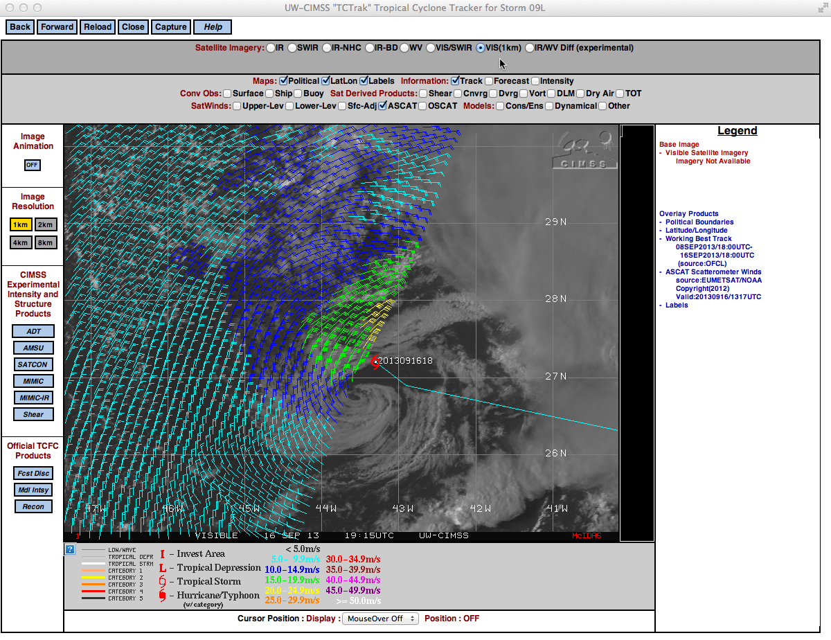
A GOES-13 0.63 µm visible channel image with an overlay of ASCAT surface scatterometer winds (above) showed evidence of tropical storm force winds (yellow wind barbs) north of the storm center at 13:17 UTC. Note the presence of a well-defined cloud vortex located southwest of the 18 UTC center fix position.The NHC discussion #26 mentioned that several smaller-scale vortices had been rotating around the mean circulation center of Humberto — and a close-up view using GOES-13 0.63 µm visible channel images (below; click image to play animation) revealed one of these exposed vortices to the southwest of the center of Humberto.
See From the Lee Side for a discussion on the role of vertical wind shear on tropical cyclones such as this.


