Moore, Oklahoma tornado
A devastating tornado struck Moore, Oklahoma just after 20:00 UTC or 3:00 PM local time on 20 May 2013, causing extensive (EF4 to EF5) damage and at least 24 fatalities. McIDAS images of GOES-15 (GOES-West) and GOES-13 (GOES-East) 0.63 µm visible channel data (above) showed the line of rapidly-developing thunderstorms over southern and central Oklahoma during the early afternoon hours — Moore is located about halfway between Oklahoma City (OKC) and Norman (OUN). Earlier in the day the GOES-13 satellite had been placed into Rapid Scan Operations (RSO) mode (providing images as frequently as every 5-10 minutes), while the GOES-15 satellite was placed into Super Rapid Scan Operations (SRSO) mode (providing bursts of imagery at 1-minute intervals) after 20:15 UTC. According to the preliminary NWS damage survey, the tornado began around 19:45 UTC just west of Newcastle, and ended around 20:35 UTC just east of Moore.
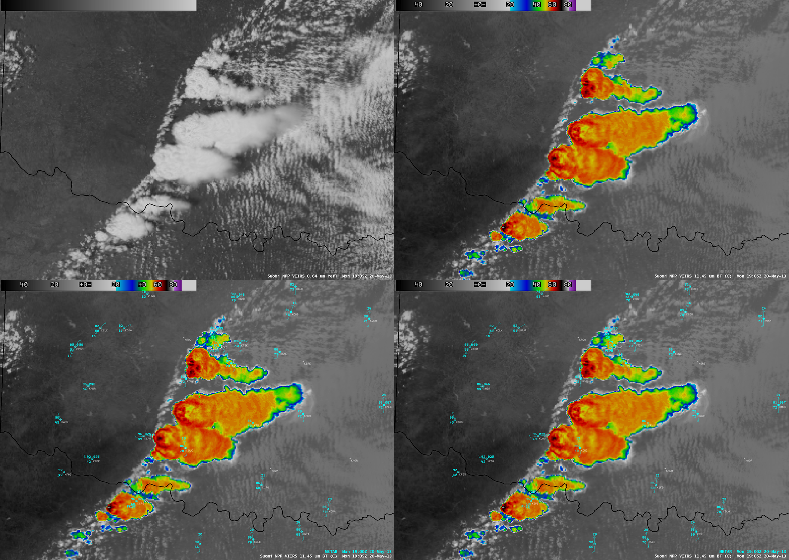
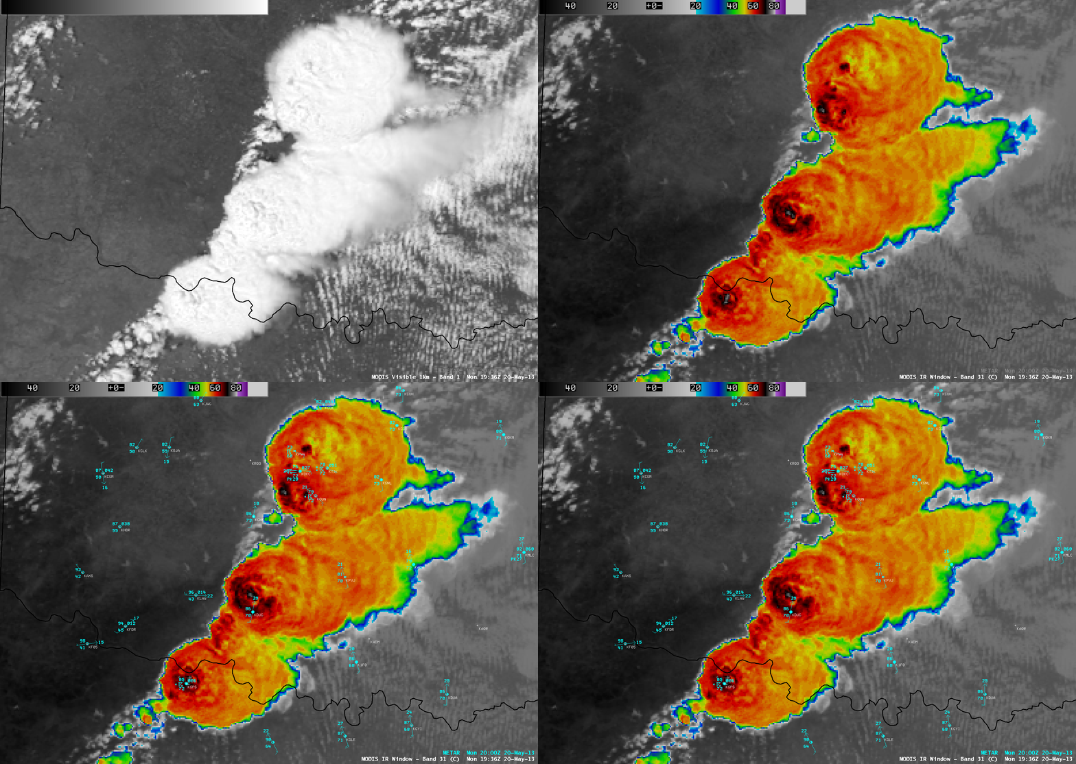
An AWIPS comparison of 1-km resolution Suomi NPP VIIRS 0.64 µm visible channel and 11.45 µm IR channel images about an hour before the tornado arrived in Moore (above) revealed the presence of shadowing from overshooting tops and cloud-top IR brightness temperatures as cold as -68º C. About 30 minutes prior to the Moore tornado, a comparison of 1-km resolution Aqua MODIS 0.65 µm visible channel and 11.0 µm IR channel images (below) again indicated signatures of vigorous overshooting tops, with cloud-top IR temperatures as cold as -76º C.
Comparisons of the 1-km resolution VIIRS 11.45 µm IR and MODIS 11.0 µm IR images with their corresponding 4-km resolution GOES-13 10.7 µm IR images (below) demonstrated the value of higher spatial resolution to aid in the earlier and more accurate detection of the cold cloud-top IR brightness temperatures values associated with these rapidly-developing convective cells. There were significant differences in the magnitude of the coldest cloud-top IR brightness temperatures with the more northerly cell that spawned the Moore tornado:Â -68 C on VIIRS vs -51 C on GOES, and -76 C on MODIS vs -62 C on GOES. The northwestward shift in the location of features on the GOES-13 images was due to parallax.

Comparison of 1-km resolution VIIRS 11.45 µm IR image and corresponding 4-km resolution GOES-13 10.7 µm IR image
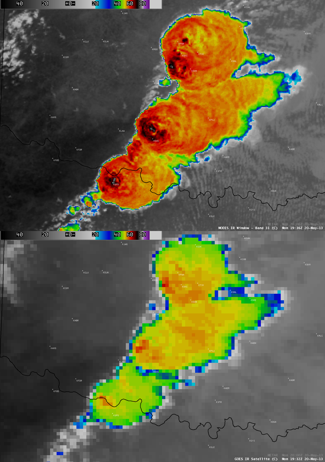
Comparison of 1-km resolution MODIS 11.0 µm IR image and corresponding 4-km resolution GOES-13 10.7 µm IR image
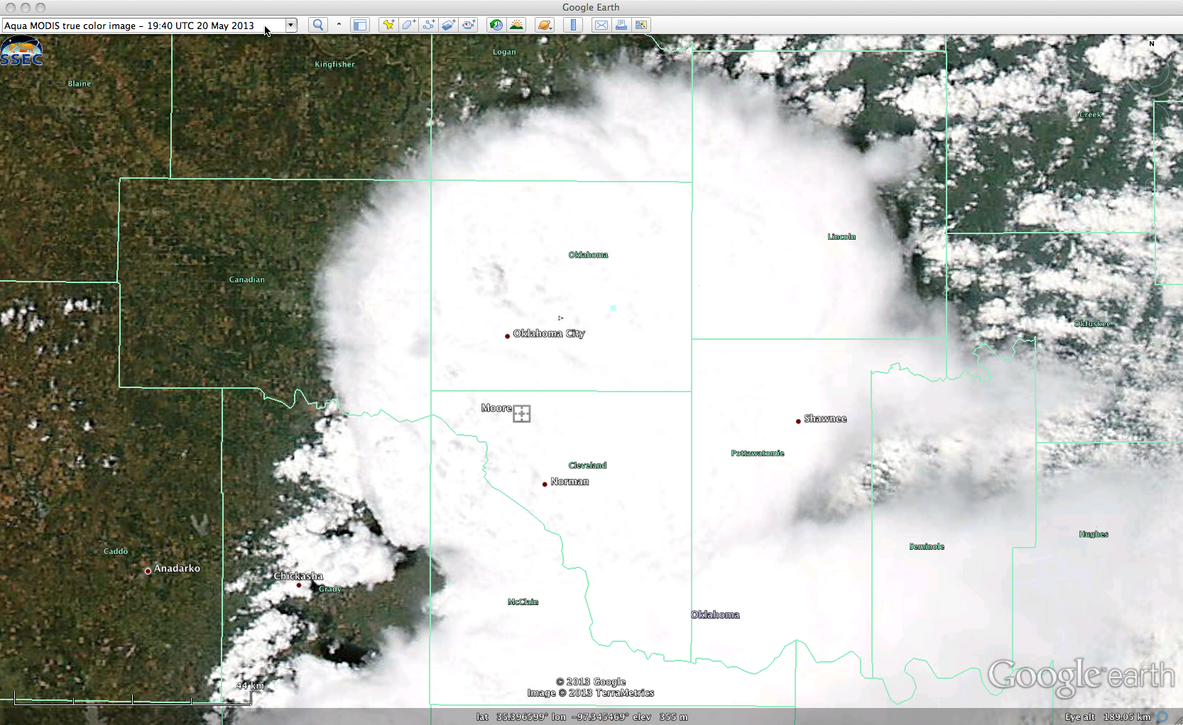
A 250-meter resolution Aqua MODIS true-color Red/Green/Blue (RGB) image from the SSEC MODIS Today site (below; viewed using Google Earth) shows a closer view of the northernmost cell that produced the Moore tornado, along with hail as large as 3.25 inches in diameter (SPC storm reports).
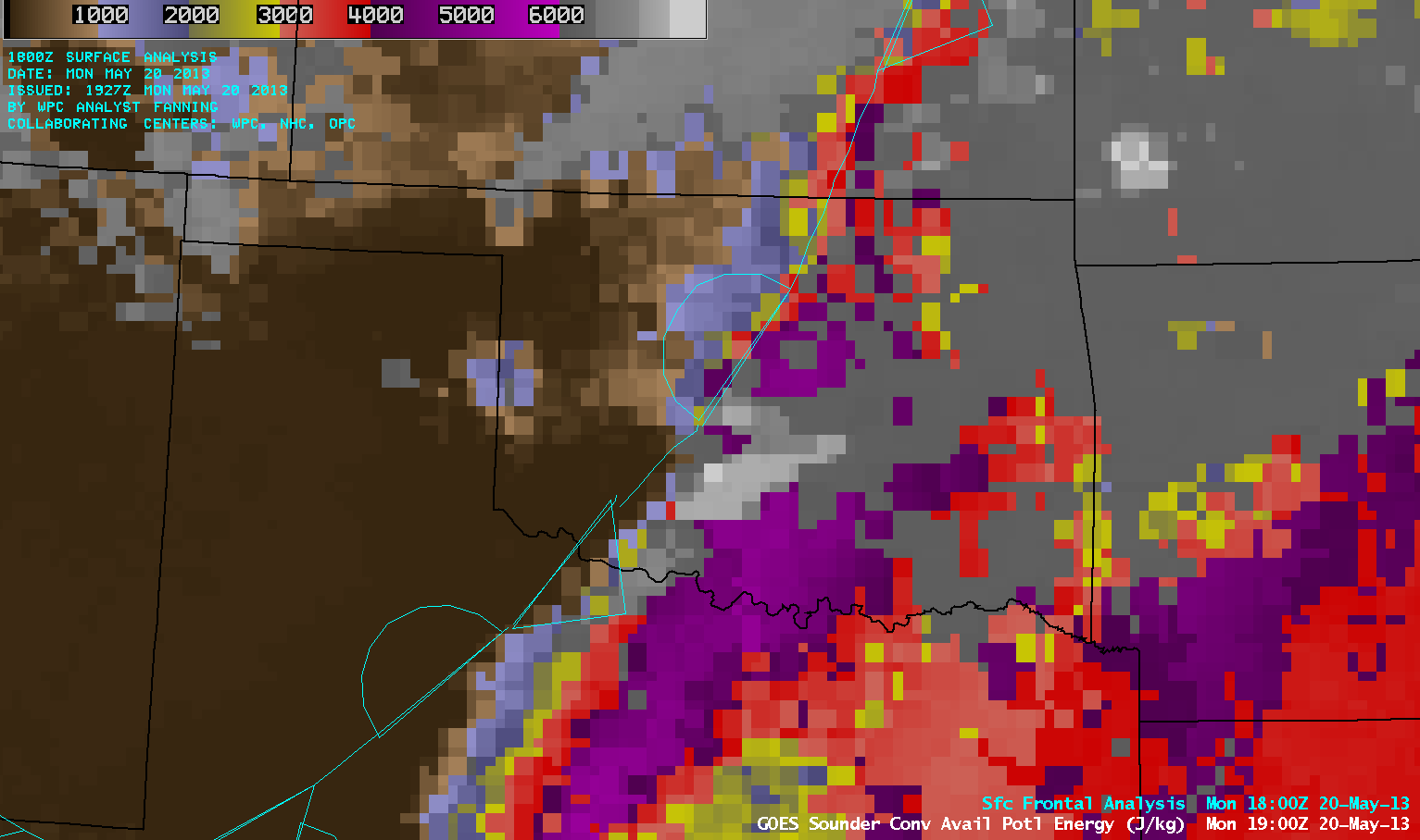
GOES-13 sounder Convective Available Potential Energy (CAPE) derived product images (below; click image to play animation) showed how the atmosphere rapidly destabilized during the day, with CAPE values in excess of 5000 J/kg (lighter purple color enhancement) at 18:00 UTC east of the stationary frontal boundary just prior to convective development.
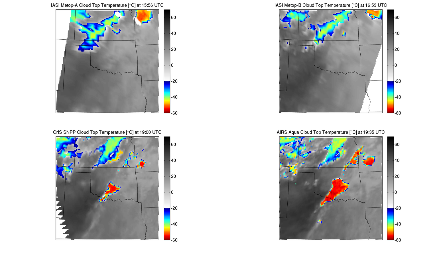
Cloud Top Temperature retrievals created using data from the IASI, CrIS, and AIRS polar-orbiting sounder instruments (below; courtesy of Elizabeth Weisz and Nadia Smith, CIMSS) showed the rapid trend in cloud-top cooling during the 15:56-19:35 UTC timeframe.


