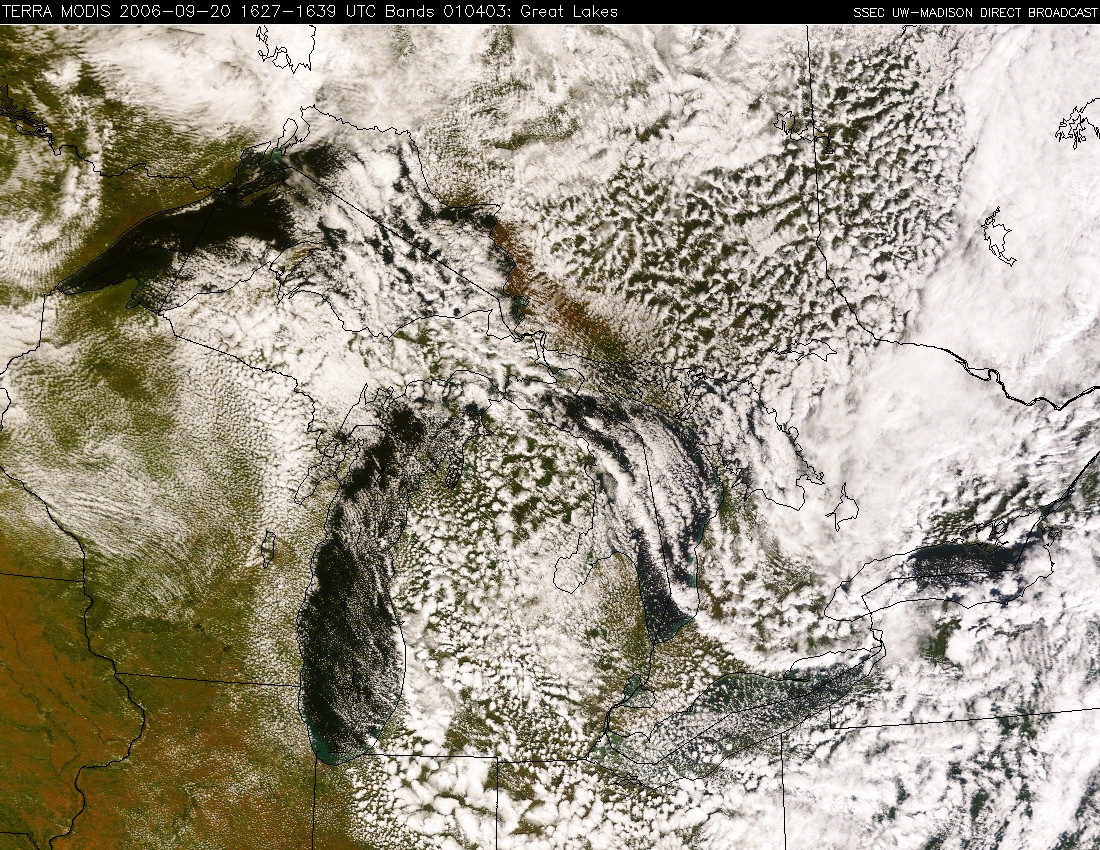
Lake-effect rain bands
Cold air advection in the wake of a secondary cold front helped to generate some well-defined lake effect rain bands over Lake Huron on 20 September (QuickTime animation of GOES-12 visible images). The cold air mass allowed daily minimum temperatures at the surface to fall into the 30s to 40s F across the Great Lakes region (getting as cold as 26 F at Hayward WI and Embarrass MN). The air temperatures aloft (850 hPa, near 5000 feet) were 0 to -3 C; as this cold air flowed over the relatively warm waters of Lake Huron (water temperatures of 15-18 C), the release of the thermal instability helped elongated cloud bands to form (generally parallel to the boundary layer wind direction. The AWIPS MODIS cloud phase product indicated that most of the lake-effect clouds were water phase clouds (blue enhancement), although it did flag portions of the longest cloud band as “mixed phase” (darker gray enhancement) where the cloud top temperatures were as cold as -12 C. With daytime surface air temperatures warming into the 50s F, the precipitation falling from these cloud bands was in the liquid form; similar cloud band features produce significant lake-effect snowfall during the colder winter months.


