Undular bore over Texas and the Gulf of Mexico
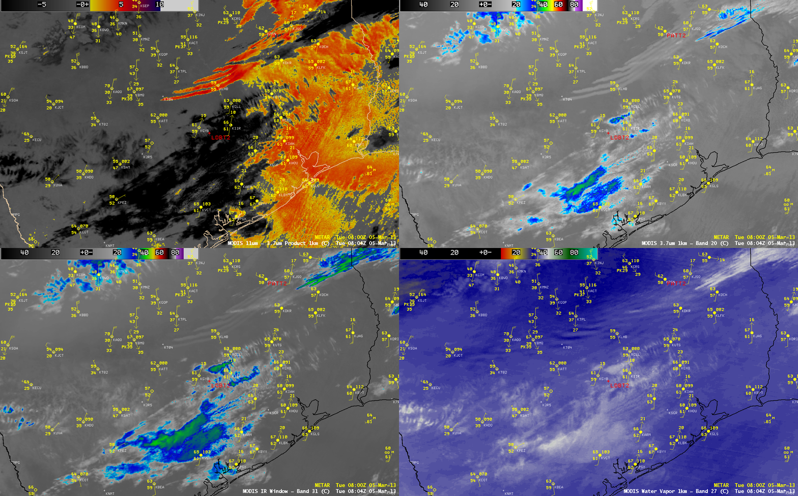
MODIS IR brightness temperature difference “fog/stratus product”, 3.7 µm shortwave IR, 11.0 µm IR window, and 6.7 µm water vapor channel images
A comparison of AWIPS images of MODIS 11.0-3.7 µm IR brightness temperature difference “fog/stratus product”, 3.7 µm shortwave IR, 11.0 µm IR window, and 6.7 µm water vapor channel images (above) showed the night-time (08:04 UTC or 3:04 AM local time) development of parallel cloud bands associated with an undular bore that was forming in advance of a strong cold frontal boundary which was moving southward across Texas on 05 March 2013. Note how the cloud band features showed up with better clarity in the 3.7 µm IR image compared to the 11.0 µm IR image, since the shortwave IR channel is more sensitive to warmer temperatures (the IR brightness temperatures of the cloud bands averaged about +5º C).
After sunrise, the undular bore cloud bands coud be seen moving southeastward off the coast of Texas and across the adjacent offshore waters of the Gulf of Mexico on McIDAS images of GOES-13 0.63 µm visible channel data (below; click image to play animation).
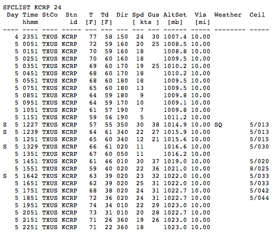
As the leading edge of the bore passed through Corpus Christi, Texas (CRP on the GOES-13 visible images), surface observations (below) indicated that winds gusted to 38 knots or 44 mph at 12:27 UTC.
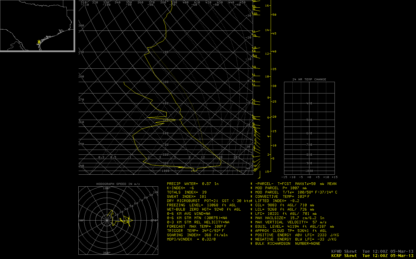
The 12 UTC morning rawinsonde data from Corpus Christi (below) revealed a very strong and deep boundary layer temperature inversion (with a top around 962 hPa or 2460 feet), which was acting to duct the undular bore as it propagated southeastward.
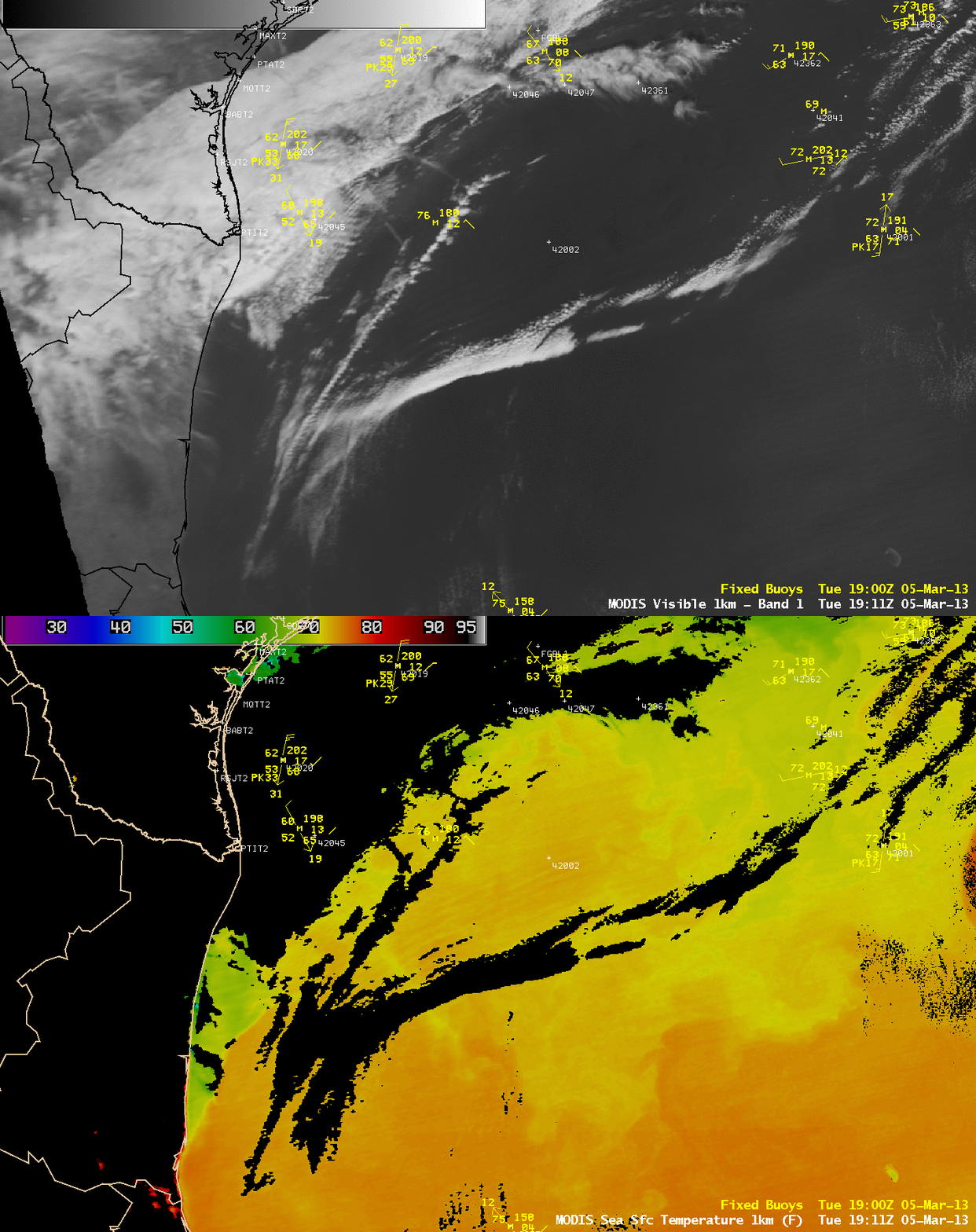
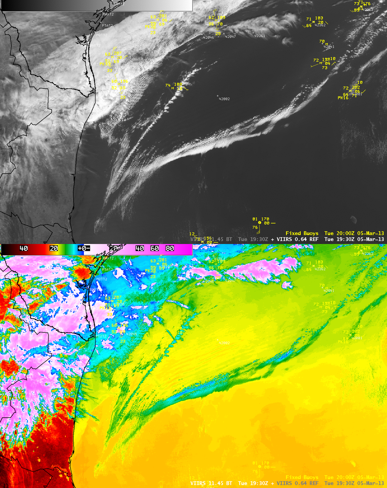
It is interesting to note that in the wake of the undular bore passage, there appeared to be a signal of Gulf of Mexico water wave activity in both the MODIS Sea Surface Temperature product (above) and the Suomi NPP VIIRS 11.45 µm IR channel image (below). On each corresponding visible channel image, a subtle wave signature could also be seen, but these waves did not appear to be cloud features. Could the strong winds of the bore passage have created wave swells which then acted to mix the water surface enough to allow a small amount of cold water upwelling?


