Polar low over the western Bering Sea
")
MTSAT-2 0.73 µm visible channel images (click image to play animation)
McIDAS images of MTSAT-2 0.73 µm visible channel data (above; click image to play animation) showed a small polar low that was developing just south of the sea ice edge in the western Bering Sea on 15 February 2013. Widespread cloud streets could be seen streaming southwestward off the sea ice edge as colder air was being drawn into the circulation of the low as it propagated westward.
Greater detail in the sea ice, the cloud streets, and the curved cloud bands associated with the circulation of the polar low could be seen in an AWIPS comparison of 1-km resolution Suomi NPP VIIRS 0.64 µm visible channel and false-color Red/Green/Blue (RGB) images (below). In the RGB image, snow and ice appear as darker shades of red, in contrast to supercooled water droplet clouds (which appear as varying shades of white) — and clouds that are becoming glaciated also exhibit a pink to lighter red appearance.
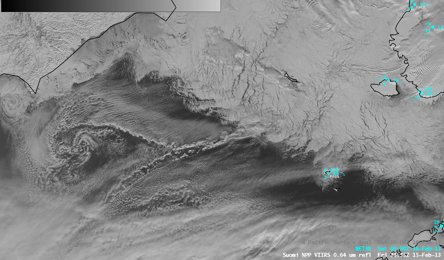
Suomi NPP VIIRS 0.64 µm visible channel and False-color Red/Green/Blue (RGB) images
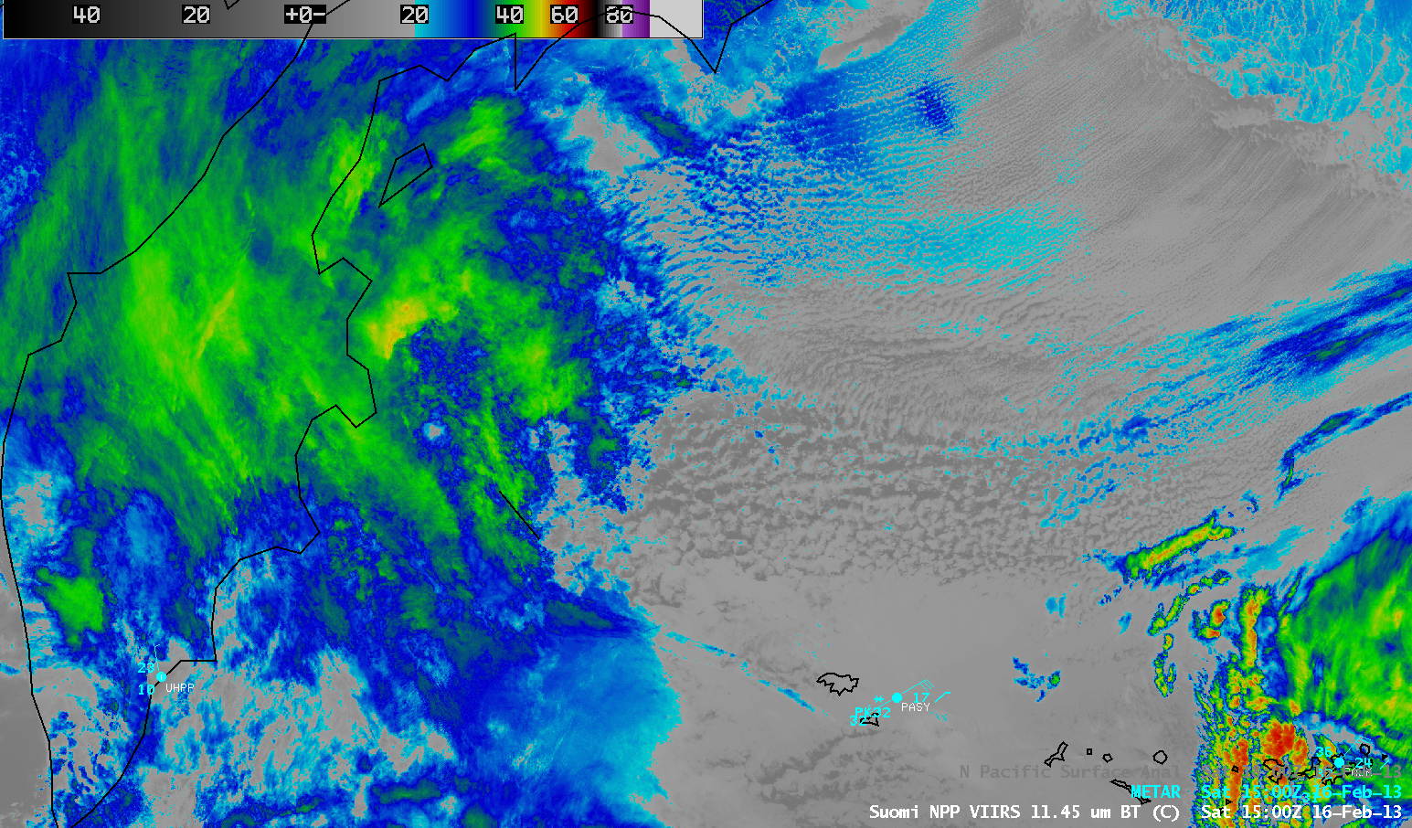
Several hours later, a comparison of Suomi NPP VIIRS 0.7 µm Day/Night Band (DNB) and 3.74 µm shortwave IR images at 15:00 UTC on 16 February (below) showed the tight circulation of the polar low approaching the east coast of Russia’s Kamchatka Peninsula. Even though a thin veil of high clouds covered most of the Kamchatka Peninsula (VIIRS 11.45 µm IR image), another feature of interest was the large (but diffuse) bright spot seen on the DNB image, which coincided with a small shortwave IR thermal anomaly or “hot spot” (darker black to yellow enhancement) which exhibited a maximum IR brightness temperature of 43º C. This feature was the Plosky Tolbachik Volcano, which was experiencing strong seismic activity and producing effusive lava flows at the time (KVERT site).
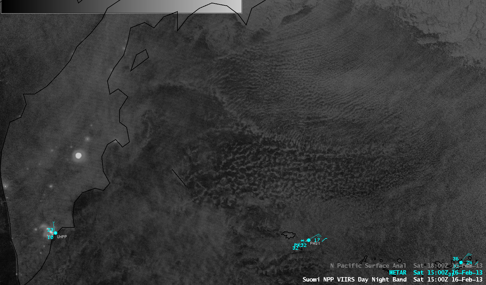
Suomi NPP VIIRS 0.7 µm Day/Night Band and 3.74 µm shortwave IR images