Features of interest seen on VIIRS Day/Night Band imagery
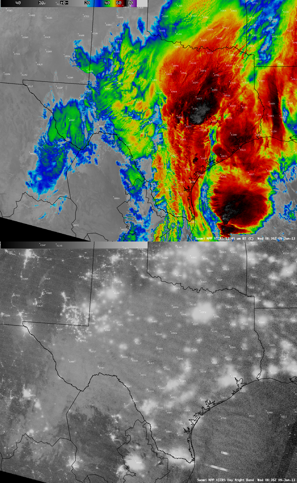
A comparison of AWIPS images of Suomi NPP VIIRS 0.7 µm Day/Night Band (DNB) and 11.45 µm IR channel data at 08:36 UTC (or 2:36 AM local time) on 09 January 2013 (above) showed a few items of interest on the DNB “visible image at night”:
- Even though there was deep convection with very cold (-70 to -75º C, black to light gray enhancement) cloud tops covering much of the eastern half of Texas, the diffuse glow of city lights could still be seen through the clouds
- Two elongated bright streaks off the southern tip of Texas: signatures of cloud-top illumination by lightning
- The relatively sparsely-populated area of far southeastern New Mexico and the adjacent New Mexico/Texas border region exhibited a pronounced signature of bright illumination
- In central New Mexico, where it was relatively cloud-free, portions of the Interstate highways — especially Interstate 40 that ran west-to-east between Albuquerque KABQ and Amarillo KAMA — appeared to be nearly continuously illuminated (presumably by a combination of small towns, truck stops, etc. and the headlights of vehicle traffic along the route)
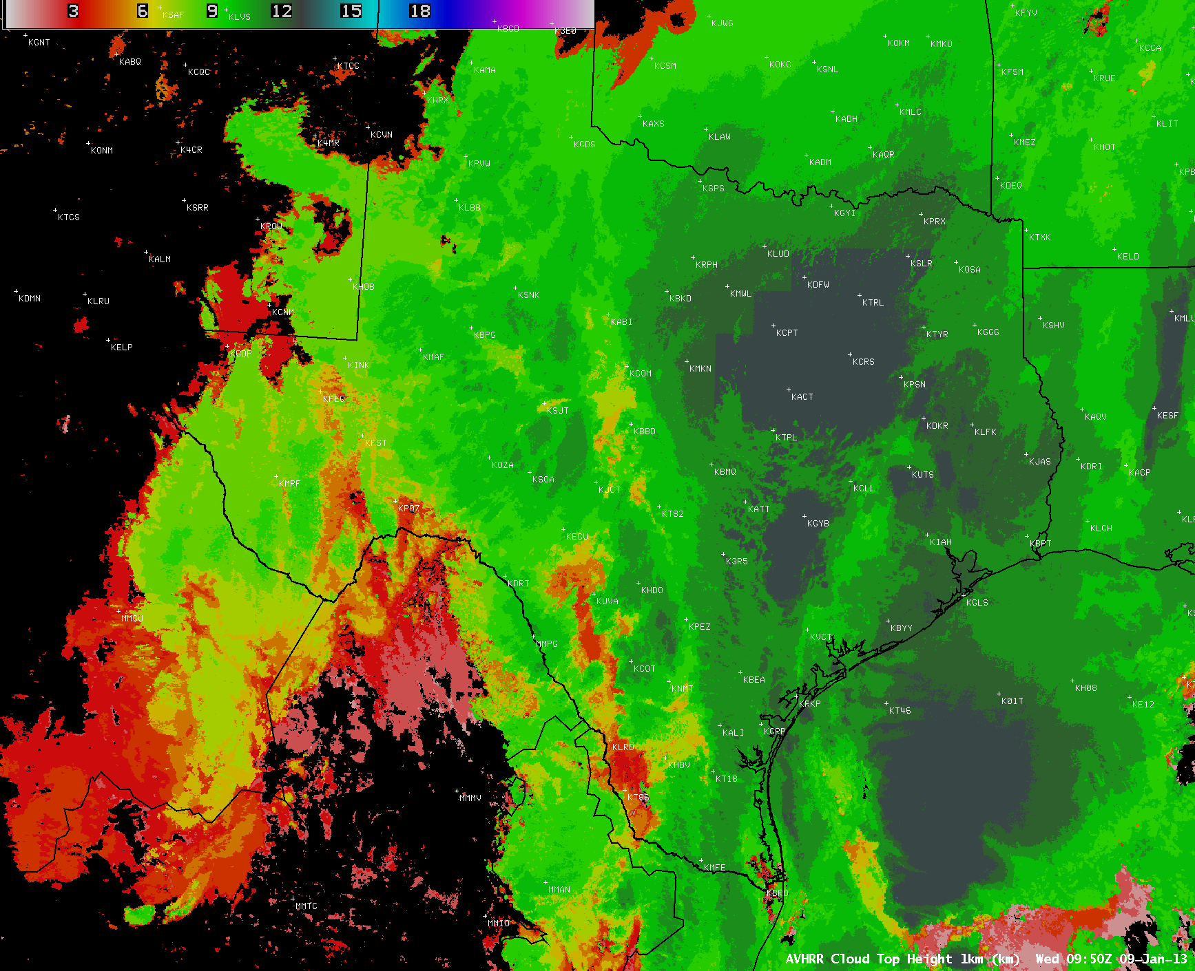
Regarding point number 1 with the city light signatures, let’s attempt to explore how thick the clouds were over eastern Texas. An AWIPS image of the POES AVHRR Cloud Top Height product about an hour later at 09:50 UTC (above) indicated that the vast majority of the cloud tops were in the 11-13 km or 36,000-43,000 feet range. The VIIRS IR cloud top brightness temperatures as cold as -70 to -75 C agreed well with the temperature of the tropopause on the 12 UTC Fort Worth, Texas rawinsonde report (the tropopause height on that sounding was around 43,000 feet).
Surface station cloud ceiling and visibility data plotted on the VIIRS IR image (below) showed that overcast cloud bases nearest to the area of the coldest IR cloud top temperatures were 3500 feet above ground level at Temple KTPL and 5500 feet above ground level at Waco KACT. Outside of the main convective updraft cores the cloudiness was likely distributed within a number of discrete layers, but the fact that such a bright (albeit diffuse) signature of city lights could be seen through 30,000-40,000 feet of cloud layers is rather remarkable.
Regarding point number 3 with the bright lights seen across far southeastern New Mexico and the adjacent New Mexico/Texas border region, that is due to widespread drilling activity in the Avalon / Bone Spring oil shale region. While some natural gas flares might be present, the vast majority of the bright signatures are likely due to illuminated “man camps” that house the drilling support crews. Similar night-time illumination signatures are seen in the Eagle Ford and Bakken oil shale drilling regions.
===== 10 January Update =====
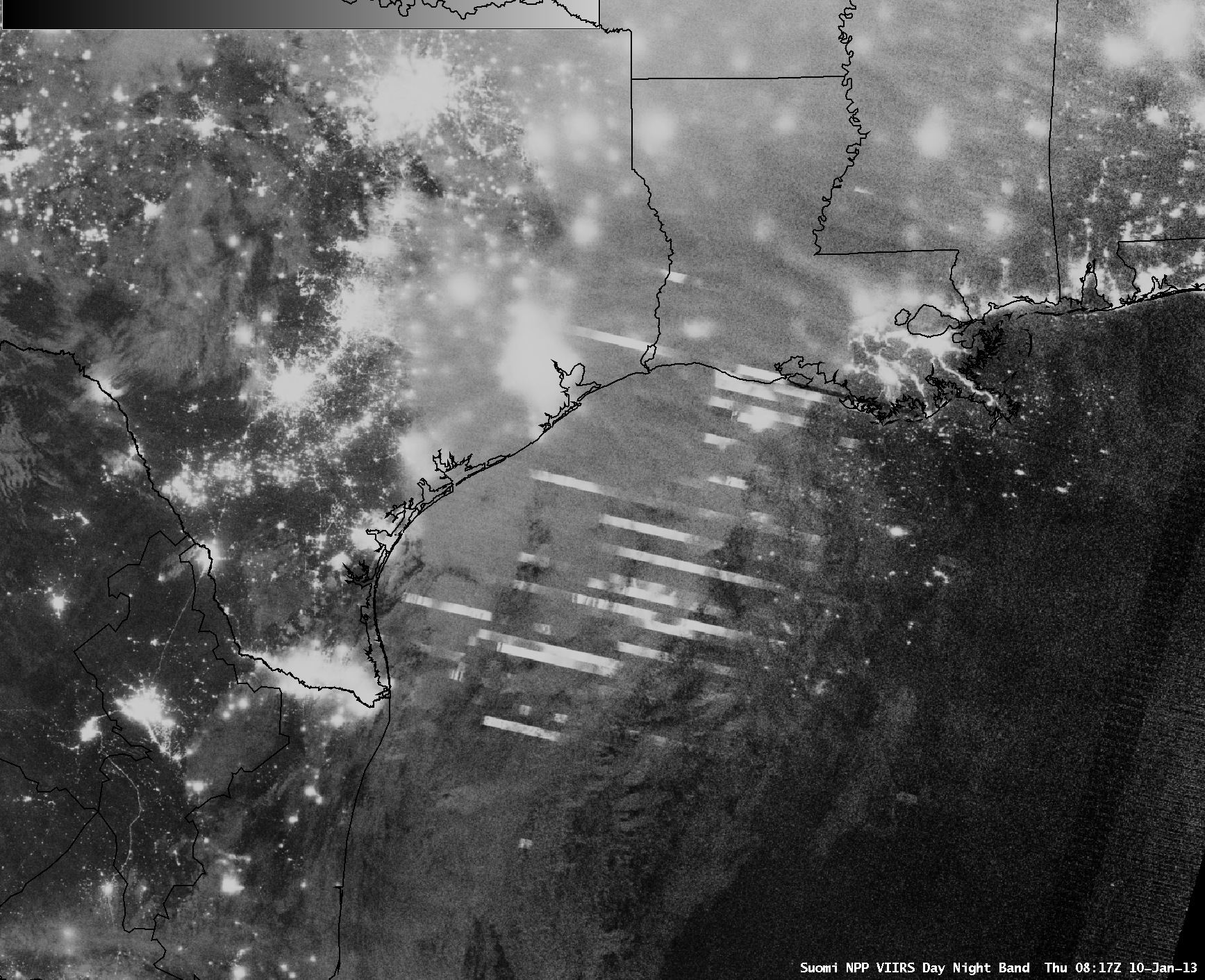
The deep convection persisted off the coast of Texas into 10 January — a Suomi NPP VIIRS 0.7 µm Day/Night Band image at 08:17 UTC or 2:17 AM local time (above) displayed a large number of elongated bright streaks as the sensor detected lightning-illuminated clouds.


