Fog-related multiple-vehicle accident in eastern Texas
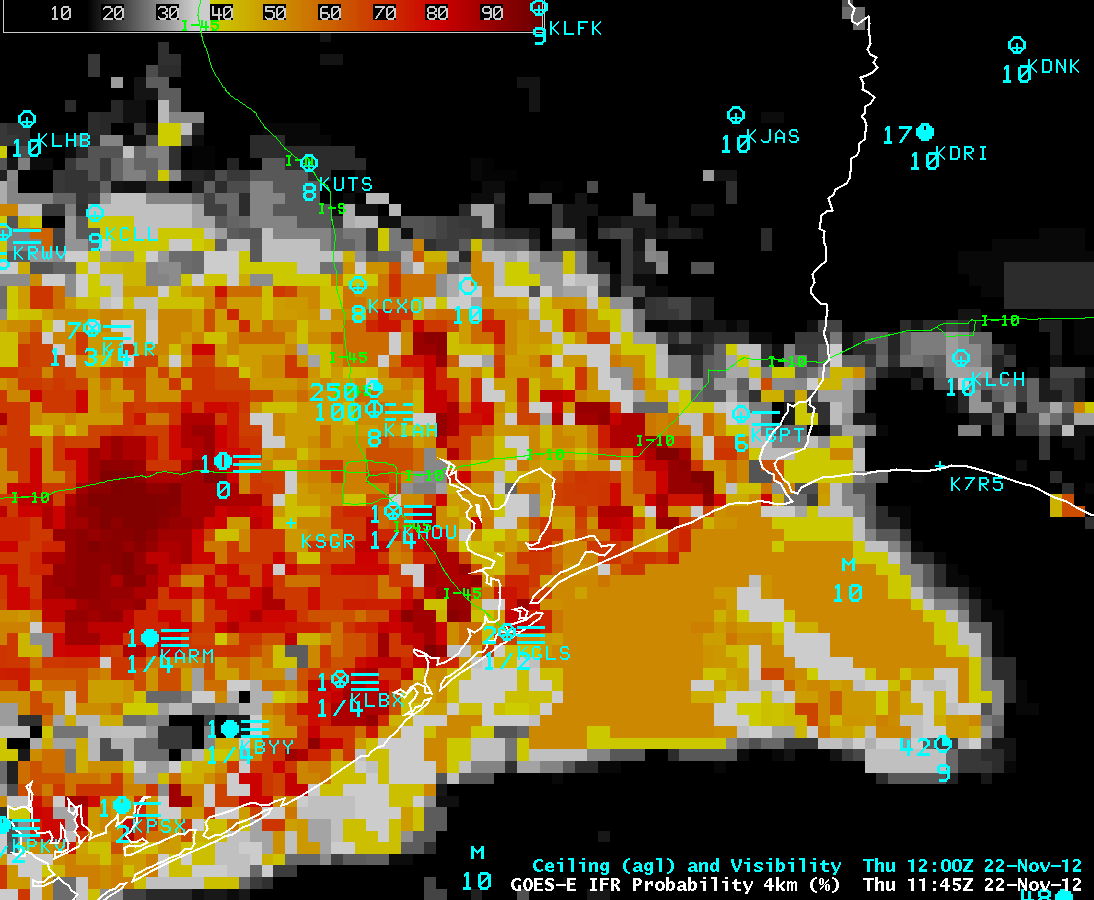
Dense fog was a factor in causing a multiple-vehicle accident (an estimated 140 vehicles involved; 2 fatalities; dozens of injuries requiring transport to hospitals) along Interstate 10 between Houston and Beaumont in eastern Texas on the morning of 22 November 2012. The GOES-R Instrument Flight Rules (IFR) Probability product (with the algorithm applied to GOES-13 data) showed that the likelihood of IFR conditions (visiblity less than 3 miles, and/or cloud bases less than 1000 feet) began to increase in coverage and magnitude over the area between Houston and Beaumont after around 08 UTC or 2 AM local time (above; click image to play animation), with the probability reaching the 80-90% range (darker red color enhancement) after 11 UTC or 5 AM local time.
According to media reports, the accident occurred around 14 UTC or 8 AM local time, near the “I-10” label on the eastbound portion of Interstate 10 that turned sharply northeastward toward Beaumont. There were no surface observations in the immediate vicinity of the accident, but the visibility had dropped as low as 1/4 mile at Houston (KHOU) and 4 miles an Beaumont (KBPT) during the pre-dawn hours.
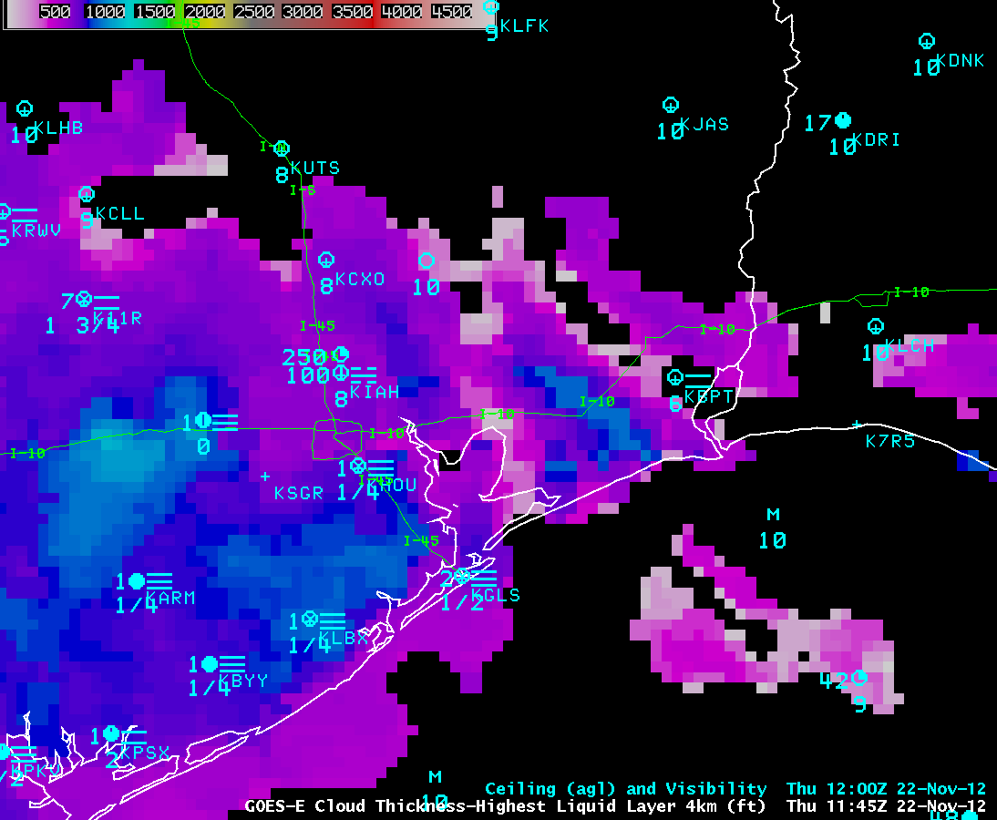
The GOES-R Cloud Thickness product (again, with the algorithm applied to GOES-13 data) showed that the fog/low stratus feature near the accident site reached a maximum depth of around 1000 feet (cyan color enhancement) after 12 UTC or 6 AM local time (below; click image to play animation). For additional examples and information about these GOES-R Fog and Low Stratus (FLS) products, see the GOES-R Fog Product Examples blog or view the GOES-R FLS training material (VISITview | PowerPoint).
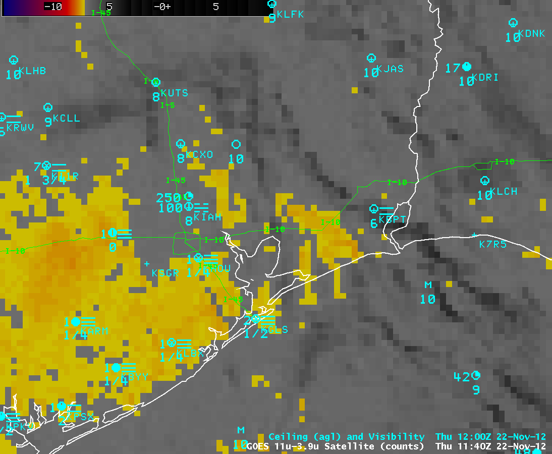
The traditional or “legacy” GOES-13 IR brightness temperature difference (BTD) “fog/stratus product” (below; click image to play animation) did exhibit a signal of fog and/or stratus (yellow to red color enhancement) increasing over that region, but part of that signal was being contaminiated by high cloud features (black enhancement) drifting overhead. In addition, the primary weakness of the legacy BTD fog/stratus product is that it does not provide the distinction between potentially hazardous fog on the ground and non-hazardous stratus clouds located above the surface.
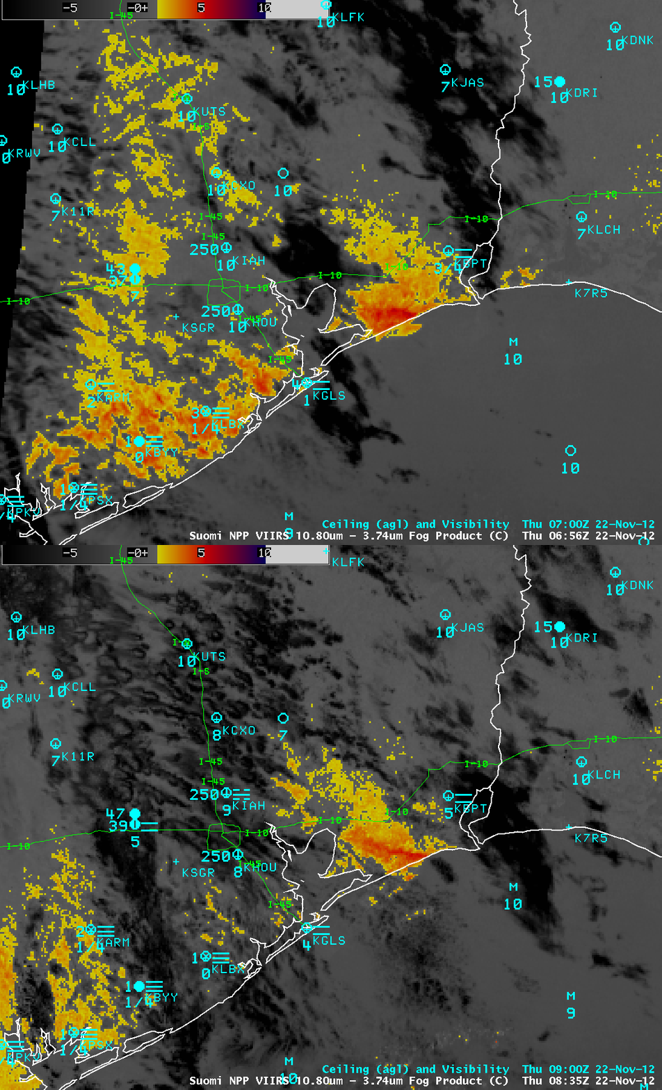
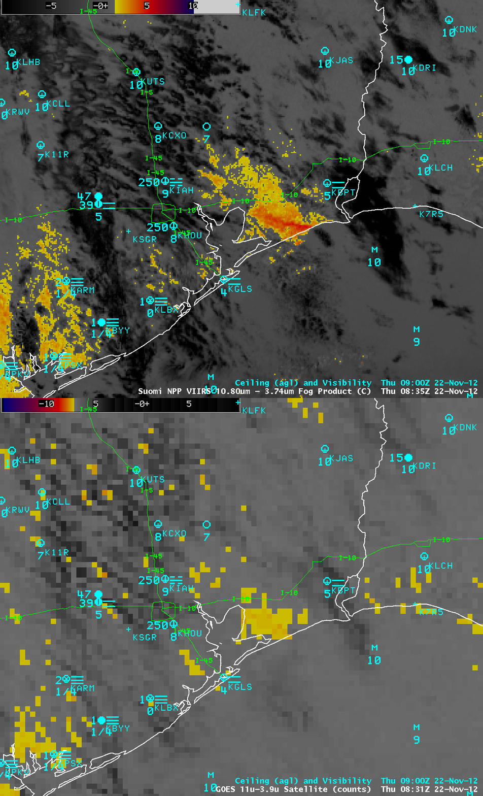
Suomi NPP VIIRS IR BTD fog/stratus product images at 06:56 UTC or 12:56 AM local time and again at 08:35 UTC or 2:35 AM local time (below) also displayed a signal indicating that a well-defined fog/stratus feature was located over the area.
With higher spatial reolution (1 km) compared to GOES-13 (4 km), the Suomi NPP VIIRS IR BTD fog/stratus product image at 08:35 UTC (below) did a better job at showing the signal of fog/stratus in the area, even through the patches of high clouds (black enhancement) that were drifting overhead.
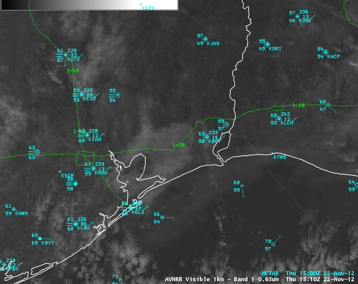
The fog began to burn off rather quickly after sunrise — however, the fog feature over the Interstate 10 accident area could still be seen on a POES AVHRR 0.63 µm visible channel image about 1 hour after the accident at 15:10 UTC or 9:10 AM local time (below). By this time, the surface visibility had improved to 3 miles at Houston (KHOU) and 10 miles at Beaumont (KBPT).


