Tropical Storm Rafael
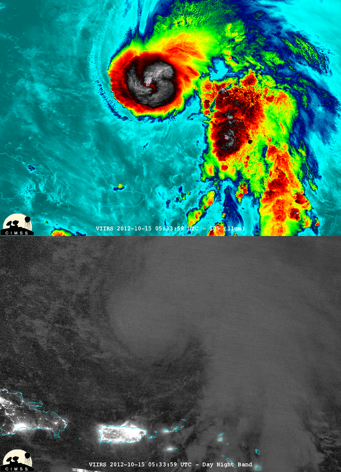
Tropical Storm Rafael was slowly intensifying over the Atlantic Ocean north-northeast of Puerto Rico on 15 October 2012. McIDAS-V images of Suomi NPP VIIRS 11.45 µm IR channel and 0.8 µm Day/Night Band data at 05:33 UTC (above; courtesy of William Straka, CIMSS) showed cloud top IR brightness temperatures colder than -85 C (violet color enhancement), as well as city lights from the islands of the Dominican Republic, Puerto Rico, and other nearby islands.
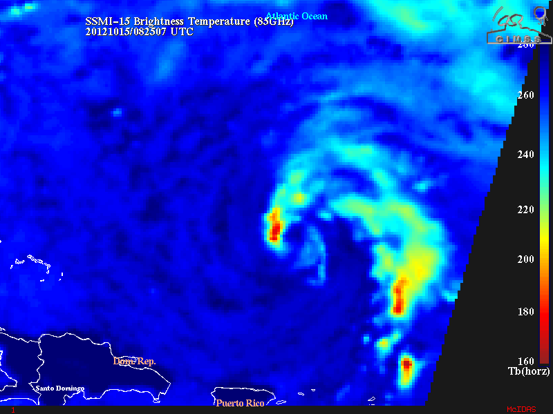
A 08:25 UTC SSMI-15 85 GHz microwave image from the CIMSS Tropical Cyclones site (below) revealed a ragged banding structure that suggested Rafael was trying to form an organized eye.
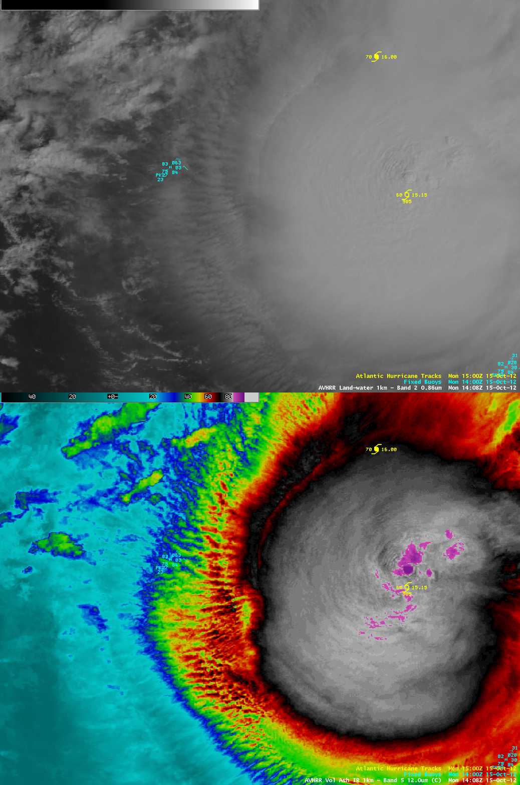
A comparison of AWIPS images of POES AVHRR 0.86 µm visible channel and 12.0 µm IR channel data at 14:08 UTC (below) offered a close-up view of the central dense overcast region of Rafael, with transverse banding forming along the periphery and convective overshooting tops with IR brightness temperatures as cold as -93 C (darker violet color enhancement).


