Snow cover across southern Manitoba, northeastern North Dakota and northwestern Minnesota
The first significant winter storm of the season over the north-central US and south-central Canada produced snowfall amounts as high as 14 inches over northwestern Minnesota and 4 inches over northeastern North Dakota on 04 October 2012. It is interesting to note that this snow event occurred 2 days after that same region was impacted by significant wildfire activity ahead of an advancing cold front.
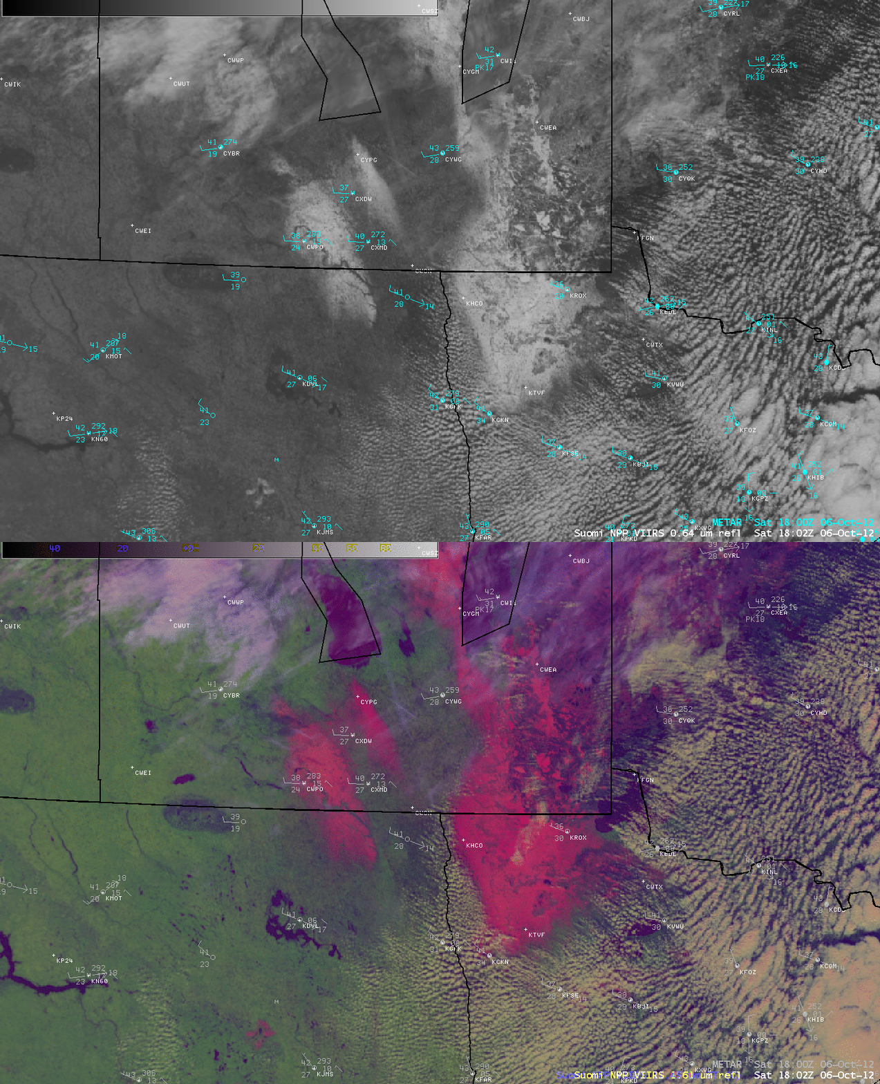
The snow cover that remained on 06 October 2012 could be seen in an AWIPS comparison of a Suomi NPP VIIRS 0.64 µm visible channel image and the corresponding false-color Red/Green/Blue (RGB) image created using the 1.61 µm “snow/ice” channel (above), where the snow on the ground was enhanced with a brigher pink color. Note the lack of development of cumulus clouds over the deeper snow cover in northwestern Minnesota, where boundary layer stability was maintained by the lack of surface heating over the high-albedo snow surfaces.
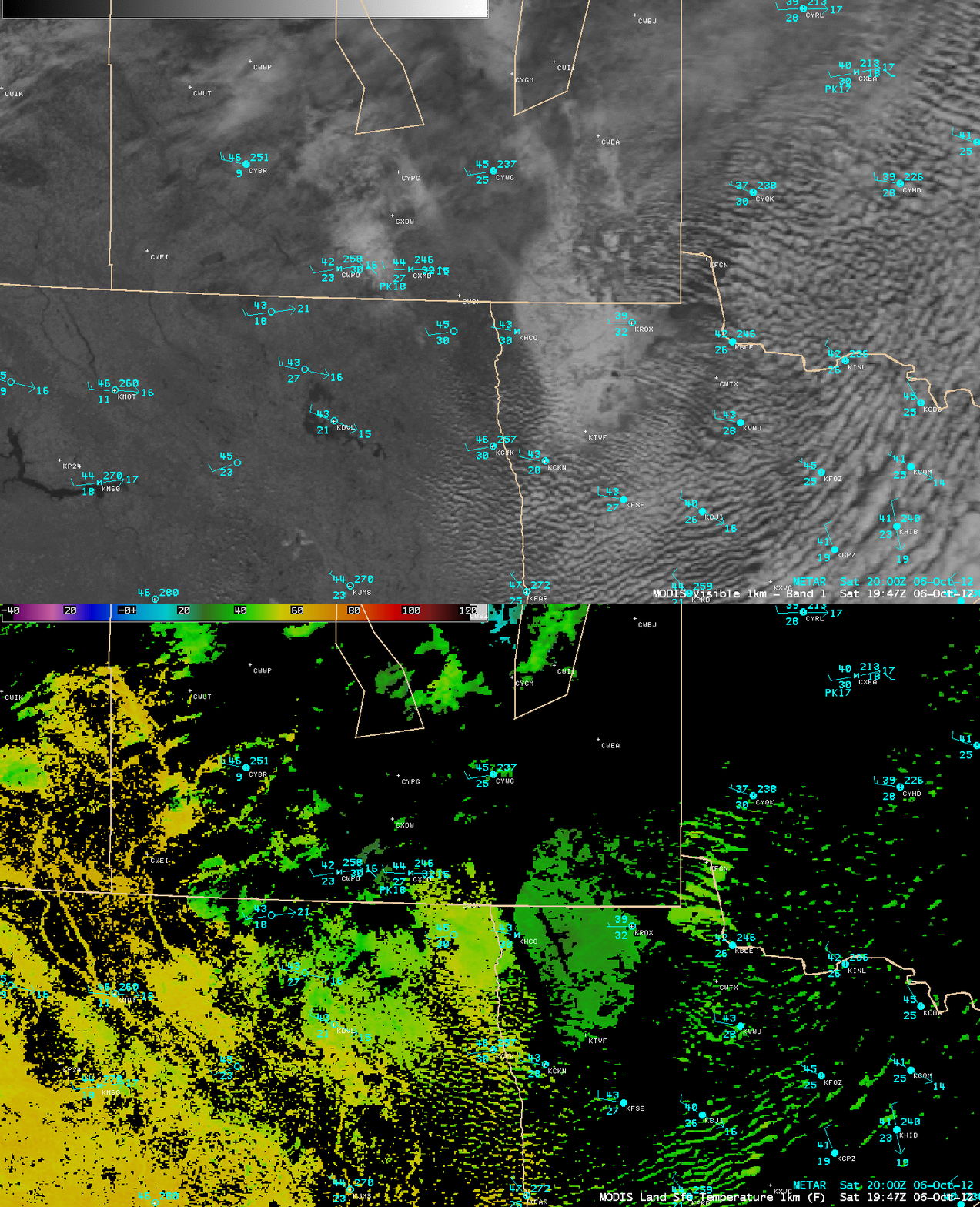
A comparison of the MODIS 0.65 µm visible channel image with the corresponding MODIS Land Surface Temperature (LST) product (below) showed that LST values over the areas of deeper snow cover in northwestern Minnesota were only in the upper 20s to low 30s F (darker green color enhancement), while LST values just to the west over bare ground in far eastern North Dakota LST values were in the upper 40s to low 50s F (lighter green to yellow color enhancement). Surace air tempertures were alo recoverng more rapidly at nearby stations with no snow cover.
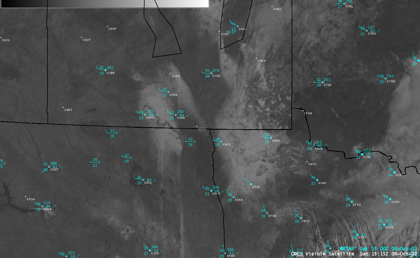
GOES-14 0.63 µm visible channel images (below; click image to play animation) showed the rapid melting of snow cover in areas wherre the snow depth was only on the order of 1-2 inches on the morning of 06 October.
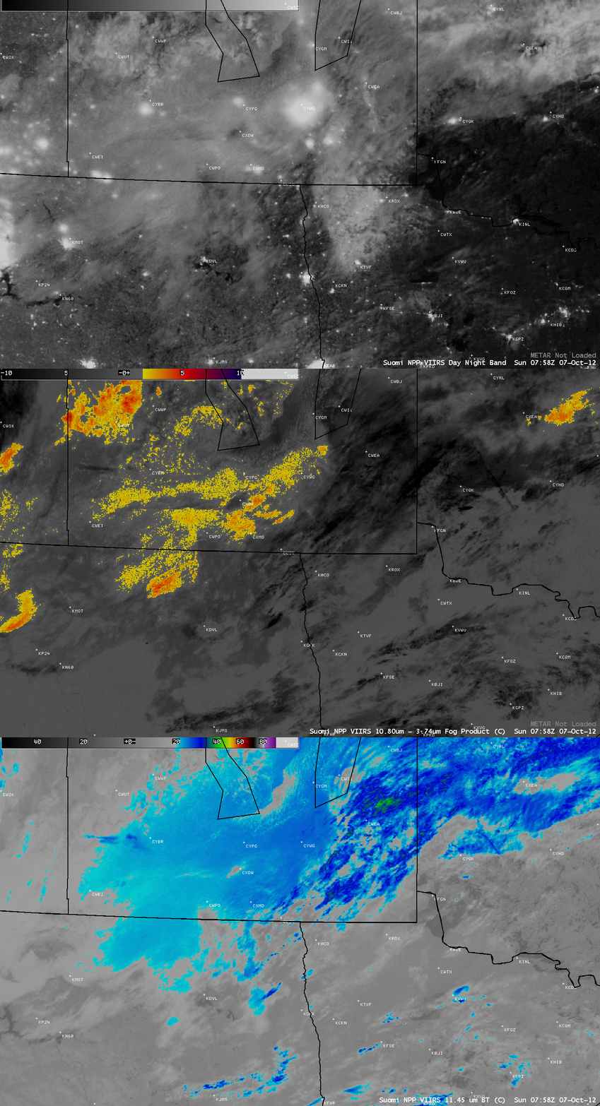
On the following night, the deep snow cover remaining across northwestern Minnesota could be seen (via illumination by moonlight) in a Suomi NPP VIIRS 0.7 µm Day/Night Band (DNB) image at 07:58 UTC (2:58 AM local time). The corresponding VIIRS fog/stratus product image confirmed that this bright area on the DNB image was not a low cloud or fog feature; however, there there were some thin cirrus features over the area at the time, which showed up as darker black on the fog/stratus product image and brighter white to cyan to blue colors on the 11.45 µm IR image.


