Wildfires in North Dakota, Minnesota, and Manitoba
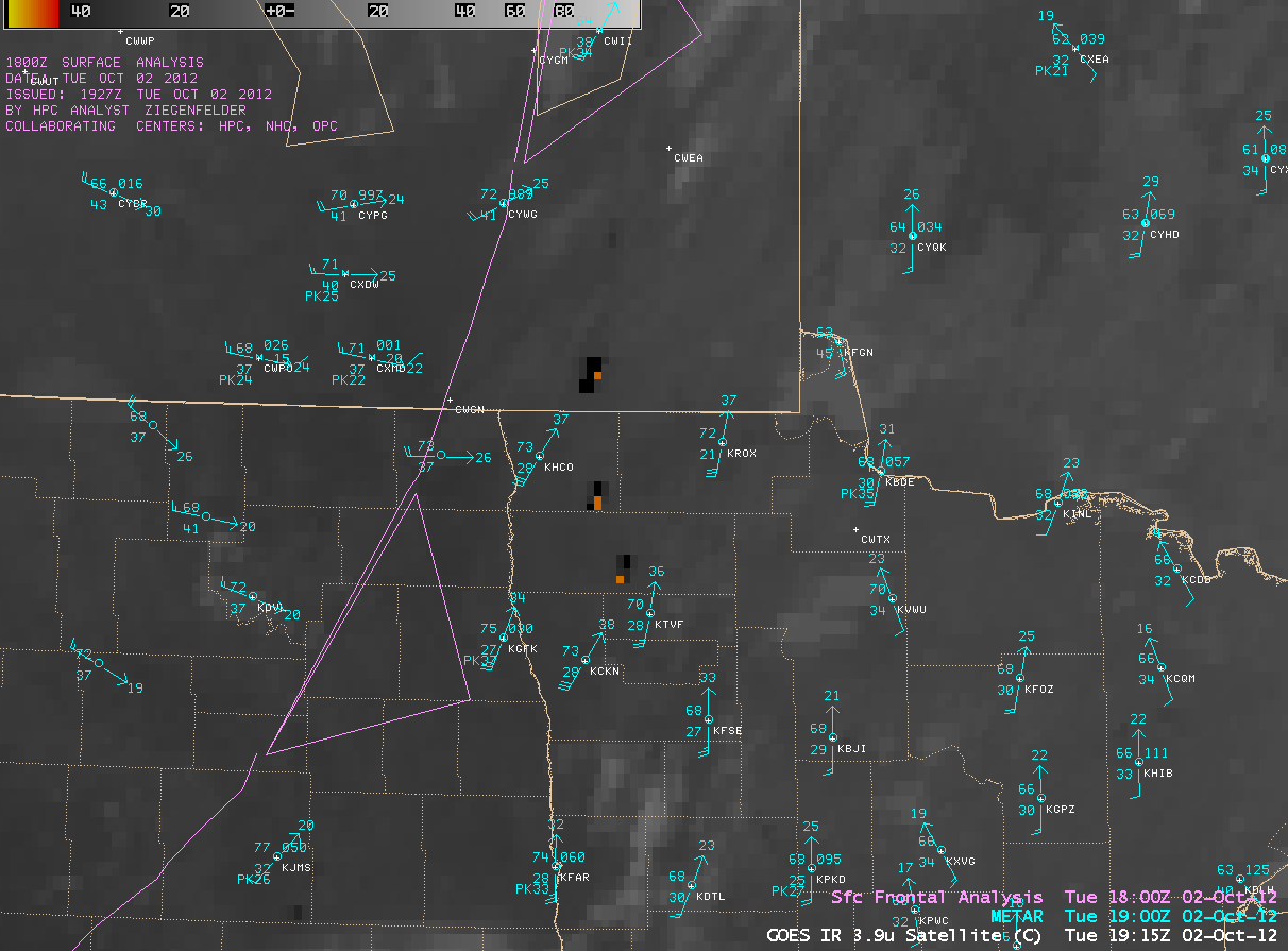
Numerous wildfires began to burn across parts of northeastern North Dakota, northwestern Minnesota, and southeastern Manitoba during the afternoon hours on 02 October 2012. Strong south to southwest winds in advance of an approaching cold front were gusting into the 35-45 mph range, helping many of these fires to grow rather quickly. 4-km resolution GOES-14 3.9 µm shortwave IR images (above; click image to play animation) showed the appearance of several prominent “hot spots” (red to yellow to black color enhancement) associated with the larger fires.
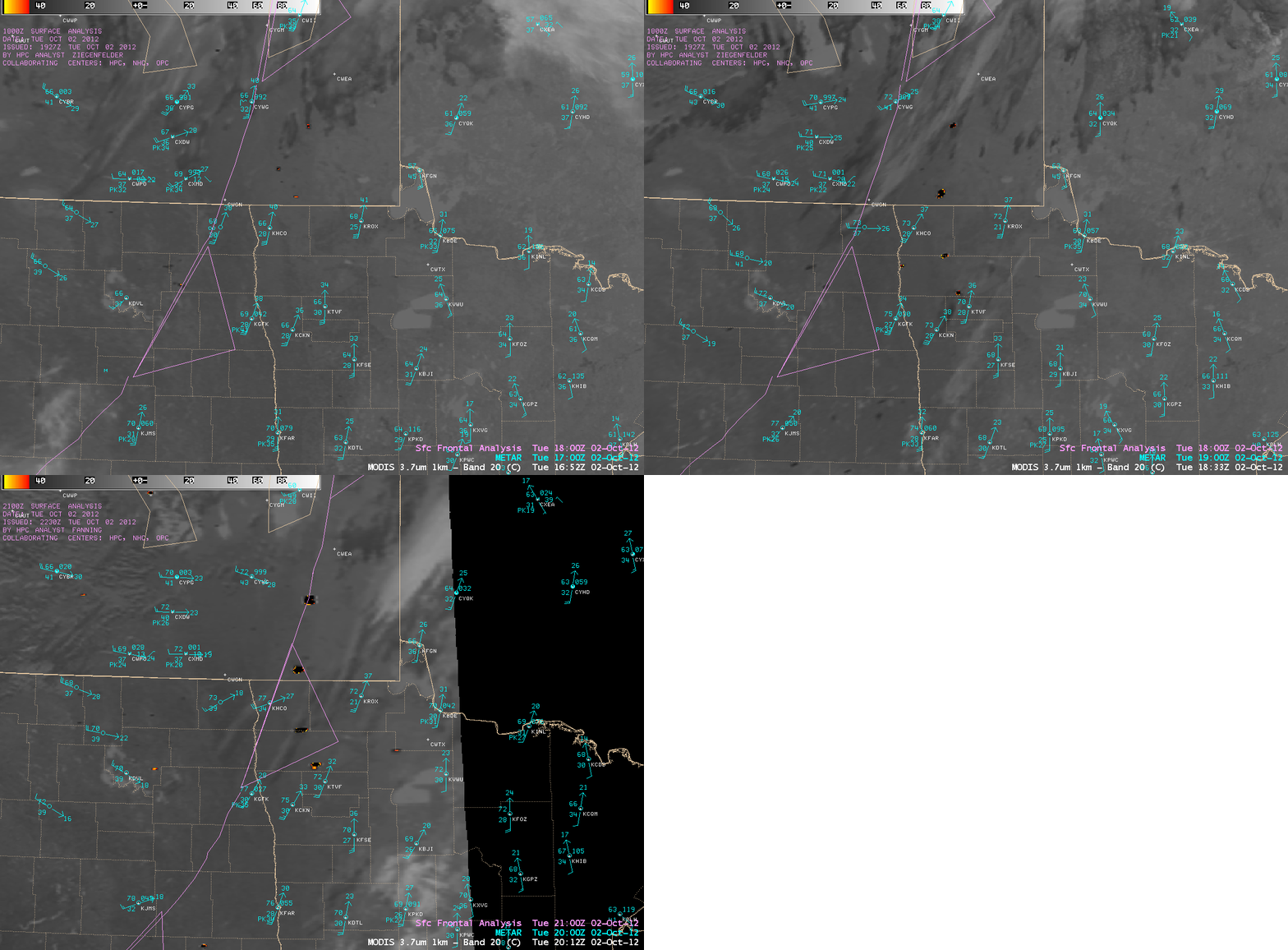
A sequence of 1-km resolution MODIS 3.7 µm shortwave IR images (below) showed the increase in size of some of the larger fire hot spots during the day as the cold front approached.
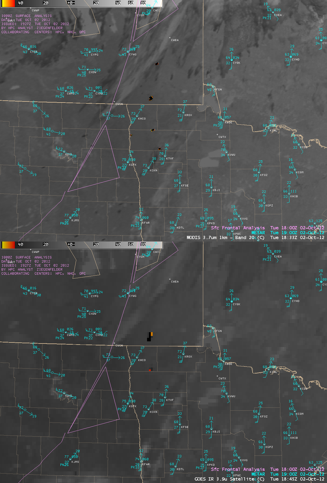
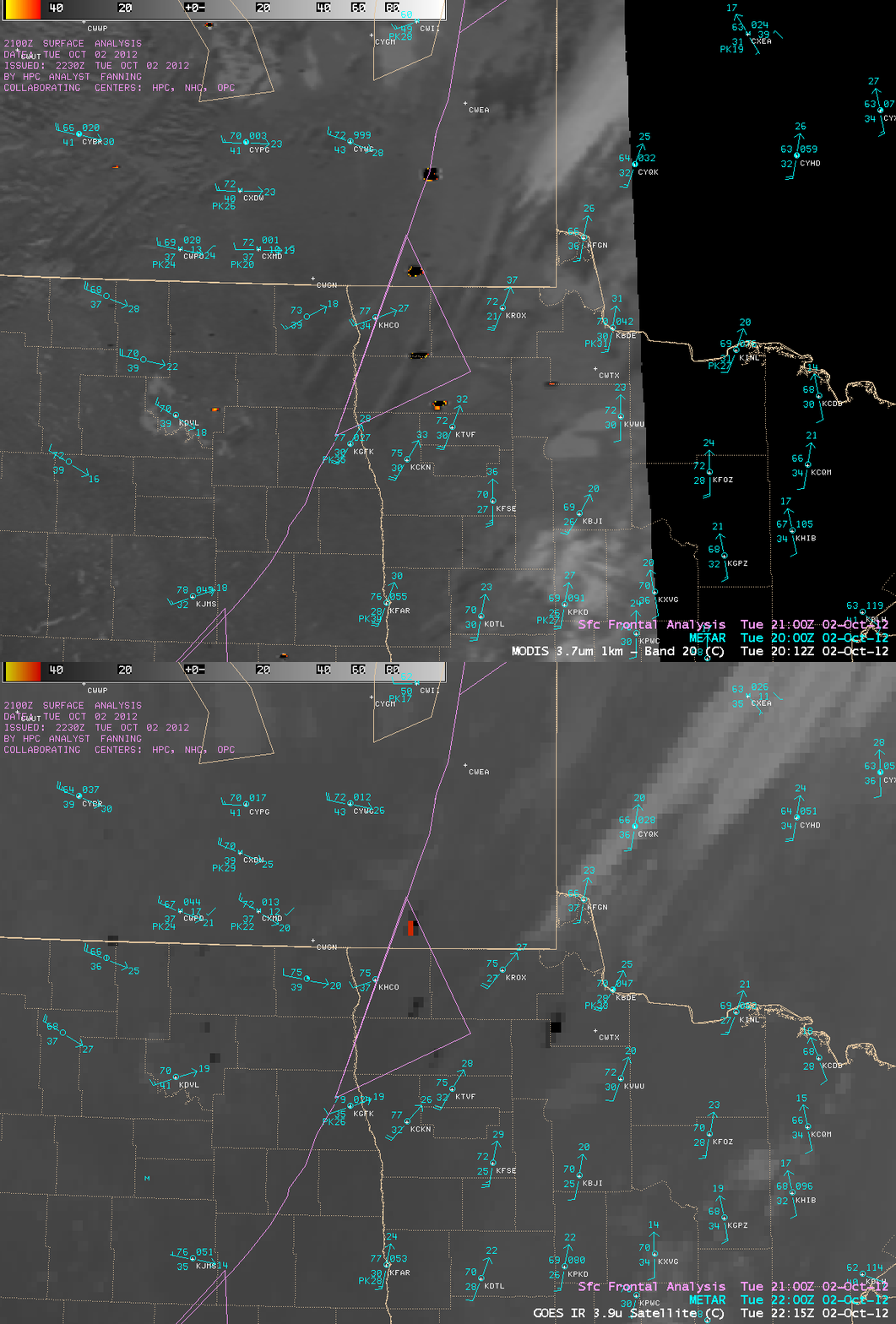
Two comparisons of 4-km resolution GOES-14 3.9 µm shortwave IR images with their corresponding 1-km resolution MODIS 3.7 µm shortwave IR images (below) demonstrated the advantage of higher spatial resolution for not only detecting some of the smaller fires, but for also more accurately locating the hot spots associated with the fires themselves. For example, mandatory evacuations were ordered for parts of the town of Karlstad in far northwestern Minnesota (located about 20 miles southeast of Hallock, station identifier KHCO), due to a large fire along the Kittson and Marshall county line. The MODIS images correctly dislayed the hot spot of this fire along that particular county line, placing it just south of Karlstad.
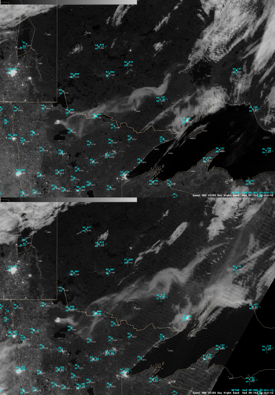
During the subsequent overnight hours, the fire located north of Upper Red Lake and Lower Red Lake in northwestern Minnesota continued to grow very rapidly, and produced an unusually long smoke plume that was quite evident on Suomi NPP VIIRS 0.7 µm Day/Night Band (DNB) images at 07:33 UTC (2:33 AM local time) and 09:14 UTC (4:14 AM local time) as it drifted northeastward over southern Ontario (below). Illumination from the nearly full (waning gibbous phase, 87% full) Harvest Moon allowed the smoke plume and surrounding cloud features to be easily seen at night.
Comparisons of the Suomi NPPP VIIRS 0.7 µm Day/Night Band images with their corresponding 3.74 µm shortwave IR images at those two times (below) showed the large fire hot spots (yellow to red to black color enhancement) on the shortwave IR imagery along with the brightly glowing signature of the fire on the DNB imagery.
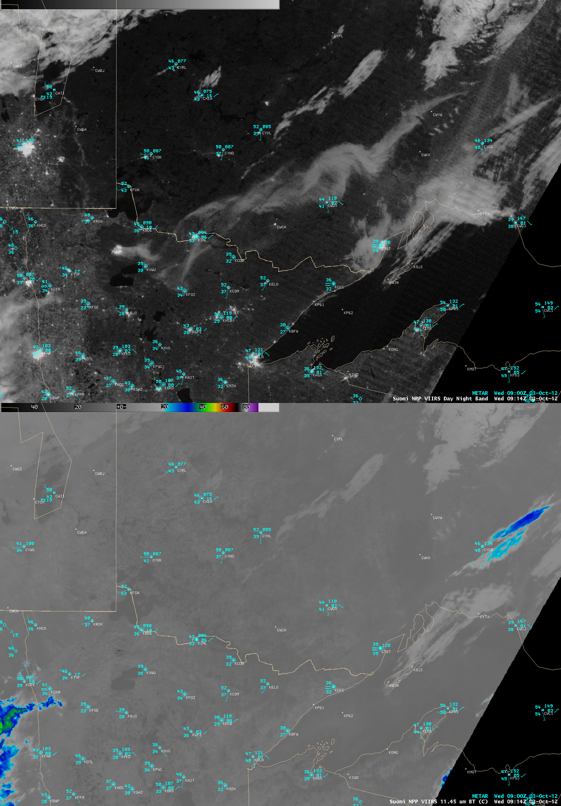
Since smoke is essentially transparent to longwave InfraRed (IR) thermal radiation, comparisons of the Suomi NPP VIIRS 0.7 µm Day/Night Band images with their corresponding 11.45 µm IR images (below) showed that there was no discernable signature of the smoke plume on the IR imagery.


