Hurricane Kyle: the transition to extratropical
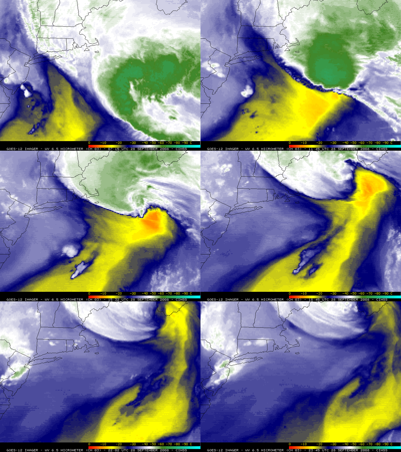
GOES-12 6.5 micrometer “water vapor channel” imagery (above) revealed a pronounced warming/drying signature (darker orange colors) as Hurricane Kyle was beginning the transition to an extratropical system on 28 September 2008. GOES-12 water vapor brightness temperatures were as warm as 268º K (-5.15º C) at 16:45 and 17:02 UTC — and the rapid trend of warming/drying suggested that strong subsidence was occurring in that region.
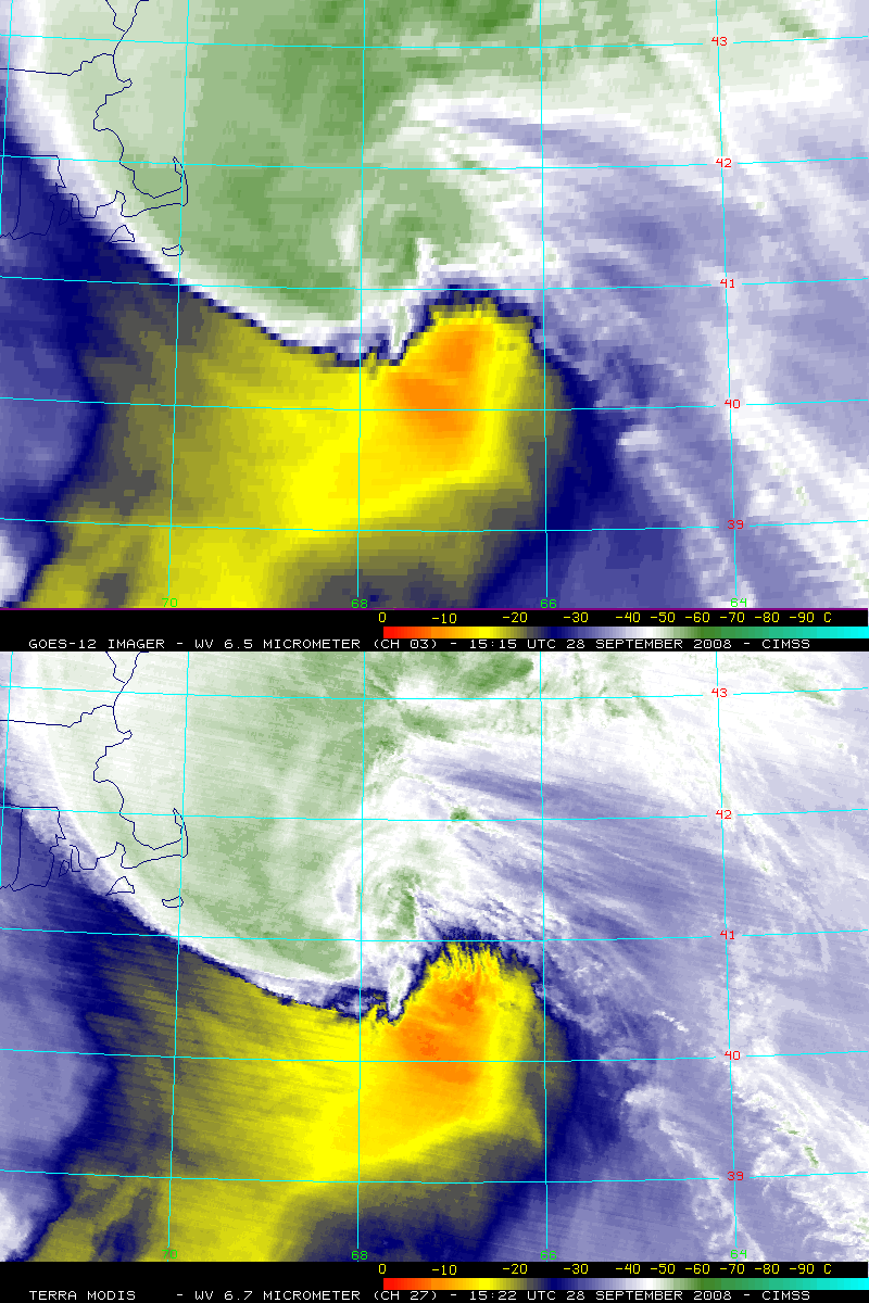
A comparison of the 4-km resolution GOES-12 and the 1-km resolution MODIS water vapor channel data (below) yielded similar brightness temperature values within the core of the warm/dry region (-5.1º C on MODIS, -7.5º C on GOES-12).
Curiously, the GOES-12 sounder total column ozone product (animation) did not exhibit a high ozone feature co-located with the warm/dry pocket seen on the water vapor imagery (below) — if this dry air were due to a stratospheric intrusion or a tropopause fold, ozone values would normally increase to the 350-400 Dobson Unit range (green to red colors).


