Mesoscale Convective System over Alabama
A large mesoscale convective system (MCS) developed in western Tennessee, which then grew in size and intensity as it propagated southward across Alabama on 31 July 2012. An AWIPS image of 1-km resolution POES AVHRR 10.8 µm IR channel data (above) showed cloud top IR brightness temperatures as cold as -87º C (darker purple color enhancement). Overlaid on the image are the cumulative SPC storm reports of hail (green) and damaging winds (cyan).
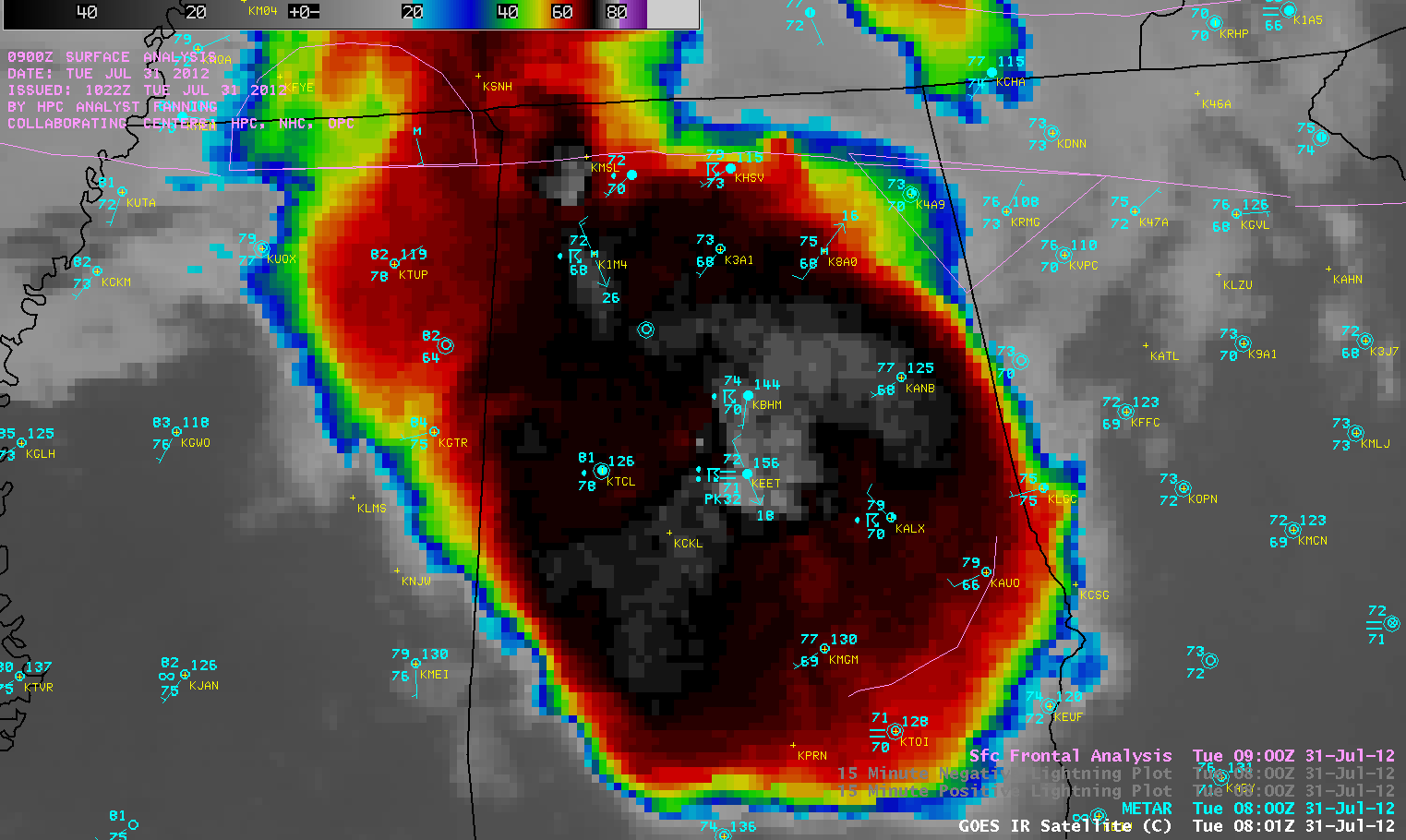
GOES-13 10.7 µm IR channel images (below; click image to play animation) showed the increase in size of cold cloud tops as the MCS moved southward, with cloud top IR brightness temperatures as cold as -82º C (purple color enhancement).
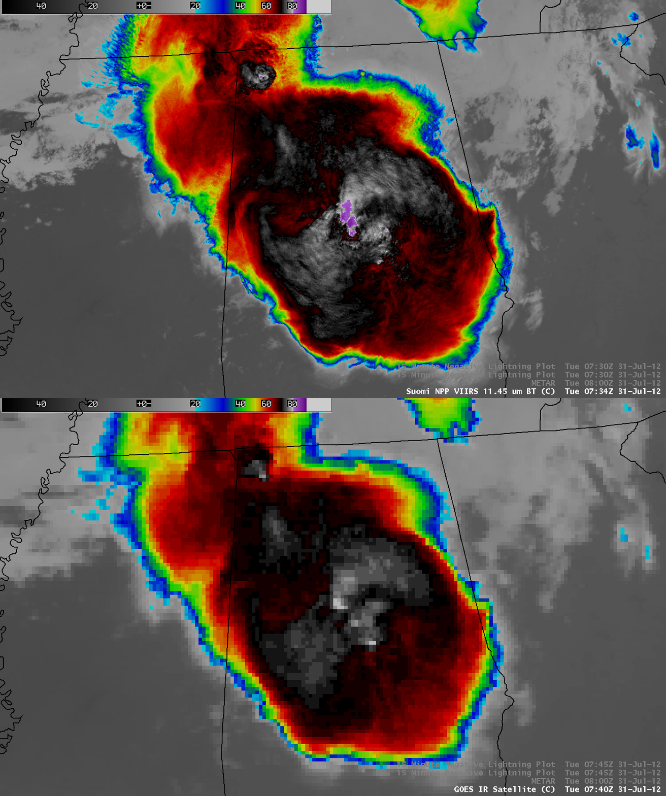
A comparison of a 375-meter resolution (projected onto a 1-km AWIPS grid) VIIRS 11.45 µm IR image with the corresponding 4-km resolution GOES-13 10.7 µm IR image (below) showed the advantage of higher spatial resolution in the identification of locations of the coldest cloud tops and their magnitude (-88º C on the VIIRS image, vs -80º C on the GOES-13 image). Also note the slight northwestward shift in the location of features on the GOES-13 image, a result of parallax due to the larger viewing angle from the GOES-East satellite located at 75º West longtude.
With illumination from moonlight, the Suomi NPP VIIRS 0.7 µm Day/Night Band (DNB) can serve as a “visible channel” at night — and a comparison with the corresponding 11.45 µm IR image (below) aided in the identification of features such as overshooting tops and thunderstorm top gravity waves. Note how some city lights can be seen through the thinner edges of the MCS cirrus canopy.
This MCS produced a great deal of lightning, with over 2500 cloud-to-ground strikes in the 15-minute period preceeding the VIIRS DNB image (below). Also note the appearance of several brighter white “smeared” pixels, which indicated portions of the thunderstorm cloud top which were illuminated by lightning as the VIIRS instrument was scanning the area.
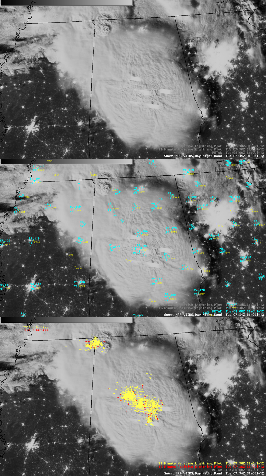
Suomi NPP VIIRS 0.7 µm Day/Night Band image + METAR surface reports + cloud-to-ground lightning strikes
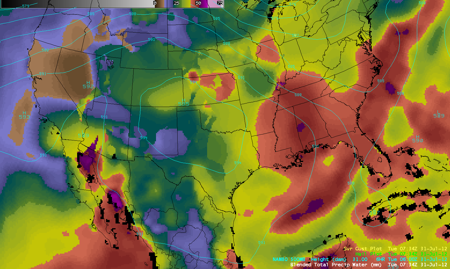
The Blended Total Precipitable Water (TPW) product (below; click image to play animation) indicated that the MCS was moving southward toward an axis of higher TPW values (50-60 mm or 2.0-2.4 inches, red to purple color enhancement).
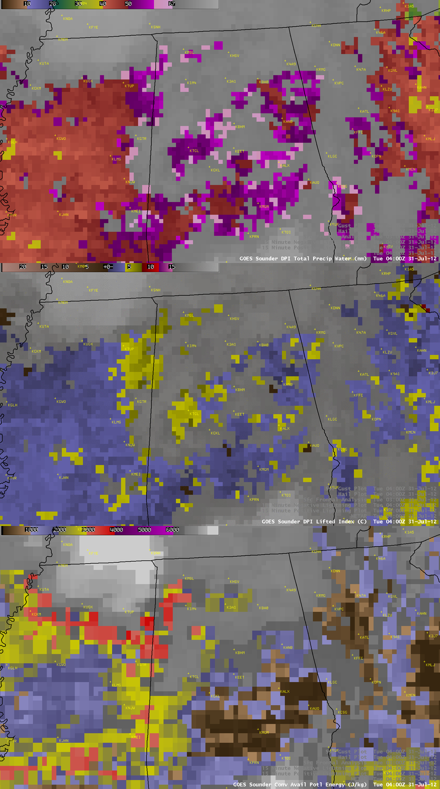
A closer view using 10-km resolution GOES-13 sounder derived product images of TPW, Lifted Index, and Convective Available Potential Energy (below) showed that there were pockets of higher moisture and instability ahead of the advancing MCS.


