Cold front approaching Hawaii
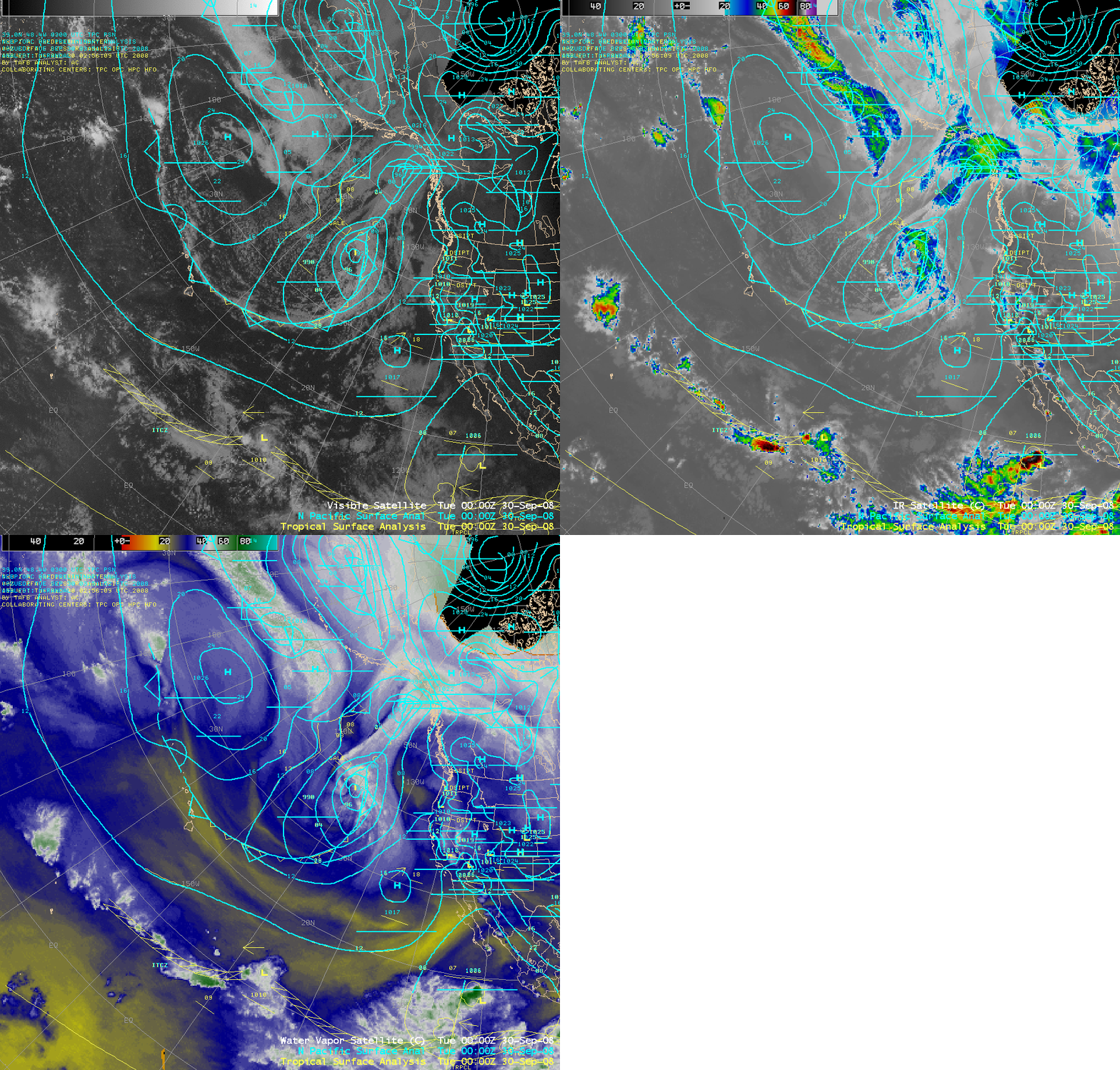
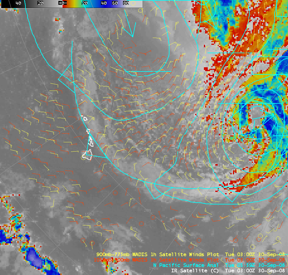
A cold frontal boundary was moving southward across the Pacific Ocean and approaching the Hawaiian Islands on 29 September – 30 September 2008, as seen on a comparison of AWIPS visible, IR, and water vapor satellite imagery and corresponding surface analysis (above). According to the boundary layer Meteorological Assimilation Data Ingest System (MADIS) atmospheric motion vectors (below), the front was moving southward at a speed of around 15-20 knots — IR cloud top temperatures were warmer than 0º C along the frontal cloud band north of Hawaii, suggesting rather shallow cloud features.
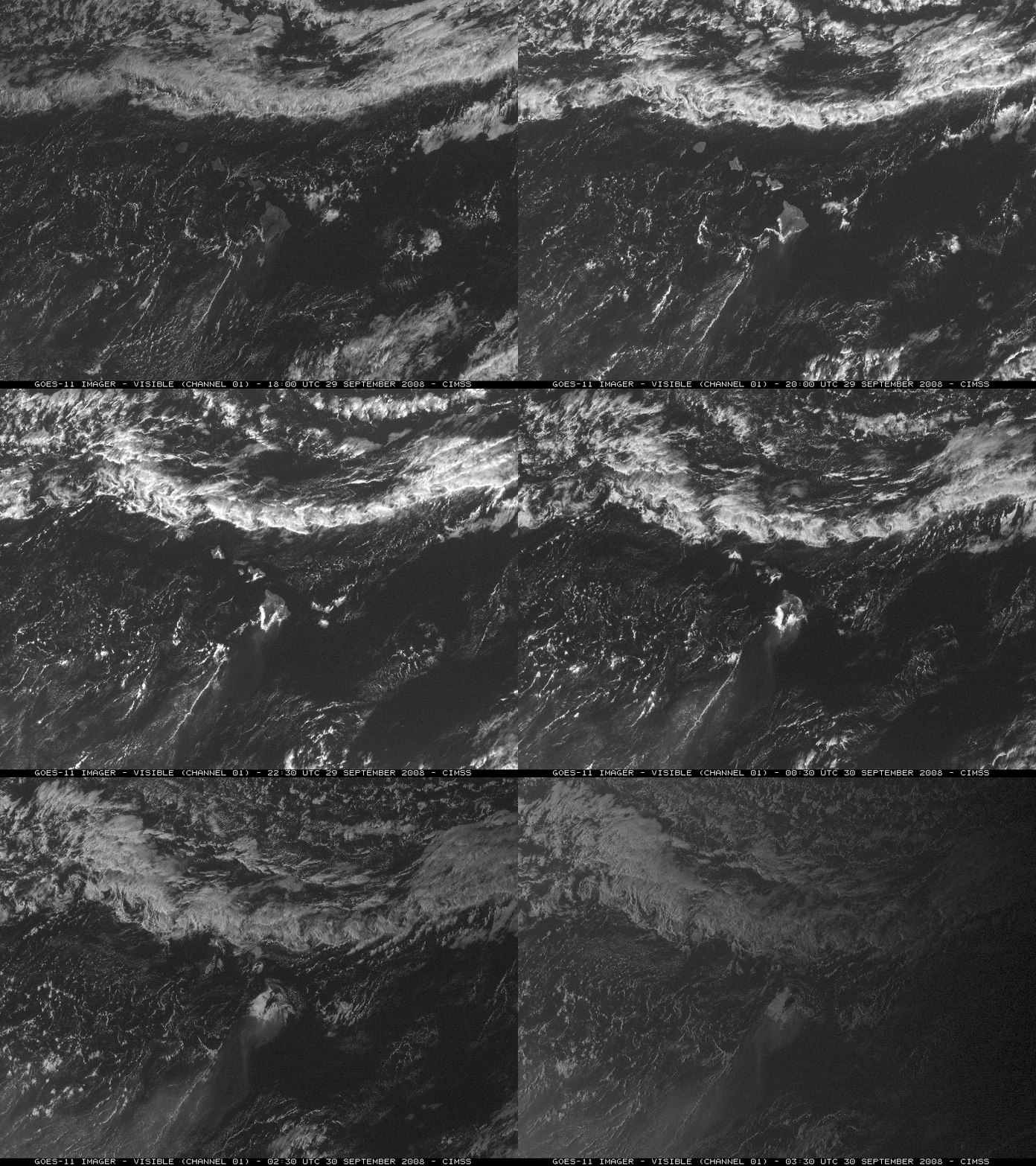
A closer view using GOES-11 visible imagery (below) revealed that a series of mesoscale vorticies had developed along the frontal boundary. Another interesting feature was the persistent volcanic plume downwind of the big island of Hawaii (streaming toward the southwest), due to ongoing activity at the Kilauea volcano since Spring 2008 (see the April 2008 CIMSS satellite blog entry). Also note the long, thin line of cumulus clouds below the volcanic plume, a result of lee-side convergence.
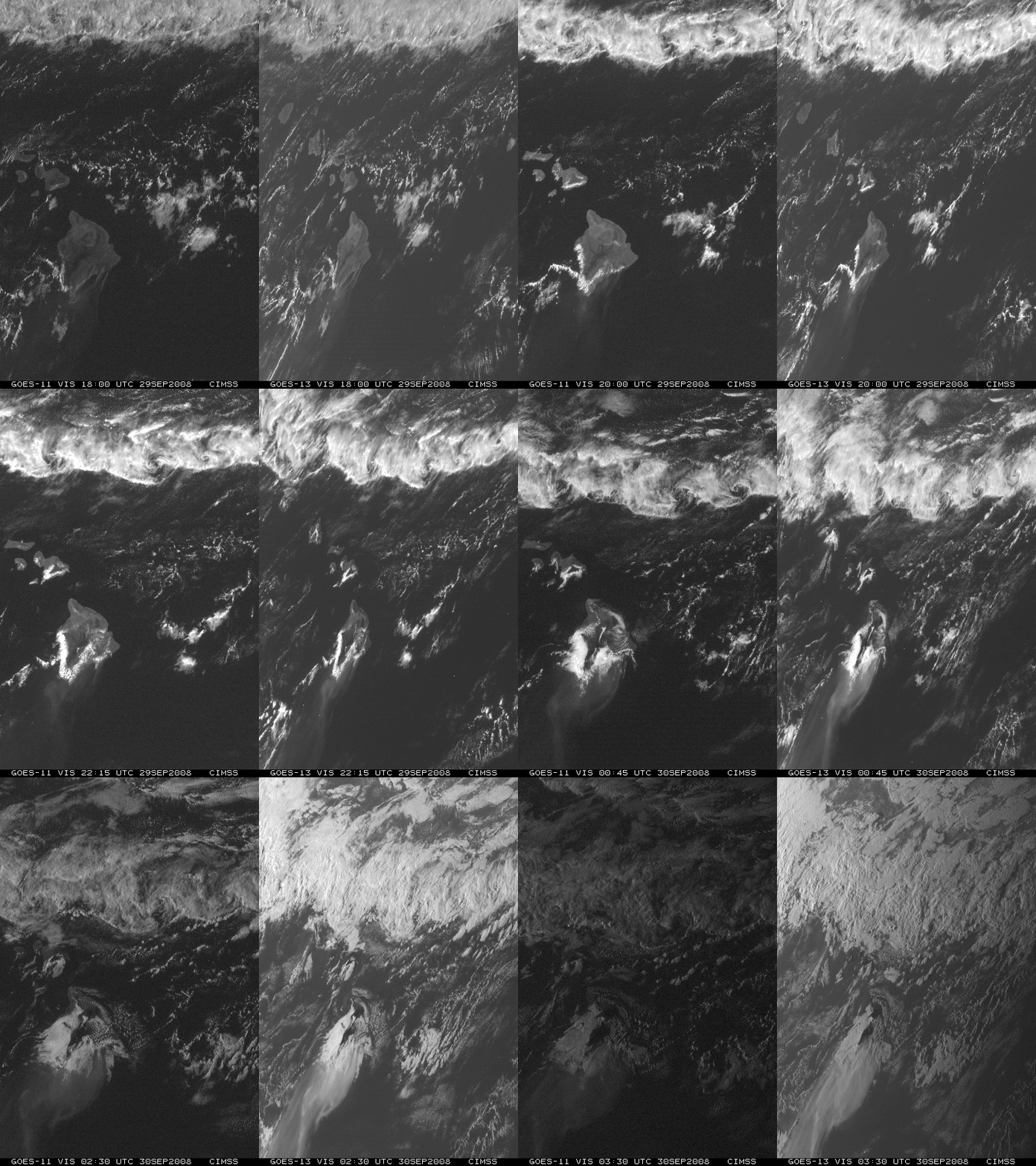
A comparison of GOES-11 and GOES-13 visible images (below) shows that the volcanic plume was even more apparent with the larger viewing angle and more favorable “forward scattering” geometry from the GOES-13 satellite (positioned at 105º W longitude, vs. 135º W longitude for GOES-11).


