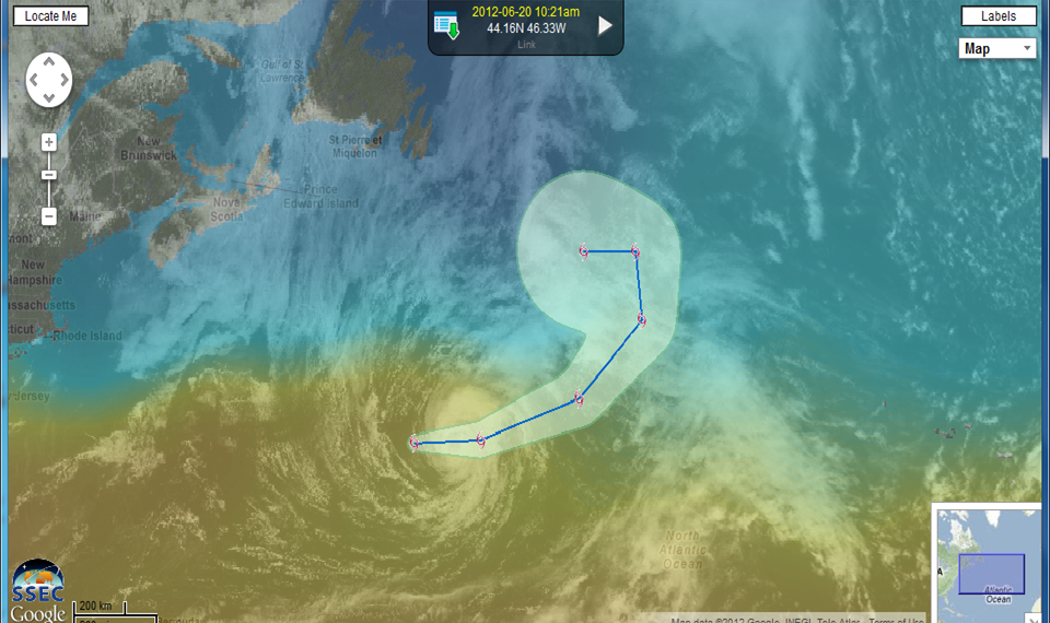
Tropical Storm Chris in the North Atlantic
The image above from the SSEC Web Map Service (WMS) shows visible imagery of Tropical Storm Chris over the central Atlantic on June 20th, just south of the north wall of the Gulf Stream. Sea-surface temperatures are indicated by the color shading. The projected path of the storm, and the cone of uncertainty (retrieved from the NOAA nowcoast wms), are also indicated. The path takes the storm over the cold waters of the North Atlantic, so strengthening to hurricane status is unlikely, especially after today. (Added: Click here for QuickTime animation of WMS images)
For more information on Chris, please see the National Hurricane Center website, or the CIMSS Tropical Cyclones website.
===== 21 June Update =====
Chris did manage to reach hurricane intensity for several hours on 21 June 2012 (NHC advisory), becoming the first hurricane of the 2012 North Atlantic season. GOES-13 10.7 µm IR channel images (above; click image to play animation) showed a well-defined eye during this period.


