Overshooting Tops in the Tropics
 images (click image to play animation)")
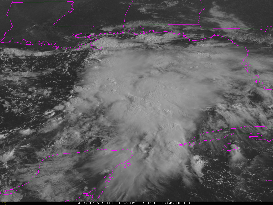
GOES-13 Visible (0.63 µm) image and auto-detected Overshooting Tops (click image to toggle)
Overshooting tops above a thunderstorm suggest an updraft powerful enough to penetrate through the tropopause into the stratosphere. In mid-latitudes, overshoots are well-correlated with both heavy precipitation and severe weather. In the tropics, overshooting tops are linked to intensification in tropical systems. In the image toggle above of an area of disturbed weather that may become a named tropical system in the Gulf of Mexico over the weekend, visible imagery and infrared data are shown with the automatically-detected overshooting tops (red being a more intense OT, that is, a bigger temperature difference between the tower top and the surrounding anvil cirrus through which the OT penetrates). Overshooting tops over the Continental United States are shown here (computed using data from GOES-13); Data from MSG are used to compute OTs over the tropical Atlantic, as shown here.
 used to detect Overshooting Tops")
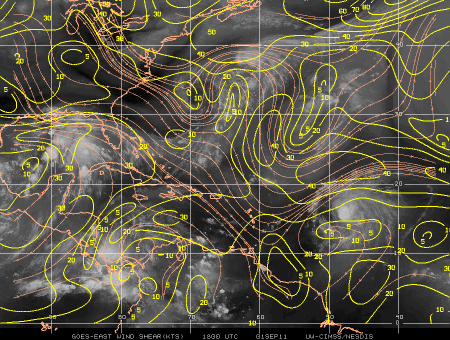
GOES-13 IR/WV (10.7 µm - 6.5 µm) used to detect Overshooting Tops
Difference fields between infrared data at 10.7 µm and the so-called water vapor channel (6.5 µm) can also be used to infer overshooting tops because Hot Towers push water vapor into the stratosphere and this alters the difference between the two channels. The image above, taken from the CIMSS Tropical Weather website, shows maxima in the difference field in the region where strong convection is occurring. (Click here for the toggle between the visible image and a similar WV/IR difference image). The automated detection algorithm seems to miss some towers; the wv/ir difference field identifies too many.
As the system in the Gulf of Mexico intensifies, the signal from the IR/WV difference and the number of autmomated detections should both increase. Intensification for now is inhibited by high shear over the region. The CIMSS Tropical Weather website offers information on this developing Gulf system.