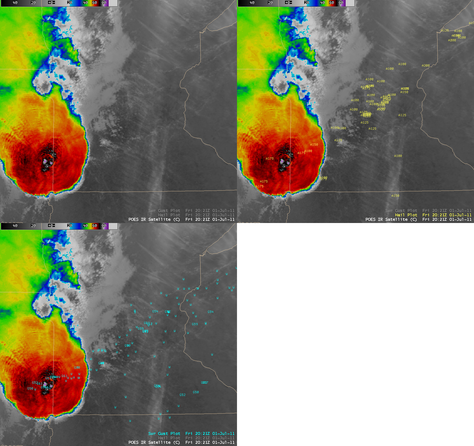
Large hail and damaging wind event across the Upper Midwest region
Severe thunderstorms produced a long swath of large hail and damaging winds (SPC storm reports) across much of the Upper Midwest region from eastern South Dakota to northwestern Wisconsin on 01 July 2011. In addition, there were tornadoes that produced EF-1 and EF-2 damage in southwestern Minnesota (NWS Sioux Falls summary), EF-1 rated tornadoes in central Minnesota (NWS Minneapolis summary), and a tornado that produced EF-2 damage in northwestern Wisconsin (NWS Duluth tornado event summary). At a campground in northwestern Wisconsin there was one fatality and 39 injuries as a result of falling trees from severe straight-line winds.
An AWIPS image of POES AVHRR 10.8 µm IR data at 20:21 UTC or 3:21 PM local time (above) showed the initial thunderstorm as it was intensifying near the South Dakota / Minnesota border, along with the resulting widespread reports of hail and wind damage as the thunderstorm complex grew and moved northeastward (NWS Duluth event summary). The coldest cloud top IR brightness temperature on the AVHRR image was -81ºC (violet color enhancement).
McIDAS images of GOES-13 0.63 µm visible channel data (below; click image to play animation; also available as a QuickTime movie) showed numerous overshooting tops associated with the severe thunderstorms as they moved from eastern South Dakota across Minnesota and into northwestern Wisconsin. Early in the animation, it is also interesting to note the persistent low-level fog/stratus cloud bank that covered the western portion of Lake Superior as the warm, humid air moved across the still-cold waters of the lake.
The corresponding GOES-13 10.7 µm IR images (below; click image to play animation; also available as a QuickTime movie) showed the cold cloud top IR brightness temperatures with these storms, which reached a minimum value of -72ºC at 21:15 over Minnesota.Several storm top IR cold/warm thermal couplets were seen, along with subtle “enhanced-V” storm top signatures over the Minnesota/Wisconsin border region.


